Mountains by Elevation

0-999m Peaks

Peaks below 1000 metres.

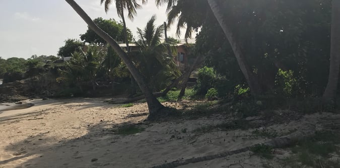
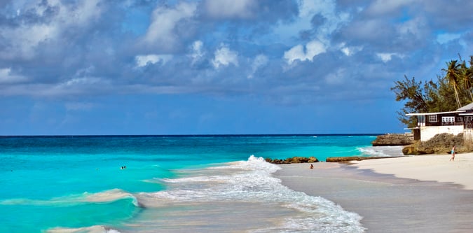
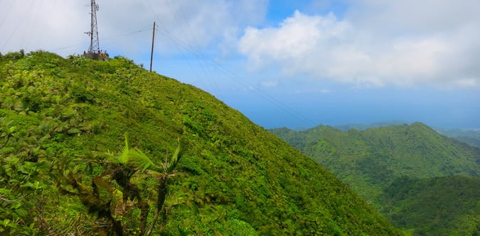
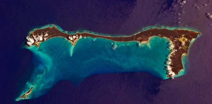
Photos from 0-999m Peaks

Collection photos are shown first, then member mountain photos.

Mount Obama hero image.
Mount Hillaby hero image.
Mount Saint Catherine hero image.
Mount Alvernia hero image.
Mountain of Smoke hero image.
Monte Titano hero image.
Kneiff hero image.

0-999m Peaks mountain map

Mapped overview of the published summits in the 0-999m Peaks collection.

Mountains

'S Airde Beinn

295M in United Kingdom

UK hill weather, navigation in poor visibility, and ground conditions on the approach are the main planning factors for 'S Airde Beinn.

A' Bheinn Bhan

477M in United Kingdom

UK hill weather, navigation in poor visibility, and ground conditions on the approach are the main planning factors for A' Bheinn Bhan.

A' Bhuidheanach Bheag

936M in United Kingdom

UK hill weather, navigation in poor visibility, and ground conditions on the approach are the main planning factors for A' Bhuidheanach Bheag.

A' Chailleach

929M in United Kingdom

UK hill weather, navigation in poor visibility, and ground conditions on the approach are the main planning factors for A' Chailleach.

A' Chailleach

999M in United Kingdom

UK hill weather, navigation in poor visibility, and ground conditions on the approach are the main planning factors for A' Chailleach.

A' Chaoirnich [Maol Creag an Loch]

876M in United Kingdom

UK hill weather, navigation in poor visibility, and ground conditions on the approach are the main planning factors for A' Chaoirnich [Maol Creag an Loch].

A' Chruach

366M in United Kingdom

UK hill weather, navigation in poor visibility, and ground conditions on the approach are the main planning factors for A' Chruach.

A' Chruach

512M in United Kingdom

UK hill weather, navigation in poor visibility, and ground conditions on the approach are the main planning factors for A' Chruach.

A' Ghlas-bheinn

918M in United Kingdom

UK hill weather, navigation in poor visibility, and ground conditions on the approach are the main planning factors for A' Ghlas-bheinn.

A' Mhaighdean

966M in United Kingdom

UK hill weather, navigation in poor visibility, and ground conditions on the approach are the main planning factors for A' Mhaighdean.

A' Mharconaich

973M in United Kingdom

UK hill weather, navigation in poor visibility, and ground conditions on the approach are the main planning factors for A' Mharconaich.

Aberedw Hill

451M in United Kingdom

UK hill weather, navigation in poor visibility, and ground conditions on the approach are the main planning factors for Aberedw Hill.

Aconbury Hill

276M in United Kingdom

UK hill weather, navigation in poor visibility, and ground conditions on the approach are the main planning factors for Aconbury Hill.

Ailsa Craig

339M in United Kingdom

UK hill weather, navigation in poor visibility, and ground conditions on the approach are the main planning factors for Ailsa Craig.

Ainshval

781M in United Kingdom

UK hill weather, navigation in poor visibility, and ground conditions on the approach are the main planning factors for Ainshval.

Airds Hill

181M in United Kingdom

UK hill weather, navigation in poor visibility, and ground conditions on the approach are the main planning factors for Airds Hill.

Airneabhal [Arnaval]

255M in United Kingdom

UK hill weather, navigation in poor visibility, and ground conditions on the approach are the main planning factors for Airneabhal [Arnaval].

Alhang

642M in United Kingdom

UK hill weather, navigation in poor visibility, and ground conditions on the approach are the main planning factors for Alhang.

Allen Crags

785M in United Kingdom

UK hill weather, navigation in poor visibility, and ground conditions on the approach are the main planning factors for Allen Crags.

Allermuir Hill

493M in United Kingdom

UK hill weather, navigation in poor visibility, and ground conditions on the approach are the main planning factors for Allermuir Hill.

Allt Lwyd

653M in United Kingdom

UK hill weather, navigation in poor visibility, and ground conditions on the approach are the main planning factors for Allt Lwyd.

Allt y Main

356M in United Kingdom

UK hill weather, navigation in poor visibility, and ground conditions on the approach are the main planning factors for Allt y Main.

Allt yr Esgair

393M in United Kingdom

UK hill weather, navigation in poor visibility, and ground conditions on the approach are the main planning factors for Allt yr Esgair.

Allt-fawr

698M in United Kingdom

UK hill weather, navigation in poor visibility, and ground conditions on the approach are the main planning factors for Allt-fawr.

Am Basteir

934M in United Kingdom

UK hill weather, navigation in poor visibility, and ground conditions on the approach are the main planning factors for Am Basteir.

Am Bathach

798M in United Kingdom

UK hill weather, navigation in poor visibility, and ground conditions on the approach are the main planning factors for Am Bathach.

Am Faochagach

953M in United Kingdom

UK hill weather, navigation in poor visibility, and ground conditions on the approach are the main planning factors for Am Faochagach.

An Cabar

558M in United Kingdom

UK hill weather, navigation in poor visibility, and ground conditions on the approach are the main planning factors for An Cabar.

An Caisteal

996M in United Kingdom

UK hill weather, navigation in poor visibility, and ground conditions on the approach are the main planning factors for An Caisteal.

An Cliseam [Clisham]

800M in United Kingdom

UK hill weather, navigation in poor visibility, and ground conditions on the approach are the main planning factors for An Cliseam [Clisham].

An Coileach

389M in United Kingdom

UK hill weather, navigation in poor visibility, and ground conditions on the approach are the main planning factors for An Coileach.

An Coileachan

924M in United Kingdom

UK hill weather, navigation in poor visibility, and ground conditions on the approach are the main planning factors for An Coileachan.

An Cruachan

705M in United Kingdom

UK hill weather, navigation in poor visibility, and ground conditions on the approach are the main planning factors for An Cruachan.

An Cruachan

435M in United Kingdom

UK hill weather, navigation in poor visibility, and ground conditions on the approach are the main planning factors for An Cruachan.

An Cuaidh

296M in United Kingdom

UK hill weather, navigation in poor visibility, and ground conditions on the approach are the main planning factors for An Cuaidh.

An Dun

827M in United Kingdom

UK hill weather, navigation in poor visibility, and ground conditions on the approach are the main planning factors for An Dun.

An Gearanach

982M in United Kingdom

UK hill weather, navigation in poor visibility, and ground conditions on the approach are the main planning factors for An Gearanach.

An Grianan

549M in United Kingdom

UK hill weather, navigation in poor visibility, and ground conditions on the approach are the main planning factors for An Grianan.

An Grianan

467M in United Kingdom

UK hill weather, navigation in poor visibility, and ground conditions on the approach are the main planning factors for An Grianan.

An Lean-charn

521M in United Kingdom

UK hill weather, navigation in poor visibility, and ground conditions on the approach are the main planning factors for An Lean-charn.

An Ruadh-mheallan

672M in United Kingdom

UK hill weather, navigation in poor visibility, and ground conditions on the approach are the main planning factors for An Ruadh-mheallan.

An Ruadh-Stac

890M in United Kingdom

UK hill weather, navigation in poor visibility, and ground conditions on the approach are the main planning factors for An Ruadh-Stac.

An Sgurr

391M in United Kingdom

UK hill weather, navigation in poor visibility, and ground conditions on the approach are the main planning factors for An Sgurr.

An Sgurr

394M in United Kingdom

UK hill weather, navigation in poor visibility, and ground conditions on the approach are the main planning factors for An Sgurr.

An Sithean [An Sidhean]

814M in United Kingdom

UK hill weather, navigation in poor visibility, and ground conditions on the approach are the main planning factors for An Sithean [An Sidhean].

An Sleaghach

515M in United Kingdom

UK hill weather, navigation in poor visibility, and ground conditions on the approach are the main planning factors for An Sleaghach.

An Socach

943M in United Kingdom

UK hill weather, navigation in poor visibility, and ground conditions on the approach are the main planning factors for An Socach.

An Socach

362M in United Kingdom

UK hill weather, navigation in poor visibility, and ground conditions on the approach are the main planning factors for An Socach.

An Socach

920M in United Kingdom

UK hill weather, navigation in poor visibility, and ground conditions on the approach are the main planning factors for An Socach.

An Stac

718M in United Kingdom

UK hill weather, navigation in poor visibility, and ground conditions on the approach are the main planning factors for An Stac.

An Stac

814M in United Kingdom

UK hill weather, navigation in poor visibility, and ground conditions on the approach are the main planning factors for An Stac.

An Staonach

516M in United Kingdom

UK hill weather, navigation in poor visibility, and ground conditions on the approach are the main planning factors for An Staonach.

An Tobha [The Hoe]

171M in United Kingdom

UK hill weather, navigation in poor visibility, and ground conditions on the approach are the main planning factors for An Tobha [The Hoe].

Andrewhinney Hill

677M in United Kingdom

UK hill weather, navigation in poor visibility, and ground conditions on the approach are the main planning factors for Andrewhinney Hill.

Angletarn Pikes [Angletarn Pikes North Top]

566M in United Kingdom

UK hill weather, navigation in poor visibility, and ground conditions on the approach are the main planning factors for Angletarn Pikes [Angletarn Pikes North Top].

Aodann Chleireig

663M in United Kingdom

UK hill weather, navigation in poor visibility, and ground conditions on the approach are the main planning factors for Aodann Chleireig.

Aonach Buidhe

899M in United Kingdom

UK hill weather, navigation in poor visibility, and ground conditions on the approach are the main planning factors for Aonach Buidhe.

Aonach Eagach - Meall Dearg

952M in United Kingdom

UK hill weather, navigation in poor visibility, and ground conditions on the approach are the main planning factors for Aonach Eagach - Meall Dearg.

Aonach Eagach - Sgorr nam Fiannaidh

968M in United Kingdom

UK hill weather, navigation in poor visibility, and ground conditions on the approach are the main planning factors for Aonach Eagach - Sgorr nam Fiannaidh.

Aonach Shasuinn

888M in United Kingdom

UK hill weather, navigation in poor visibility, and ground conditions on the approach are the main planning factors for Aonach Shasuinn.

Aran Benllyn

885M in United Kingdom

UK hill weather, navigation in poor visibility, and ground conditions on the approach are the main planning factors for Aran Benllyn.

Aran Fawddwy

906M in United Kingdom

UK hill weather, navigation in poor visibility, and ground conditions on the approach are the main planning factors for Aran Fawddwy.

Archy Styrigg [Gregory Chapel]

695M in United Kingdom

UK hill weather, navigation in poor visibility, and ground conditions on the approach are the main planning factors for Archy Styrigg [Gregory Chapel].

Ard Crags

581M in United Kingdom

UK hill weather, navigation in poor visibility, and ground conditions on the approach are the main planning factors for Ard Crags.

Ardsheal Hill

263M in United Kingdom

UK hill weather, navigation in poor visibility, and ground conditions on the approach are the main planning factors for Ardsheal Hill.

Arenig Fach

689M in United Kingdom

UK hill weather, navigation in poor visibility, and ground conditions on the approach are the main planning factors for Arenig Fach.

Arenig Fawr

854M in United Kingdom

UK hill weather, navigation in poor visibility, and ground conditions on the approach are the main planning factors for Arenig Fawr.

Arenig Fawr South Ridge Top

714M in United Kingdom

UK hill weather, navigation in poor visibility, and ground conditions on the approach are the main planning factors for Arenig Fawr South Ridge Top.

Arenig Fawr South Top

837M in United Kingdom

UK hill weather, navigation in poor visibility, and ground conditions on the approach are the main planning factors for Arenig Fawr South Top.

Arkle

787M in United Kingdom

UK hill weather, navigation in poor visibility, and ground conditions on the approach are the main planning factors for Arkle.

Armboth Fell [Armboth Fell South Top]

475M in United Kingdom

UK hill weather, navigation in poor visibility, and ground conditions on the approach are the main planning factors for Armboth Fell [Armboth Fell South Top].

Arnaval

369M in United Kingdom

UK hill weather, navigation in poor visibility, and ground conditions on the approach are the main planning factors for Arnaval.

Arnison Crag

433M in United Kingdom

UK hill weather, navigation in poor visibility, and ground conditions on the approach are the main planning factors for Arnison Crag.

Arnside Knott

159M in United Kingdom

UK hill weather, navigation in poor visibility, and ground conditions on the approach are the main planning factors for Arnside Knott.

Arthur's Pike

533M in United Kingdom

UK hill weather, navigation in poor visibility, and ground conditions on the approach are the main planning factors for Arthur's Pike.

Arthur's Seat

251M in United Kingdom

UK hill weather, navigation in poor visibility, and ground conditions on the approach are the main planning factors for Arthur's Seat.

Askival

812M in United Kingdom

UK hill weather, navigation in poor visibility, and ground conditions on the approach are the main planning factors for Askival.

Atkinson Pike [Foule Crag]

845M in United Kingdom

UK hill weather, navigation in poor visibility, and ground conditions on the approach are the main planning factors for Atkinson Pike [Foule Crag].

Auchnafree Hill

787M in United Kingdom

UK hill weather, navigation in poor visibility, and ground conditions on the approach are the main planning factors for Auchnafree Hill.

Auchtertyre Hill

453M in United Kingdom

UK hill weather, navigation in poor visibility, and ground conditions on the approach are the main planning factors for Auchtertyre Hill.

Highest mountain in country Add to my list

Aukštojas Hill

294M in Lithuania

Aukštojas Hill is a 294M mountain in Lithuania and the highest mountain in Lithuania.

Aye Gill Pike

556M in United Kingdom

UK hill weather, navigation in poor visibility, and ground conditions on the approach are the main planning factors for Aye Gill Pike.

Bac an Eich

849M in United Kingdom

UK hill weather, navigation in poor visibility, and ground conditions on the approach are the main planning factors for Bac an Eich.

Bache Hill

610M in United Kingdom

UK hill weather, navigation in poor visibility, and ground conditions on the approach are the main planning factors for Bache Hill.

Backstone Edge

699M in United Kingdom

UK hill weather, navigation in poor visibility, and ground conditions on the approach are the main planning factors for Backstone Edge.

Bad a' Chreamha

395M in United Kingdom

UK hill weather, navigation in poor visibility, and ground conditions on the approach are the main planning factors for Bad a' Chreamha.

Badandun Hill

740M in United Kingdom

UK hill weather, navigation in poor visibility, and ground conditions on the approach are the main planning factors for Badandun Hill.

Bainloch Hill

287M in United Kingdom

UK hill weather, navigation in poor visibility, and ground conditions on the approach are the main planning factors for Bainloch Hill.

Bakestall

674M in United Kingdom

UK hill weather, navigation in poor visibility, and ground conditions on the approach are the main planning factors for Bakestall.

Highest mountain in country Add to my list

Bălănești Hill

430M in Moldova

Bălănești Hill is a 430M mountain in Moldova and the highest mountain in Moldova.

Ballencleuch Law

691M in United Kingdom

UK hill weather, navigation in poor visibility, and ground conditions on the approach are the main planning factors for Ballencleuch Law.

Ballencrieff Hill [Cairnpapple Hill]

312M in United Kingdom

UK hill weather, navigation in poor visibility, and ground conditions on the approach are the main planning factors for Ballencrieff Hill [Cairnpapple Hill].

Highest mountain in country Add to my list

Banaba Island

81M in Kiribati

Banaba Island is a 81M mountain in Kiribati and the highest mountain in Kiribati.

Banc Llechwedd-mawr

560M in United Kingdom

UK hill weather, navigation in poor visibility, and ground conditions on the approach are the main planning factors for Banc Llechwedd-mawr.

Bannau Sir Gaer - Picws Du

749M in United Kingdom

UK hill weather, navigation in poor visibility, and ground conditions on the approach are the main planning factors for Bannau Sir Gaer - Picws Du.

Bannerdale Crags

684M in United Kingdom

UK hill weather, navigation in poor visibility, and ground conditions on the approach are the main planning factors for Bannerdale Crags.

Baosbheinn

875M in United Kingdom

UK hill weather, navigation in poor visibility, and ground conditions on the approach are the main planning factors for Baosbheinn.

Bardon Hill

280M in United Kingdom

UK hill weather, navigation in poor visibility, and ground conditions on the approach are the main planning factors for Bardon Hill.

Barf

469M in United Kingdom

UK hill weather, navigation in poor visibility, and ground conditions on the approach are the main planning factors for Barf.

Barrow

455M in United Kingdom

UK hill weather, navigation in poor visibility, and ground conditions on the approach are the main planning factors for Barrow.

Base Brown

646M in United Kingdom

UK hill weather, navigation in poor visibility, and ground conditions on the approach are the main planning factors for Base Brown.

Baugh Fell - Tarn Rigg Hill

678M in United Kingdom

UK hill weather, navigation in poor visibility, and ground conditions on the approach are the main planning factors for Baugh Fell - Tarn Rigg Hill.

Baystones [Wansfell]

487M in United Kingdom

UK hill weather, navigation in poor visibility, and ground conditions on the approach are the main planning factors for Baystones [Wansfell].

Beacon Batch

324M in United Kingdom

UK hill weather, navigation in poor visibility, and ground conditions on the approach are the main planning factors for Beacon Batch.

Beacon Hill

547M in United Kingdom

UK hill weather, navigation in poor visibility, and ground conditions on the approach are the main planning factors for Beacon Hill.

Beda Fell [Beda Head]

509M in United Kingdom

UK hill weather, navigation in poor visibility, and ground conditions on the approach are the main planning factors for Beda Fell [Beda Head].

Beinn a' Bhacaidh

555M in United Kingdom

UK hill weather, navigation in poor visibility, and ground conditions on the approach are the main planning factors for Beinn a' Bhacaidh.

Beinn a' Bhaillidh

266M in United Kingdom

UK hill weather, navigation in poor visibility, and ground conditions on the approach are the main planning factors for Beinn a' Bhaillidh.

Beinn a' Bhathaich Ard [Beinn a' Bha' ach Ard]

862M in United Kingdom

UK hill weather, navigation in poor visibility, and ground conditions on the approach are the main planning factors for Beinn a' Bhathaich Ard [Beinn a' Bha' ach Ard].

Beinn a' Bhraghad

461M in United Kingdom

UK hill weather, navigation in poor visibility, and ground conditions on the approach are the main planning factors for Beinn a' Bhraghad.

Beinn a' Bhuiridh

898M in United Kingdom

UK hill weather, navigation in poor visibility, and ground conditions on the approach are the main planning factors for Beinn a' Bhuiridh.

Beinn a' Chaisgein Beag

682M in United Kingdom

UK hill weather, navigation in poor visibility, and ground conditions on the approach are the main planning factors for Beinn a' Chaisgein Beag.

Beinn a' Chaisgein Mor

856M in United Kingdom

UK hill weather, navigation in poor visibility, and ground conditions on the approach are the main planning factors for Beinn a' Chaisgein Mor.

Beinn a' Chaisil

437M in United Kingdom

UK hill weather, navigation in poor visibility, and ground conditions on the approach are the main planning factors for Beinn a' Chaisil.

Beinn a' Chaisteil

886M in United Kingdom

UK hill weather, navigation in poor visibility, and ground conditions on the approach are the main planning factors for Beinn a' Chaisteil.

Beinn a' Chaisteil

787M in United Kingdom

UK hill weather, navigation in poor visibility, and ground conditions on the approach are the main planning factors for Beinn a' Chaisteil.

Beinn a' Chaoinich

410M in United Kingdom

UK hill weather, navigation in poor visibility, and ground conditions on the approach are the main planning factors for Beinn a' Chaoinich.

Beinn a' Chaolais

735M in United Kingdom

UK hill weather, navigation in poor visibility, and ground conditions on the approach are the main planning factors for Beinn a' Chaolais.

Beinn a' Chapuill

760M in United Kingdom

UK hill weather, navigation in poor visibility, and ground conditions on the approach are the main planning factors for Beinn a' Chapuill.

Beinn a' Charnain

196M in United Kingdom

UK hill weather, navigation in poor visibility, and ground conditions on the approach are the main planning factors for Beinn a' Charnain.

Beinn a' Chearcaill

725M in United Kingdom

UK hill weather, navigation in poor visibility, and ground conditions on the approach are the main planning factors for Beinn a' Chearcaill.

Beinn a' Chlachain [Meall an Doireachain]

626M in United Kingdom

UK hill weather, navigation in poor visibility, and ground conditions on the approach are the main planning factors for Beinn a' Chlachain [Meall an Doireachain].

Beinn a' Chlaidheimh

914M in United Kingdom

UK hill weather, navigation in poor visibility, and ground conditions on the approach are the main planning factors for Beinn a' Chlaidheimh.

Beinn a' Chleibh

916M in United Kingdom

UK hill weather, navigation in poor visibility, and ground conditions on the approach are the main planning factors for Beinn a' Chleibh.

Beinn a' Chochuill

980M in United Kingdom

UK hill weather, navigation in poor visibility, and ground conditions on the approach are the main planning factors for Beinn a' Chochuill.

Beinn a' Choin

769M in United Kingdom

UK hill weather, navigation in poor visibility, and ground conditions on the approach are the main planning factors for Beinn a' Choin.

Beinn a' Chroin

941M in United Kingdom

UK hill weather, navigation in poor visibility, and ground conditions on the approach are the main planning factors for Beinn a' Chroin.

Beinn a' Chrulaiste

857M in United Kingdom

UK hill weather, navigation in poor visibility, and ground conditions on the approach are the main planning factors for Beinn a' Chrulaiste.

Beinn a' Chuallaich

892M in United Kingdom

UK hill weather, navigation in poor visibility, and ground conditions on the approach are the main planning factors for Beinn a' Chuallaich.

Beinn a' Chuirn

569M in United Kingdom

UK hill weather, navigation in poor visibility, and ground conditions on the approach are the main planning factors for Beinn a' Chuirn.

Beinn a' Chuirn

603M in United Kingdom

UK hill weather, navigation in poor visibility, and ground conditions on the approach are the main planning factors for Beinn a' Chuirn.

Beinn a' Ghlo - Carn Liath

976M in United Kingdom

UK hill weather, navigation in poor visibility, and ground conditions on the approach are the main planning factors for Beinn a' Ghlo - Carn Liath.

Beinn a' Ghraig

591M in United Kingdom

UK hill weather, navigation in poor visibility, and ground conditions on the approach are the main planning factors for Beinn a' Ghraig.

Beinn a' Mhanaich

709M in United Kingdom

UK hill weather, navigation in poor visibility, and ground conditions on the approach are the main planning factors for Beinn a' Mhanaich.

Beinn a' Mheadhain [Beinn a' Mheadhoin]

414M in United Kingdom

UK hill weather, navigation in poor visibility, and ground conditions on the approach are the main planning factors for Beinn a' Mheadhain [Beinn a' Mheadhoin].

Beinn a' Mheadhoin

612M in United Kingdom

UK hill weather, navigation in poor visibility, and ground conditions on the approach are the main planning factors for Beinn a' Mheadhoin.

Beinn a' Mhonicag

567M in United Kingdom

UK hill weather, navigation in poor visibility, and ground conditions on the approach are the main planning factors for Beinn a' Mhonicag.

Beinn a' Mhuinidh

690M in United Kingdom

UK hill weather, navigation in poor visibility, and ground conditions on the approach are the main planning factors for Beinn a' Mhuinidh.

Beinn Airigh Charr

792M in United Kingdom

UK hill weather, navigation in poor visibility, and ground conditions on the approach are the main planning factors for Beinn Airigh Charr.

Beinn Akie

288M in United Kingdom

UK hill weather, navigation in poor visibility, and ground conditions on the approach are the main planning factors for Beinn Akie.

Beinn Alligin - Sgurr Mor

986M in United Kingdom

UK hill weather, navigation in poor visibility, and ground conditions on the approach are the main planning factors for Beinn Alligin - Sgurr Mor.

Beinn Alligin - Tom na Gruagaich

922M in United Kingdom

UK hill weather, navigation in poor visibility, and ground conditions on the approach are the main planning factors for Beinn Alligin - Tom na Gruagaich.

Beinn an Aodainn [Ben Aden]

887M in United Kingdom

UK hill weather, navigation in poor visibility, and ground conditions on the approach are the main planning factors for Beinn an Aodainn [Ben Aden].

Beinn an Eoin

855M in United Kingdom

UK hill weather, navigation in poor visibility, and ground conditions on the approach are the main planning factors for Beinn an Eoin.

Beinn an Eoin

545M in United Kingdom

UK hill weather, navigation in poor visibility, and ground conditions on the approach are the main planning factors for Beinn an Eoin.

Beinn an Eoin

619M in United Kingdom

UK hill weather, navigation in poor visibility, and ground conditions on the approach are the main planning factors for Beinn an Eoin.

Beinn an Lochain

902M in United Kingdom

UK hill weather, navigation in poor visibility, and ground conditions on the approach are the main planning factors for Beinn an Lochain.

Beinn an Oir

785M in United Kingdom

UK hill weather, navigation in poor visibility, and ground conditions on the approach are the main planning factors for Beinn an Oir.

Beinn an t-Sidhein

572M in United Kingdom

UK hill weather, navigation in poor visibility, and ground conditions on the approach are the main planning factors for Beinn an t-Sidhein.

Beinn an Tuirc

454M in United Kingdom

UK hill weather, navigation in poor visibility, and ground conditions on the approach are the main planning factors for Beinn an Tuirc.

Beinn Bhac-ghlais

409M in United Kingdom

UK hill weather, navigation in poor visibility, and ground conditions on the approach are the main planning factors for Beinn Bhac-ghlais.

Beinn Bhalgairean

637M in United Kingdom

UK hill weather, navigation in poor visibility, and ground conditions on the approach are the main planning factors for Beinn Bhalgairean.

Beinn Bhan

796M in United Kingdom

UK hill weather, navigation in poor visibility, and ground conditions on the approach are the main planning factors for Beinn Bhan.

Beinn Bhan

319M in United Kingdom

UK hill weather, navigation in poor visibility, and ground conditions on the approach are the main planning factors for Beinn Bhan.

Beinn Bhan

896M in United Kingdom

UK hill weather, navigation in poor visibility, and ground conditions on the approach are the main planning factors for Beinn Bhan.

Beinn Bharrain - Mullach Buidhe

721M in United Kingdom

UK hill weather, navigation in poor visibility, and ground conditions on the approach are the main planning factors for Beinn Bharrain - Mullach Buidhe.

Beinn Bheag

668M in United Kingdom

UK hill weather, navigation in poor visibility, and ground conditions on the approach are the main planning factors for Beinn Bheag.

Beinn Bheag

737M in United Kingdom

UK hill weather, navigation in poor visibility, and ground conditions on the approach are the main planning factors for Beinn Bheag.

Beinn Bheag

620M in United Kingdom

UK hill weather, navigation in poor visibility, and ground conditions on the approach are the main planning factors for Beinn Bheag.

Beinn Bheigier

491M in United Kingdom

UK hill weather, navigation in poor visibility, and ground conditions on the approach are the main planning factors for Beinn Bheigier.

Beinn Bheula

779M in United Kingdom

UK hill weather, navigation in poor visibility, and ground conditions on the approach are the main planning factors for Beinn Bheula.

Beinn Bhragair

262M in United Kingdom

UK hill weather, navigation in poor visibility, and ground conditions on the approach are the main planning factors for Beinn Bhragair.

Beinn Bhreac

681M in United Kingdom

UK hill weather, navigation in poor visibility, and ground conditions on the approach are the main planning factors for Beinn Bhreac.

Beinn Bhreac

329M in United Kingdom

UK hill weather, navigation in poor visibility, and ground conditions on the approach are the main planning factors for Beinn Bhreac.

Beinn Bhreac

448M in United Kingdom

UK hill weather, navigation in poor visibility, and ground conditions on the approach are the main planning factors for Beinn Bhreac.

Beinn Bhreac

240M in United Kingdom

UK hill weather, navigation in poor visibility, and ground conditions on the approach are the main planning factors for Beinn Bhreac.

Beinn Bhreac

526M in United Kingdom

UK hill weather, navigation in poor visibility, and ground conditions on the approach are the main planning factors for Beinn Bhreac.

Beinn Bhreac

468M in United Kingdom

UK hill weather, navigation in poor visibility, and ground conditions on the approach are the main planning factors for Beinn Bhreac.

Beinn Bhreac

441M in United Kingdom

UK hill weather, navigation in poor visibility, and ground conditions on the approach are the main planning factors for Beinn Bhreac.

Beinn Bhreac

574M in United Kingdom

UK hill weather, navigation in poor visibility, and ground conditions on the approach are the main planning factors for Beinn Bhreac.

Beinn Bhreac

191M in United Kingdom

UK hill weather, navigation in poor visibility, and ground conditions on the approach are the main planning factors for Beinn Bhreac.

Beinn Bhreac

912M in United Kingdom

UK hill weather, navigation in poor visibility, and ground conditions on the approach are the main planning factors for Beinn Bhreac.

Beinn Bhreac

930M in United Kingdom

UK hill weather, navigation in poor visibility, and ground conditions on the approach are the main planning factors for Beinn Bhreac.

Beinn Bhreac [Meall Dubh]

666M in United Kingdom

UK hill weather, navigation in poor visibility, and ground conditions on the approach are the main planning factors for Beinn Bhreac [Meall Dubh].

Beinn Bhreac-liath

802M in United Kingdom

UK hill weather, navigation in poor visibility, and ground conditions on the approach are the main planning factors for Beinn Bhreac-liath.

Beinn Bhuidhe

948M in United Kingdom

UK hill weather, navigation in poor visibility, and ground conditions on the approach are the main planning factors for Beinn Bhuidhe.

Beinn Bhuidhe

413M in United Kingdom

UK hill weather, navigation in poor visibility, and ground conditions on the approach are the main planning factors for Beinn Bhuidhe.

Beinn Bhuidhe

855M in United Kingdom

UK hill weather, navigation in poor visibility, and ground conditions on the approach are the main planning factors for Beinn Bhuidhe.

Beinn Chabhair

932M in United Kingdom

UK hill weather, navigation in poor visibility, and ground conditions on the approach are the main planning factors for Beinn Chabhair.

Beinn Chaorach

713M in United Kingdom

UK hill weather, navigation in poor visibility, and ground conditions on the approach are the main planning factors for Beinn Chaorach.

Beinn Chaorach

818M in United Kingdom

UK hill weather, navigation in poor visibility, and ground conditions on the approach are the main planning factors for Beinn Chaorach.

Beinn Chapull

515M in United Kingdom

UK hill weather, navigation in poor visibility, and ground conditions on the approach are the main planning factors for Beinn Chapull.

Beinn Chlaonleud

479M in United Kingdom

UK hill weather, navigation in poor visibility, and ground conditions on the approach are the main planning factors for Beinn Chlaonleud.

Beinn Chliad [Ben Cleit] [Ben Cliad]

206M in United Kingdom

UK hill weather, navigation in poor visibility, and ground conditions on the approach are the main planning factors for Beinn Chliad [Ben Cleit] [Ben Cliad].

Beinn Choradail [Ben Corodale]

526M in United Kingdom

UK hill weather, navigation in poor visibility, and ground conditions on the approach are the main planning factors for Beinn Choradail [Ben Corodale].

Beinn Chreagach

326M in United Kingdom

UK hill weather, navigation in poor visibility, and ground conditions on the approach are the main planning factors for Beinn Chreagach.

Beinn Chreagach

378M in United Kingdom

UK hill weather, navigation in poor visibility, and ground conditions on the approach are the main planning factors for Beinn Chreagach.

Beinn Chreagach

313M in United Kingdom

UK hill weather, navigation in poor visibility, and ground conditions on the approach are the main planning factors for Beinn Chreagach.

Beinn Chuirn

880M in United Kingdom

UK hill weather, navigation in poor visibility, and ground conditions on the approach are the main planning factors for Beinn Chuirn.

Beinn Churalain

549M in United Kingdom

UK hill weather, navigation in poor visibility, and ground conditions on the approach are the main planning factors for Beinn Churalain.

Beinn Clachach

642M in United Kingdom

UK hill weather, navigation in poor visibility, and ground conditions on the approach are the main planning factors for Beinn Clachach.

Beinn Conchra

453M in United Kingdom

UK hill weather, navigation in poor visibility, and ground conditions on the approach are the main planning factors for Beinn Conchra.

Beinn Damh

902M in United Kingdom

UK hill weather, navigation in poor visibility, and ground conditions on the approach are the main planning factors for Beinn Damh.

Beinn Damhain

684M in United Kingdom

UK hill weather, navigation in poor visibility, and ground conditions on the approach are the main planning factors for Beinn Damhain.

Beinn Dearg

427M in United Kingdom

UK hill weather, navigation in poor visibility, and ground conditions on the approach are the main planning factors for Beinn Dearg.

Beinn Dearg

424M in United Kingdom

UK hill weather, navigation in poor visibility, and ground conditions on the approach are the main planning factors for Beinn Dearg.

Beinn Dearg

830M in United Kingdom

UK hill weather, navigation in poor visibility, and ground conditions on the approach are the main planning factors for Beinn Dearg.

Beinn Dearg

914M in United Kingdom

UK hill weather, navigation in poor visibility, and ground conditions on the approach are the main planning factors for Beinn Dearg.

Beinn Dearg Bheag

818M in United Kingdom

UK hill weather, navigation in poor visibility, and ground conditions on the approach are the main planning factors for Beinn Dearg Bheag.

Beinn Dearg Mhor

734M in United Kingdom

UK hill weather, navigation in poor visibility, and ground conditions on the approach are the main planning factors for Beinn Dearg Mhor.

Beinn Dearg Mhor

709M in United Kingdom

UK hill weather, navigation in poor visibility, and ground conditions on the approach are the main planning factors for Beinn Dearg Mhor.

Beinn Dearg Mor

906M in United Kingdom

UK hill weather, navigation in poor visibility, and ground conditions on the approach are the main planning factors for Beinn Dearg Mor.

Beinn Dhorain

628M in United Kingdom

UK hill weather, navigation in poor visibility, and ground conditions on the approach are the main planning factors for Beinn Dhorain.

Beinn Dhubh

506M in United Kingdom

UK hill weather, navigation in poor visibility, and ground conditions on the approach are the main planning factors for Beinn Dhubh.

Beinn Direach

689M in United Kingdom

UK hill weather, navigation in poor visibility, and ground conditions on the approach are the main planning factors for Beinn Direach.

Beinn Domhnaill

349M in United Kingdom

UK hill weather, navigation in poor visibility, and ground conditions on the approach are the main planning factors for Beinn Domhnaill.

Beinn Donachain

651M in United Kingdom

UK hill weather, navigation in poor visibility, and ground conditions on the approach are the main planning factors for Beinn Donachain.

Beinn Donn

473M in United Kingdom

UK hill weather, navigation in poor visibility, and ground conditions on the approach are the main planning factors for Beinn Donn.

Beinn Dronaig

797M in United Kingdom

UK hill weather, navigation in poor visibility, and ground conditions on the approach are the main planning factors for Beinn Dronaig.

Beinn Dubh

508M in United Kingdom

UK hill weather, navigation in poor visibility, and ground conditions on the approach are the main planning factors for Beinn Dubh.

Beinn Dubh Airigh

459M in United Kingdom

UK hill weather, navigation in poor visibility, and ground conditions on the approach are the main planning factors for Beinn Dubh Airigh.

Beinn Dubh an Iaruinn

591M in United Kingdom

UK hill weather, navigation in poor visibility, and ground conditions on the approach are the main planning factors for Beinn Dubh an Iaruinn.

Beinn Dubhain

417M in United Kingdom

UK hill weather, navigation in poor visibility, and ground conditions on the approach are the main planning factors for Beinn Dubhain.

Beinn Dubhchraig

979M in United Kingdom

UK hill weather, navigation in poor visibility, and ground conditions on the approach are the main planning factors for Beinn Dubhchraig.

Beinn Duirinnis

556M in United Kingdom

UK hill weather, navigation in poor visibility, and ground conditions on the approach are the main planning factors for Beinn Duirinnis.

Beinn Each

811M in United Kingdom

UK hill weather, navigation in poor visibility, and ground conditions on the approach are the main planning factors for Beinn Each.

Beinn Eich

702M in United Kingdom

UK hill weather, navigation in poor visibility, and ground conditions on the approach are the main planning factors for Beinn Eich.

Beinn Eighe - Spidean Coire nan Clach

993M in United Kingdom

UK hill weather, navigation in poor visibility, and ground conditions on the approach are the main planning factors for Beinn Eighe - Spidean Coire nan Clach.

Beinn Eilideach

559M in United Kingdom

UK hill weather, navigation in poor visibility, and ground conditions on the approach are the main planning factors for Beinn Eilideach.

Beinn Enaiglair

890M in United Kingdom

UK hill weather, navigation in poor visibility, and ground conditions on the approach are the main planning factors for Beinn Enaiglair.

Beinn Eunaich

989M in United Kingdom

UK hill weather, navigation in poor visibility, and ground conditions on the approach are the main planning factors for Beinn Eunaich.

Beinn Fhada

702M in United Kingdom

UK hill weather, navigation in poor visibility, and ground conditions on the approach are the main planning factors for Beinn Fhada.

Beinn Fhionnlaidh

959M in United Kingdom

UK hill weather, navigation in poor visibility, and ground conditions on the approach are the main planning factors for Beinn Fhionnlaidh.

Beinn Gaire

666M in United Kingdom

UK hill weather, navigation in poor visibility, and ground conditions on the approach are the main planning factors for Beinn Gaire.

Beinn Ghlas

551M in United Kingdom

UK hill weather, navigation in poor visibility, and ground conditions on the approach are the main planning factors for Beinn Ghlas.

Beinn Ghlas

516M in United Kingdom

UK hill weather, navigation in poor visibility, and ground conditions on the approach are the main planning factors for Beinn Ghlas.

Beinn Ghlas

420M in United Kingdom

UK hill weather, navigation in poor visibility, and ground conditions on the approach are the main planning factors for Beinn Ghlas.

Beinn Ghobhlach

635M in United Kingdom

UK hill weather, navigation in poor visibility, and ground conditions on the approach are the main planning factors for Beinn Ghobhlach.

Beinn Ghuilean

354M in United Kingdom

UK hill weather, navigation in poor visibility, and ground conditions on the approach are the main planning factors for Beinn Ghuilean.

Beinn Iaruinn

804M in United Kingdom

UK hill weather, navigation in poor visibility, and ground conditions on the approach are the main planning factors for Beinn Iaruinn.

Beinn Lagan

465M in United Kingdom

UK hill weather, navigation in poor visibility, and ground conditions on the approach are the main planning factors for Beinn Lagan.

Beinn Lair

859M in United Kingdom

UK hill weather, navigation in poor visibility, and ground conditions on the approach are the main planning factors for Beinn Lair.

Beinn Leamhain

508M in United Kingdom

UK hill weather, navigation in poor visibility, and ground conditions on the approach are the main planning factors for Beinn Leamhain.

Beinn Leoid

792M in United Kingdom

UK hill weather, navigation in poor visibility, and ground conditions on the approach are the main planning factors for Beinn Leoid.

Beinn Liath Mhor

926M in United Kingdom

UK hill weather, navigation in poor visibility, and ground conditions on the approach are the main planning factors for Beinn Liath Mhor.

Beinn Liath Mhor a' Ghiubhais Li [Beinn Liath Mhor a' Ghiuthais]

766M in United Kingdom

UK hill weather, navigation in poor visibility, and ground conditions on the approach are the main planning factors for Beinn Liath Mhor a' Ghiubhais Li [Beinn Liath Mhor a' Ghiuthais].

Beinn Liath Mhor Fannaich

954M in United Kingdom

UK hill weather, navigation in poor visibility, and ground conditions on the approach are the main planning factors for Beinn Liath Mhor Fannaich.

Beinn Lochain

703M in United Kingdom

UK hill weather, navigation in poor visibility, and ground conditions on the approach are the main planning factors for Beinn Lochain.

Beinn Lora

308M in United Kingdom

UK hill weather, navigation in poor visibility, and ground conditions on the approach are the main planning factors for Beinn Lora.

Beinn Luibhean

860M in United Kingdom

UK hill weather, navigation in poor visibility, and ground conditions on the approach are the main planning factors for Beinn Luibhean.

Beinn Lunndaidh

446M in United Kingdom

UK hill weather, navigation in poor visibility, and ground conditions on the approach are the main planning factors for Beinn Lunndaidh.

Beinn Maol Chaluim

906M in United Kingdom

UK hill weather, navigation in poor visibility, and ground conditions on the approach are the main planning factors for Beinn Maol Chaluim.

Beinn Mhanach

952M in United Kingdom

UK hill weather, navigation in poor visibility, and ground conditions on the approach are the main planning factors for Beinn Mhanach.

Beinn Mheadhanach [Beinn Mheadhonach]

397M in United Kingdom

UK hill weather, navigation in poor visibility, and ground conditions on the approach are the main planning factors for Beinn Mheadhanach [Beinn Mheadhonach].

Beinn Mheadhoin

739M in United Kingdom

UK hill weather, navigation in poor visibility, and ground conditions on the approach are the main planning factors for Beinn Mheadhoin.

Beinn Mheadhoin

555M in United Kingdom

UK hill weather, navigation in poor visibility, and ground conditions on the approach are the main planning factors for Beinn Mheadhoin.

Beinn Mheadhoin

664M in United Kingdom

UK hill weather, navigation in poor visibility, and ground conditions on the approach are the main planning factors for Beinn Mheadhoin.

Beinn Mheadhonach

715M in United Kingdom

UK hill weather, navigation in poor visibility, and ground conditions on the approach are the main planning factors for Beinn Mheadhonach.

Beinn Mheadhonach

589M in United Kingdom

UK hill weather, navigation in poor visibility, and ground conditions on the approach are the main planning factors for Beinn Mheadhonach.

Beinn Mheadhonach

901M in United Kingdom

UK hill weather, navigation in poor visibility, and ground conditions on the approach are the main planning factors for Beinn Mheadhonach.

Beinn Mhealaich

592M in United Kingdom

UK hill weather, navigation in poor visibility, and ground conditions on the approach are the main planning factors for Beinn Mhealaich.

Beinn Mhialairigh

548M in United Kingdom

UK hill weather, navigation in poor visibility, and ground conditions on the approach are the main planning factors for Beinn Mhialairigh.

Beinn Mhic Cedidh

783M in United Kingdom

UK hill weather, navigation in poor visibility, and ground conditions on the approach are the main planning factors for Beinn Mhic Cedidh.

Beinn Mhic Chasgaig

864M in United Kingdom

UK hill weather, navigation in poor visibility, and ground conditions on the approach are the main planning factors for Beinn Mhic Chasgaig.

Beinn Mhic Mhonaidh

795M in United Kingdom

UK hill weather, navigation in poor visibility, and ground conditions on the approach are the main planning factors for Beinn Mhic Mhonaidh.

Beinn Mholach

842M in United Kingdom

UK hill weather, navigation in poor visibility, and ground conditions on the approach are the main planning factors for Beinn Mholach.

Beinn Mholach

292M in United Kingdom

UK hill weather, navigation in poor visibility, and ground conditions on the approach are the main planning factors for Beinn Mholach.

Beinn Mhor

471M in United Kingdom

UK hill weather, navigation in poor visibility, and ground conditions on the approach are the main planning factors for Beinn Mhor.

Beinn Mhor

194M in United Kingdom

UK hill weather, navigation in poor visibility, and ground conditions on the approach are the main planning factors for Beinn Mhor.

Beinn Mhor

742M in United Kingdom

UK hill weather, navigation in poor visibility, and ground conditions on the approach are the main planning factors for Beinn Mhor.

Beinn Mhor

202M in United Kingdom

UK hill weather, navigation in poor visibility, and ground conditions on the approach are the main planning factors for Beinn Mhor.

Beinn Mhor

572M in United Kingdom

UK hill weather, navigation in poor visibility, and ground conditions on the approach are the main planning factors for Beinn Mhor.

Beinn Mhor

620M in United Kingdom

UK hill weather, navigation in poor visibility, and ground conditions on the approach are the main planning factors for Beinn Mhor.

Beinn Mhor

190M in United Kingdom

UK hill weather, navigation in poor visibility, and ground conditions on the approach are the main planning factors for Beinn Mhor.

Beinn Molurgainn

688M in United Kingdom

UK hill weather, navigation in poor visibility, and ground conditions on the approach are the main planning factors for Beinn Molurgainn.

Beinn na Caillich

785M in United Kingdom

UK hill weather, navigation in poor visibility, and ground conditions on the approach are the main planning factors for Beinn na Caillich.

Beinn na Caillich

732M in United Kingdom

UK hill weather, navigation in poor visibility, and ground conditions on the approach are the main planning factors for Beinn na Caillich.

Beinn na Caillich

731M in United Kingdom

UK hill weather, navigation in poor visibility, and ground conditions on the approach are the main planning factors for Beinn na Caillich.

Beinn na Cille

652M in United Kingdom

UK hill weather, navigation in poor visibility, and ground conditions on the approach are the main planning factors for Beinn na Cille.

Beinn na Cloiche

645M in United Kingdom

UK hill weather, navigation in poor visibility, and ground conditions on the approach are the main planning factors for Beinn na Cloiche.

Beinn na Cro [Ben na Cro]

572M in United Kingdom

UK hill weather, navigation in poor visibility, and ground conditions on the approach are the main planning factors for Beinn na Cro [Ben na Cro].

Beinn na Croise

503M in United Kingdom

UK hill weather, navigation in poor visibility, and ground conditions on the approach are the main planning factors for Beinn na Croise.

Beinn na Drise

424M in United Kingdom

UK hill weather, navigation in poor visibility, and ground conditions on the approach are the main planning factors for Beinn na Drise.

Beinn na Duatharach

456M in United Kingdom

UK hill weather, navigation in poor visibility, and ground conditions on the approach are the main planning factors for Beinn na Duatharach.

Beinn na Feusaige

627M in United Kingdom

UK hill weather, navigation in poor visibility, and ground conditions on the approach are the main planning factors for Beinn na Feusaige.

Beinn na Gainimh

729M in United Kingdom

UK hill weather, navigation in poor visibility, and ground conditions on the approach are the main planning factors for Beinn na Gainimh.

Beinn na Greine

417M in United Kingdom

UK hill weather, navigation in poor visibility, and ground conditions on the approach are the main planning factors for Beinn na Greine.

Beinn na Gucaig

616M in United Kingdom

UK hill weather, navigation in poor visibility, and ground conditions on the approach are the main planning factors for Beinn na Gucaig.

Beinn na h-Eaglaise

805M in United Kingdom

UK hill weather, navigation in poor visibility, and ground conditions on the approach are the main planning factors for Beinn na h-Eaglaise.

Beinn na h-Eaglaise

735M in United Kingdom

UK hill weather, navigation in poor visibility, and ground conditions on the approach are the main planning factors for Beinn na h-Eaglaise.

Beinn na h-Iolaire

254M in United Kingdom

UK hill weather, navigation in poor visibility, and ground conditions on the approach are the main planning factors for Beinn na h-Iolaire.

Beinn na h-Uamha

762M in United Kingdom

UK hill weather, navigation in poor visibility, and ground conditions on the approach are the main planning factors for Beinn na h-Uamha.

Beinn na h-Uamha

465M in United Kingdom

UK hill weather, navigation in poor visibility, and ground conditions on the approach are the main planning factors for Beinn na h-Uamha.

Beinn na Lap

935M in United Kingdom

UK hill weather, navigation in poor visibility, and ground conditions on the approach are the main planning factors for Beinn na Lap.

Beinn na Lice

428M in United Kingdom

UK hill weather, navigation in poor visibility, and ground conditions on the approach are the main planning factors for Beinn na Lice.

Beinn na Muice

694M in United Kingdom

UK hill weather, navigation in poor visibility, and ground conditions on the approach are the main planning factors for Beinn na Muice.

Beinn na Seamraig

561M in United Kingdom

UK hill weather, navigation in poor visibility, and ground conditions on the approach are the main planning factors for Beinn na Seamraig.

Beinn na Seilg

344M in United Kingdom

UK hill weather, navigation in poor visibility, and ground conditions on the approach are the main planning factors for Beinn na Seilg.

Beinn na Sreine

521M in United Kingdom

UK hill weather, navigation in poor visibility, and ground conditions on the approach are the main planning factors for Beinn na Sreine.

Beinn na Sroine

636M in United Kingdom

UK hill weather, navigation in poor visibility, and ground conditions on the approach are the main planning factors for Beinn na Sroine.

Beinn nam Ban

580M in United Kingdom

UK hill weather, navigation in poor visibility, and ground conditions on the approach are the main planning factors for Beinn nam Ban.

Beinn nam Beathrach

582M in United Kingdom

UK hill weather, navigation in poor visibility, and ground conditions on the approach are the main planning factors for Beinn nam Beathrach.

Beinn nam Fuaran

806M in United Kingdom

UK hill weather, navigation in poor visibility, and ground conditions on the approach are the main planning factors for Beinn nam Fuaran.

Beinn nan Aighenan

959M in United Kingdom

UK hill weather, navigation in poor visibility, and ground conditions on the approach are the main planning factors for Beinn nan Aighenan.

Beinn nan Cabar

574M in United Kingdom

UK hill weather, navigation in poor visibility, and ground conditions on the approach are the main planning factors for Beinn nan Cabar.

Beinn nan Caorach

774M in United Kingdom

UK hill weather, navigation in poor visibility, and ground conditions on the approach are the main planning factors for Beinn nan Caorach.

Beinn nan Carn

301M in United Kingdom

UK hill weather, navigation in poor visibility, and ground conditions on the approach are the main planning factors for Beinn nan Carn.

Beinn nan Eun

743M in United Kingdom

UK hill weather, navigation in poor visibility, and ground conditions on the approach are the main planning factors for Beinn nan Eun.

Beinn nan Eun

631M in United Kingdom

UK hill weather, navigation in poor visibility, and ground conditions on the approach are the main planning factors for Beinn nan Eun.

Beinn nan Imirean

848M in United Kingdom

UK hill weather, navigation in poor visibility, and ground conditions on the approach are the main planning factors for Beinn nan Imirean.

Beinn nan Lus

709M in United Kingdom

UK hill weather, navigation in poor visibility, and ground conditions on the approach are the main planning factors for Beinn nan Lus.

Beinn nan Oighreag

910M in United Kingdom

UK hill weather, navigation in poor visibility, and ground conditions on the approach are the main planning factors for Beinn nan Oighreag.

Beinn nan Ramh

711M in United Kingdom

UK hill weather, navigation in poor visibility, and ground conditions on the approach are the main planning factors for Beinn nan Ramh.

Beinn Narnain

927M in United Kingdom

UK hill weather, navigation in poor visibility, and ground conditions on the approach are the main planning factors for Beinn Narnain.

Beinn Odhar

901M in United Kingdom

UK hill weather, navigation in poor visibility, and ground conditions on the approach are the main planning factors for Beinn Odhar.

Beinn Odhar Bheag

883M in United Kingdom

UK hill weather, navigation in poor visibility, and ground conditions on the approach are the main planning factors for Beinn Odhar Bheag.

Beinn Pharlagain - Meall na Meoig [Meall na Meoig]

867M in United Kingdom

UK hill weather, navigation in poor visibility, and ground conditions on the approach are the main planning factors for Beinn Pharlagain - Meall na Meoig [Meall na Meoig].

Beinn Ra [Ben Raah]

267M in United Kingdom

UK hill weather, navigation in poor visibility, and ground conditions on the approach are the main planning factors for Beinn Ra [Ben Raah].

Beinn Reidh

567M in United Kingdom

UK hill weather, navigation in poor visibility, and ground conditions on the approach are the main planning factors for Beinn Reidh.

Beinn Resipol

845M in United Kingdom

UK hill weather, navigation in poor visibility, and ground conditions on the approach are the main planning factors for Beinn Resipol.

Beinn Ruadh

665M in United Kingdom

UK hill weather, navigation in poor visibility, and ground conditions on the approach are the main planning factors for Beinn Ruadh.

Beinn Ruigh Choinnich

276M in United Kingdom

UK hill weather, navigation in poor visibility, and ground conditions on the approach are the main planning factors for Beinn Ruigh Choinnich.

Beinn Sgeireach

476M in United Kingdom

UK hill weather, navigation in poor visibility, and ground conditions on the approach are the main planning factors for Beinn Sgeireach.

Beinn Sgluich

466M in United Kingdom

UK hill weather, navigation in poor visibility, and ground conditions on the approach are the main planning factors for Beinn Sgluich.

Beinn Sgritheall

974M in United Kingdom

UK hill weather, navigation in poor visibility, and ground conditions on the approach are the main planning factors for Beinn Sgritheall.

Beinn Sgritheann [Ben Scrien]

186M in United Kingdom

UK hill weather, navigation in poor visibility, and ground conditions on the approach are the main planning factors for Beinn Sgritheann [Ben Scrien].

Beinn Sgulaird

937M in United Kingdom

UK hill weather, navigation in poor visibility, and ground conditions on the approach are the main planning factors for Beinn Sgulaird.

Beinn Shiantaidh

757M in United Kingdom

UK hill weather, navigation in poor visibility, and ground conditions on the approach are the main planning factors for Beinn Shiantaidh.

Beinn Spionnaidh

773M in United Kingdom

UK hill weather, navigation in poor visibility, and ground conditions on the approach are the main planning factors for Beinn Spionnaidh.

Beinn Stacach [Ceann na Baintighearna] [Stob Fear-tomhais] [Beinn Stacath]

772M in United Kingdom

UK hill weather, navigation in poor visibility, and ground conditions on the approach are the main planning factors for Beinn Stacach [Ceann na Baintighearna] [Stob Fear-tomhais] [Beinn Stacath].

Beinn Stumanadh

527M in United Kingdom

UK hill weather, navigation in poor visibility, and ground conditions on the approach are the main planning factors for Beinn Stumanadh.

Beinn Suidhe

676M in United Kingdom

UK hill weather, navigation in poor visibility, and ground conditions on the approach are the main planning factors for Beinn Suidhe.

Beinn Talaidh

762M in United Kingdom

UK hill weather, navigation in poor visibility, and ground conditions on the approach are the main planning factors for Beinn Talaidh.

Beinn Tangabhal [Ben Tangaval]

332M in United Kingdom

UK hill weather, navigation in poor visibility, and ground conditions on the approach are the main planning factors for Beinn Tangabhal [Ben Tangaval].

Beinn Tarsuinn

934M in United Kingdom

UK hill weather, navigation in poor visibility, and ground conditions on the approach are the main planning factors for Beinn Tarsuinn.

Beinn Tarsuinn

826M in United Kingdom

UK hill weather, navigation in poor visibility, and ground conditions on the approach are the main planning factors for Beinn Tarsuinn.

Beinn Tart a' Mhill

232M in United Kingdom

UK hill weather, navigation in poor visibility, and ground conditions on the approach are the main planning factors for Beinn Tart a' Mhill.

Beinn Teallach

915M in United Kingdom

UK hill weather, navigation in poor visibility, and ground conditions on the approach are the main planning factors for Beinn Teallach.

Beinn Tharsuinn

861M in United Kingdom

UK hill weather, navigation in poor visibility, and ground conditions on the approach are the main planning factors for Beinn Tharsuinn.

Beinn Tharsuinn

710M in United Kingdom

UK hill weather, navigation in poor visibility, and ground conditions on the approach are the main planning factors for Beinn Tharsuinn.

Beinn Tharsuinn

692M in United Kingdom

UK hill weather, navigation in poor visibility, and ground conditions on the approach are the main planning factors for Beinn Tharsuinn.

Beinn Trilleachan

840M in United Kingdom

UK hill weather, navigation in poor visibility, and ground conditions on the approach are the main planning factors for Beinn Trilleachan.

Beinn Tulaichean

946M in United Kingdom

UK hill weather, navigation in poor visibility, and ground conditions on the approach are the main planning factors for Beinn Tulaichean.

Beinn Uamha

597M in United Kingdom

UK hill weather, navigation in poor visibility, and ground conditions on the approach are the main planning factors for Beinn Uamha.

Beinn Udlaidh

840M in United Kingdom

UK hill weather, navigation in poor visibility, and ground conditions on the approach are the main planning factors for Beinn Udlaidh.

Beinn Uird

597M in United Kingdom

UK hill weather, navigation in poor visibility, and ground conditions on the approach are the main planning factors for Beinn Uird.

Belig

702M in United Kingdom

UK hill weather, navigation in poor visibility, and ground conditions on the approach are the main planning factors for Belig.

Bell Craig

623M in United Kingdom

UK hill weather, navigation in poor visibility, and ground conditions on the approach are the main planning factors for Bell Craig.

Bellbeaver Rigg

620M in United Kingdom

UK hill weather, navigation in poor visibility, and ground conditions on the approach are the main planning factors for Bellbeaver Rigg.

Belling Hill

354M in United Kingdom

UK hill weather, navigation in poor visibility, and ground conditions on the approach are the main planning factors for Belling Hill.

Ben Aigan

471M in United Kingdom

UK hill weather, navigation in poor visibility, and ground conditions on the approach are the main planning factors for Ben Aigan.

Ben Armine

705M in United Kingdom

UK hill weather, navigation in poor visibility, and ground conditions on the approach are the main planning factors for Ben Armine.

Ben Aslak

609M in United Kingdom

UK hill weather, navigation in poor visibility, and ground conditions on the approach are the main planning factors for Ben Aslak.

Ben Bowie

313M in United Kingdom

UK hill weather, navigation in poor visibility, and ground conditions on the approach are the main planning factors for Ben Bowie.

Ben Buie

718M in United Kingdom

UK hill weather, navigation in poor visibility, and ground conditions on the approach are the main planning factors for Ben Buie.

Ben Chonzie

930M in United Kingdom

UK hill weather, navigation in poor visibility, and ground conditions on the approach are the main planning factors for Ben Chonzie.

Ben Clach

533M in United Kingdom

UK hill weather, navigation in poor visibility, and ground conditions on the approach are the main planning factors for Ben Clach.

Ben Cleuch

721M in United Kingdom

UK hill weather, navigation in poor visibility, and ground conditions on the approach are the main planning factors for Ben Cleuch.

Ben Dearg

552M in United Kingdom

UK hill weather, navigation in poor visibility, and ground conditions on the approach are the main planning factors for Ben Dearg.

Ben Donich

846M in United Kingdom

UK hill weather, navigation in poor visibility, and ground conditions on the approach are the main planning factors for Ben Donich.

Ben Dreavie

512M in United Kingdom

UK hill weather, navigation in poor visibility, and ground conditions on the approach are the main planning factors for Ben Dreavie.

Ben Garrisdale

373M in United Kingdom

UK hill weather, navigation in poor visibility, and ground conditions on the approach are the main planning factors for Ben Garrisdale.

Ben Geary

284M in United Kingdom

UK hill weather, navigation in poor visibility, and ground conditions on the approach are the main planning factors for Ben Geary.

Ben Griam Beg

580M in United Kingdom

UK hill weather, navigation in poor visibility, and ground conditions on the approach are the main planning factors for Ben Griam Beg.

Ben Griam Mor

590M in United Kingdom

UK hill weather, navigation in poor visibility, and ground conditions on the approach are the main planning factors for Ben Griam Mor.

Ben Gulabin

806M in United Kingdom

UK hill weather, navigation in poor visibility, and ground conditions on the approach are the main planning factors for Ben Gulabin.

Ben Hee

873M in United Kingdom

UK hill weather, navigation in poor visibility, and ground conditions on the approach are the main planning factors for Ben Hee.

Ben Hiant

528M in United Kingdom

UK hill weather, navigation in poor visibility, and ground conditions on the approach are the main planning factors for Ben Hiant.

Ben Hiel

535M in United Kingdom

UK hill weather, navigation in poor visibility, and ground conditions on the approach are the main planning factors for Ben Hiel.

Ben Hope

927M in United Kingdom

UK hill weather, navigation in poor visibility, and ground conditions on the approach are the main planning factors for Ben Hope.

Ben Horn

520M in United Kingdom

UK hill weather, navigation in poor visibility, and ground conditions on the approach are the main planning factors for Ben Horn.

Ben Hutig

408M in United Kingdom

UK hill weather, navigation in poor visibility, and ground conditions on the approach are the main planning factors for Ben Hutig.

Ben Klibreck - Meall nan Con

962M in United Kingdom

UK hill weather, navigation in poor visibility, and ground conditions on the approach are the main planning factors for Ben Klibreck - Meall nan Con.

Ben Laga

512M in United Kingdom

UK hill weather, navigation in poor visibility, and ground conditions on the approach are the main planning factors for Ben Laga.

Ben Ledi

879M in United Kingdom

UK hill weather, navigation in poor visibility, and ground conditions on the approach are the main planning factors for Ben Ledi.

Ben Lee

444M in United Kingdom

UK hill weather, navigation in poor visibility, and ground conditions on the approach are the main planning factors for Ben Lee.

Ben Lomond

974M in United Kingdom

UK hill weather, navigation in poor visibility, and ground conditions on the approach are the main planning factors for Ben Lomond.

Ben Loyal - An Caisteal

764M in United Kingdom

UK hill weather, navigation in poor visibility, and ground conditions on the approach are the main planning factors for Ben Loyal - An Caisteal.

Ben Meabost

346M in United Kingdom

UK hill weather, navigation in poor visibility, and ground conditions on the approach are the main planning factors for Ben Meabost.

Ben More

966M in United Kingdom

UK hill weather, navigation in poor visibility, and ground conditions on the approach are the main planning factors for Ben More.

Ben More Assynt

999M in United Kingdom

UK hill weather, navigation in poor visibility, and ground conditions on the approach are the main planning factors for Ben More Assynt.

Ben More Coigach [Beinn Mhor na Coigich]

743M in United Kingdom

UK hill weather, navigation in poor visibility, and ground conditions on the approach are the main planning factors for Ben More Coigach [Beinn Mhor na Coigich].

Ben Newe

566M in United Kingdom

UK hill weather, navigation in poor visibility, and ground conditions on the approach are the main planning factors for Ben Newe.

Ben Rinnes

841M in United Kingdom

UK hill weather, navigation in poor visibility, and ground conditions on the approach are the main planning factors for Ben Rinnes.

Ben Shieldaig

534M in United Kingdom

UK hill weather, navigation in poor visibility, and ground conditions on the approach are the main planning factors for Ben Shieldaig.

Ben Stack

721M in United Kingdom

UK hill weather, navigation in poor visibility, and ground conditions on the approach are the main planning factors for Ben Stack.

Ben Tee

902M in United Kingdom

UK hill weather, navigation in poor visibility, and ground conditions on the approach are the main planning factors for Ben Tee.

Ben Tianavaig

413M in United Kingdom

UK hill weather, navigation in poor visibility, and ground conditions on the approach are the main planning factors for Ben Tianavaig.

Ben Tirran [The Goet]

897M in United Kingdom

UK hill weather, navigation in poor visibility, and ground conditions on the approach are the main planning factors for Ben Tirran [The Goet].

Ben Vane

916M in United Kingdom

UK hill weather, navigation in poor visibility, and ground conditions on the approach are the main planning factors for Ben Vane.

Ben Venue

730M in United Kingdom

UK hill weather, navigation in poor visibility, and ground conditions on the approach are the main planning factors for Ben Venue.

Ben Vorlich

985M in United Kingdom

UK hill weather, navigation in poor visibility, and ground conditions on the approach are the main planning factors for Ben Vorlich.

Ben Vorlich

943M in United Kingdom

UK hill weather, navigation in poor visibility, and ground conditions on the approach are the main planning factors for Ben Vorlich.

Ben Vrackie

842M in United Kingdom

UK hill weather, navigation in poor visibility, and ground conditions on the approach are the main planning factors for Ben Vrackie.

Ben Vuirich

903M in United Kingdom

UK hill weather, navigation in poor visibility, and ground conditions on the approach are the main planning factors for Ben Vuirich.

Benaquhallie

494M in United Kingdom

UK hill weather, navigation in poor visibility, and ground conditions on the approach are the main planning factors for Benaquhallie.

Benarty Hill

356M in United Kingdom

UK hill weather, navigation in poor visibility, and ground conditions on the approach are the main planning factors for Benarty Hill.

Benbeoch

463M in United Kingdom

UK hill weather, navigation in poor visibility, and ground conditions on the approach are the main planning factors for Benbeoch.

Beneraird

439M in United Kingdom

UK hill weather, navigation in poor visibility, and ground conditions on the approach are the main planning factors for Beneraird.

Bengairn

391M in United Kingdom

UK hill weather, navigation in poor visibility, and ground conditions on the approach are the main planning factors for Bengairn.

Bengray

367M in United Kingdom

UK hill weather, navigation in poor visibility, and ground conditions on the approach are the main planning factors for Bengray.

Bennachie - Oxen Craig

529M in United Kingdom

UK hill weather, navigation in poor visibility, and ground conditions on the approach are the main planning factors for Bennachie - Oxen Craig.

Bennan

398M in United Kingdom

UK hill weather, navigation in poor visibility, and ground conditions on the approach are the main planning factors for Bennan.

Benvane

821M in United Kingdom

UK hill weather, navigation in poor visibility, and ground conditions on the approach are the main planning factors for Benvane.

Bera Bach

806M in United Kingdom

UK hill weather, navigation in poor visibility, and ground conditions on the approach are the main planning factors for Bera Bach.

Bera Mawr

794M in United Kingdom

UK hill weather, navigation in poor visibility, and ground conditions on the approach are the main planning factors for Bera Mawr.

Bidean Bad na h-Iolaire [Bidein Bad na h-Iolaire]

528M in United Kingdom

UK hill weather, navigation in poor visibility, and ground conditions on the approach are the main planning factors for Bidean Bad na h-Iolaire [Bidein Bad na h-Iolaire].

Bidein a' Chabair

868M in United Kingdom

UK hill weather, navigation in poor visibility, and ground conditions on the approach are the main planning factors for Bidein a' Chabair.

Bidein a' Choire Sheasgaich

945M in United Kingdom

UK hill weather, navigation in poor visibility, and ground conditions on the approach are the main planning factors for Bidein a' Choire Sheasgaich.

Bidein Clann Raonaild

466M in United Kingdom

UK hill weather, navigation in poor visibility, and ground conditions on the approach are the main planning factors for Bidein Clann Raonaild.

Billinge Hill

179M in United Kingdom

UK hill weather, navigation in poor visibility, and ground conditions on the approach are the main planning factors for Billinge Hill.

Bin of Cullen

320M in United Kingdom

UK hill weather, navigation in poor visibility, and ground conditions on the approach are the main planning factors for Bin of Cullen.

Bink Moss

619M in United Kingdom

UK hill weather, navigation in poor visibility, and ground conditions on the approach are the main planning factors for Bink Moss.

Binnean nan Gobhar

585M in United Kingdom

UK hill weather, navigation in poor visibility, and ground conditions on the approach are the main planning factors for Binnean nan Gobhar.

Binnein Beag

943M in United Kingdom

UK hill weather, navigation in poor visibility, and ground conditions on the approach are the main planning factors for Binnein Beag.

Binnein Shios

667M in United Kingdom

UK hill weather, navigation in poor visibility, and ground conditions on the approach are the main planning factors for Binnein Shios.

Binnein Shuas

747M in United Kingdom

UK hill weather, navigation in poor visibility, and ground conditions on the approach are the main planning factors for Binnein Shuas.

Binsey

447M in United Kingdom

UK hill weather, navigation in poor visibility, and ground conditions on the approach are the main planning factors for Binsey.

Biod an Athair

314M in United Kingdom

UK hill weather, navigation in poor visibility, and ground conditions on the approach are the main planning factors for Biod an Athair.

Biod an Fhithich

646M in United Kingdom

UK hill weather, navigation in poor visibility, and ground conditions on the approach are the main planning factors for Biod an Fhithich.

Biod Mor

384M in United Kingdom

UK hill weather, navigation in poor visibility, and ground conditions on the approach are the main planning factors for Biod Mor.

Bioda Buidhe

466M in United Kingdom

UK hill weather, navigation in poor visibility, and ground conditions on the approach are the main planning factors for Bioda Buidhe.

Bioda Mor

178M in United Kingdom

UK hill weather, navigation in poor visibility, and ground conditions on the approach are the main planning factors for Bioda Mor.

Birkhouse Moor

718M in United Kingdom

UK hill weather, navigation in poor visibility, and ground conditions on the approach are the main planning factors for Birkhouse Moor.

Birks

624M in United Kingdom

UK hill weather, navigation in poor visibility, and ground conditions on the approach are the main planning factors for Birks.

Birks Fell

610M in United Kingdom

UK hill weather, navigation in poor visibility, and ground conditions on the approach are the main planning factors for Birks Fell.

Birkscairn Hill

662M in United Kingdom

UK hill weather, navigation in poor visibility, and ground conditions on the approach are the main planning factors for Birkscairn Hill.

Birnam Hill - King's Seat

404M in United Kingdom

UK hill weather, navigation in poor visibility, and ground conditions on the approach are the main planning factors for Birnam Hill - King's Seat.

Bishop Forest Hill

393M in United Kingdom

UK hill weather, navigation in poor visibility, and ground conditions on the approach are the main planning factors for Bishop Forest Hill.

Bishop Hill

461M in United Kingdom

UK hill weather, navigation in poor visibility, and ground conditions on the approach are the main planning factors for Bishop Hill.

Bishop Wilton Wold

248M in United Kingdom

UK hill weather, navigation in poor visibility, and ground conditions on the approach are the main planning factors for Bishop Wilton Wold.

Blabheinn [Bla Bheinn]

929M in United Kingdom

UK hill weather, navigation in poor visibility, and ground conditions on the approach are the main planning factors for Blabheinn [Bla Bheinn].

Black Combe

600M in United Kingdom

UK hill weather, navigation in poor visibility, and ground conditions on the approach are the main planning factors for Black Combe.

Black Crag

828M in United Kingdom

UK hill weather, navigation in poor visibility, and ground conditions on the approach are the main planning factors for Black Crag.

Black Craig

522M in United Kingdom

UK hill weather, navigation in poor visibility, and ground conditions on the approach are the main planning factors for Black Craig.

Black Down

281M in United Kingdom

UK hill weather, navigation in poor visibility, and ground conditions on the approach are the main planning factors for Black Down.

Black Fell

323M in United Kingdom

UK hill weather, navigation in poor visibility, and ground conditions on the approach are the main planning factors for Black Fell.

Black Fell

664M in United Kingdom

UK hill weather, navigation in poor visibility, and ground conditions on the approach are the main planning factors for Black Fell.

Black Hill

501M in United Kingdom

UK hill weather, navigation in poor visibility, and ground conditions on the approach are the main planning factors for Black Hill.

Black Hill

314M in United Kingdom

UK hill weather, navigation in poor visibility, and ground conditions on the approach are the main planning factors for Black Hill.

Black Hill

581M in United Kingdom

UK hill weather, navigation in poor visibility, and ground conditions on the approach are the main planning factors for Black Hill.

Black Law

698M in United Kingdom

UK hill weather, navigation in poor visibility, and ground conditions on the approach are the main planning factors for Black Law.

Black Mixen

650M in United Kingdom

UK hill weather, navigation in poor visibility, and ground conditions on the approach are the main planning factors for Black Mixen.

Black Mount

516M in United Kingdom

UK hill weather, navigation in poor visibility, and ground conditions on the approach are the main planning factors for Black Mount.

Black Mountain

812M in Australia

Significant summit in Australian Alps and Highlands in the Brindabella Ranges, imported from Wikidata and area-based mountain research to close live coverage gaps.

Black Sails

745M in United Kingdom

UK hill weather, navigation in poor visibility, and ground conditions on the approach are the main planning factors for Black Sails.

Blackcraig Hill

701M in United Kingdom

UK hill weather, navigation in poor visibility, and ground conditions on the approach are the main planning factors for Blackcraig Hill.

Blackhope Scar

652M in United Kingdom

UK hill weather, navigation in poor visibility, and ground conditions on the approach are the main planning factors for Blackhope Scar.

Blacklorg Hill

681M in United Kingdom

UK hill weather, navigation in poor visibility, and ground conditions on the approach are the main planning factors for Blacklorg Hill.

Blackwood Hill

447M in United Kingdom

UK hill weather, navigation in poor visibility, and ground conditions on the approach are the main planning factors for Blackwood Hill.

Blaeloch Hill

407M in United Kingdom

UK hill weather, navigation in poor visibility, and ground conditions on the approach are the main planning factors for Blaeloch Hill.

Blairdenon Hill

632M in United Kingdom

UK hill weather, navigation in poor visibility, and ground conditions on the approach are the main planning factors for Blairdenon Hill.

Blake Fell

573M in United Kingdom

UK hill weather, navigation in poor visibility, and ground conditions on the approach are the main planning factors for Blake Fell.

Blath Bhalg

640M in United Kingdom

UK hill weather, navigation in poor visibility, and ground conditions on the approach are the main planning factors for Blath Bhalg.

Blea Rigg

542M in United Kingdom

UK hill weather, navigation in poor visibility, and ground conditions on the approach are the main planning factors for Blea Rigg.

Bleaberry Fell

590M in United Kingdom

UK hill weather, navigation in poor visibility, and ground conditions on the approach are the main planning factors for Bleaberry Fell.

Bleabhal [Bleaval]

398M in United Kingdom

UK hill weather, navigation in poor visibility, and ground conditions on the approach are the main planning factors for Bleabhal [Bleaval].

Bleaklow Head

633M in United Kingdom

UK hill weather, navigation in poor visibility, and ground conditions on the approach are the main planning factors for Bleaklow Head.

Blencathra - Hallsfell Top

868M in United Kingdom

UK hill weather, navigation in poor visibility, and ground conditions on the approach are the main planning factors for Blencathra - Hallsfell Top.

Bloodybush Edge

610M in United Kingdom

UK hill weather, navigation in poor visibility, and ground conditions on the approach are the main planning factors for Bloodybush Edge.

Blotchnie Fiold

250M in United Kingdom

UK hill weather, navigation in poor visibility, and ground conditions on the approach are the main planning factors for Blotchnie Fiold.

Bodesbeck Law

664M in United Kingdom

UK hill weather, navigation in poor visibility, and ground conditions on the approach are the main planning factors for Bodesbeck Law.

Bogrie Hill

432M in United Kingdom

UK hill weather, navigation in poor visibility, and ground conditions on the approach are the main planning factors for Bogrie Hill.

Bonscale Pike

524M in United Kingdom

UK hill weather, navigation in poor visibility, and ground conditions on the approach are the main planning factors for Bonscale Pike.

Botley Hill

270M in United Kingdom

UK hill weather, navigation in poor visibility, and ground conditions on the approach are the main planning factors for Botley Hill.

Boulsworth Hill - Lad Law

518M in United Kingdom

UK hill weather, navigation in poor visibility, and ground conditions on the approach are the main planning factors for Boulsworth Hill - Lad Law.

Bowbeat Hill

626M in United Kingdom

UK hill weather, navigation in poor visibility, and ground conditions on the approach are the main planning factors for Bowbeat Hill.

Bowfell

903M in United Kingdom

UK hill weather, navigation in poor visibility, and ground conditions on the approach are the main planning factors for Bowfell.

Bowfell North Top

866M in United Kingdom

UK hill weather, navigation in poor visibility, and ground conditions on the approach are the main planning factors for Bowfell North Top.

Bowscale Fell

702M in United Kingdom

UK hill weather, navigation in poor visibility, and ground conditions on the approach are the main planning factors for Bowscale Fell.

Bradnor Hill

392M in United Kingdom

UK hill weather, navigation in poor visibility, and ground conditions on the approach are the main planning factors for Bradnor Hill.

Brae Fell

585M in United Kingdom

UK hill weather, navigation in poor visibility, and ground conditions on the approach are the main planning factors for Brae Fell.

Braigh na h-Eaglaise

424M in United Kingdom

UK hill weather, navigation in poor visibility, and ground conditions on the approach are the main planning factors for Braigh na h-Eaglaise.

Braigh nan Uamhachan

765M in United Kingdom

UK hill weather, navigation in poor visibility, and ground conditions on the approach are the main planning factors for Braigh nan Uamhachan.

Brandreth

715M in United Kingdom

UK hill weather, navigation in poor visibility, and ground conditions on the approach are the main planning factors for Brandreth.

Brandy Hill

206M in United Kingdom

UK hill weather, navigation in poor visibility, and ground conditions on the approach are the main planning factors for Brandy Hill.

Branstree

712M in United Kingdom

UK hill weather, navigation in poor visibility, and ground conditions on the approach are the main planning factors for Branstree.

Branstree NE Top [Branstree East Top] [High Howes (Mardale)]

673M in United Kingdom

UK hill weather, navigation in poor visibility, and ground conditions on the approach are the main planning factors for Branstree NE Top [Branstree East Top] [High Howes (Mardale)].

Breabag

815M in United Kingdom

UK hill weather, navigation in poor visibility, and ground conditions on the approach are the main planning factors for Breabag.

Breac-Bheinn

464M in United Kingdom

UK hill weather, navigation in poor visibility, and ground conditions on the approach are the main planning factors for Breac-Bheinn.

Bredon Hill

299M in United Kingdom

UK hill weather, navigation in poor visibility, and ground conditions on the approach are the main planning factors for Bredon Hill.

Brighstone Down

214M in United Kingdom

UK hill weather, navigation in poor visibility, and ground conditions on the approach are the main planning factors for Brighstone Down.

Brim Fell

796M in United Kingdom

UK hill weather, navigation in poor visibility, and ground conditions on the approach are the main planning factors for Brim Fell.

Brimmond Hill

266M in United Kingdom

UK hill weather, navigation in poor visibility, and ground conditions on the approach are the main planning factors for Brimmond Hill.

Broad Cairn

997M in United Kingdom

UK hill weather, navigation in poor visibility, and ground conditions on the approach are the main planning factors for Broad Cairn.

Broad Crag

935M in United Kingdom

UK hill weather, navigation in poor visibility, and ground conditions on the approach are the main planning factors for Broad Crag.

Broad Law

840M in United Kingdom

UK hill weather, navigation in poor visibility, and ground conditions on the approach are the main planning factors for Broad Law.

Brock Crags (Wainwright)

561M in United Kingdom

UK hill weather, navigation in poor visibility, and ground conditions on the approach are the main planning factors for Brock Crags (Wainwright).

Broom Fell

510M in United Kingdom

UK hill weather, navigation in poor visibility, and ground conditions on the approach are the main planning factors for Broom Fell.

Broomy Law

426M in United Kingdom

UK hill weather, navigation in poor visibility, and ground conditions on the approach are the main planning factors for Broomy Law.

Broughton Heights [Pyked Stane Hill]

571M in United Kingdom

UK hill weather, navigation in poor visibility, and ground conditions on the approach are the main planning factors for Broughton Heights [Pyked Stane Hill].

Brown Carrick Hill

288M in United Kingdom

UK hill weather, navigation in poor visibility, and ground conditions on the approach are the main planning factors for Brown Carrick Hill.

Brown Clee Hill

540M in United Kingdom

UK hill weather, navigation in poor visibility, and ground conditions on the approach are the main planning factors for Brown Clee Hill.

Brown Cow Hill

829M in United Kingdom

UK hill weather, navigation in poor visibility, and ground conditions on the approach are the main planning factors for Brown Cow Hill.

Brown Muir

339M in United Kingdom

UK hill weather, navigation in poor visibility, and ground conditions on the approach are the main planning factors for Brown Muir.

Brown Willy

420M in United Kingdom

UK hill weather, navigation in poor visibility, and ground conditions on the approach are the main planning factors for Brown Willy.

Bruach na Frithe

959M in United Kingdom

UK hill weather, navigation in poor visibility, and ground conditions on the approach are the main planning factors for Bruach na Frithe.

Bryn Amlwg

490M in United Kingdom

UK hill weather, navigation in poor visibility, and ground conditions on the approach are the main planning factors for Bryn Amlwg.

Bryn Arw

385M in United Kingdom

UK hill weather, navigation in poor visibility, and ground conditions on the approach are the main planning factors for Bryn Arw.

Bryn y Fan

482M in United Kingdom

UK hill weather, navigation in poor visibility, and ground conditions on the approach are the main planning factors for Bryn y Fan.

Buachaille Etive Beag - Stob Coire Raineach

924M in United Kingdom

UK hill weather, navigation in poor visibility, and ground conditions on the approach are the main planning factors for Buachaille Etive Beag - Stob Coire Raineach.

Buachaille Etive Beag - Stob Dubh

957M in United Kingdom

UK hill weather, navigation in poor visibility, and ground conditions on the approach are the main planning factors for Buachaille Etive Beag - Stob Dubh.

Buachaille Etive Mor - Stob na Broige

953M in United Kingdom

UK hill weather, navigation in poor visibility, and ground conditions on the approach are the main planning factors for Buachaille Etive Mor - Stob na Broige.

Buckbarrow

423M in United Kingdom

UK hill weather, navigation in poor visibility, and ground conditions on the approach are the main planning factors for Buckbarrow.

Buckden Pike

702M in United Kingdom

UK hill weather, navigation in poor visibility, and ground conditions on the approach are the main planning factors for Buckden Pike.

Buidhe Bheinn

886M in United Kingdom

UK hill weather, navigation in poor visibility, and ground conditions on the approach are the main planning factors for Buidhe Bheinn.

Highest mountain in country Add to my list

Bukit Timah

164M in Singapore

Bukit Timah is a 164M mountain in Singapore and the highest mountain in Singapore.

Bullman Hills

611M in United Kingdom

UK hill weather, navigation in poor visibility, and ground conditions on the approach are the main planning factors for Bullman Hills.

Burach

607M in United Kingdom

UK hill weather, navigation in poor visibility, and ground conditions on the approach are the main planning factors for Burach.

Burgiehill

254M in United Kingdom

UK hill weather, navigation in poor visibility, and ground conditions on the approach are the main planning factors for Burgiehill.

Burnbank Fell

475M in United Kingdom

UK hill weather, navigation in poor visibility, and ground conditions on the approach are the main planning factors for Burnbank Fell.

Burnhope Seat

748M in United Kingdom

UK hill weather, navigation in poor visibility, and ground conditions on the approach are the main planning factors for Burnhope Seat.

Burrow

358M in United Kingdom

UK hill weather, navigation in poor visibility, and ground conditions on the approach are the main planning factors for Burrow.

Burton Hill

294M in United Kingdom

UK hill weather, navigation in poor visibility, and ground conditions on the approach are the main planning factors for Burton Hill.

Bush Howe

622M in United Kingdom

UK hill weather, navigation in poor visibility, and ground conditions on the approach are the main planning factors for Bush Howe.

Butser Hill

270M in United Kingdom

UK hill weather, navigation in poor visibility, and ground conditions on the approach are the main planning factors for Butser Hill.

Button Hills [Dalescord Hill]

252M in United Kingdom

UK hill weather, navigation in poor visibility, and ground conditions on the approach are the main planning factors for Button Hills [Dalescord Hill].

Bwlch y Ddwyallt [Gwaun Cerrig Llwydion]

754M in United Kingdom

UK hill weather, navigation in poor visibility, and ground conditions on the approach are the main planning factors for Bwlch y Ddwyallt [Gwaun Cerrig Llwydion].

Cacra Hill

472M in United Kingdom

UK hill weather, navigation in poor visibility, and ground conditions on the approach are the main planning factors for Cacra Hill.

Cadair Berwyn

832M in United Kingdom

UK hill weather, navigation in poor visibility, and ground conditions on the approach are the main planning factors for Cadair Berwyn.

Cadair Berwyn North Top

826M in United Kingdom

UK hill weather, navigation in poor visibility, and ground conditions on the approach are the main planning factors for Cadair Berwyn North Top.

Cadair Bronwen

783M in United Kingdom

UK hill weather, navigation in poor visibility, and ground conditions on the approach are the main planning factors for Cadair Bronwen.

Cadair Idris - Penygadair

893M in United Kingdom

UK hill weather, navigation in poor visibility, and ground conditions on the approach are the main planning factors for Cadair Idris - Penygadair.

Cademuir Hill

415M in United Kingdom

UK hill weather, navigation in poor visibility, and ground conditions on the approach are the main planning factors for Cademuir Hill.

Caeliber Isaf

354M in United Kingdom

UK hill weather, navigation in poor visibility, and ground conditions on the approach are the main planning factors for Caeliber Isaf.

Caer Caradoc Hill

460M in United Kingdom

UK hill weather, navigation in poor visibility, and ground conditions on the approach are the main planning factors for Caer Caradoc Hill.

Cairn Hill

451M in United Kingdom

UK hill weather, navigation in poor visibility, and ground conditions on the approach are the main planning factors for Cairn Hill.

Cairn Pat

182M in United Kingdom

UK hill weather, navigation in poor visibility, and ground conditions on the approach are the main planning factors for Cairn Pat.

Cairn Table

593M in United Kingdom

UK hill weather, navigation in poor visibility, and ground conditions on the approach are the main planning factors for Cairn Table.

Cairn William

448M in United Kingdom

UK hill weather, navigation in poor visibility, and ground conditions on the approach are the main planning factors for Cairn William.

Cairn-mon-earn

378M in United Kingdom

UK hill weather, navigation in poor visibility, and ground conditions on the approach are the main planning factors for Cairn-mon-earn.

Cairnharrow

457M in United Kingdom

UK hill weather, navigation in poor visibility, and ground conditions on the approach are the main planning factors for Cairnharrow.

Cairnie Hill

229M in United Kingdom

UK hill weather, navigation in poor visibility, and ground conditions on the approach are the main planning factors for Cairnie Hill.

Cairnkinna Hill

554M in United Kingdom

UK hill weather, navigation in poor visibility, and ground conditions on the approach are the main planning factors for Cairnkinna Hill.

Cairnsgarroch

659M in United Kingdom

UK hill weather, navigation in poor visibility, and ground conditions on the approach are the main planning factors for Cairnsgarroch.

Cairnsmore [Black Craig of Dee]

493M in United Kingdom

UK hill weather, navigation in poor visibility, and ground conditions on the approach are the main planning factors for Cairnsmore [Black Craig of Dee].

Cairnsmore of Carsphairn

797M in United Kingdom

UK hill weather, navigation in poor visibility, and ground conditions on the approach are the main planning factors for Cairnsmore of Carsphairn.

Cairnsmore of Fleet

711M in United Kingdom

UK hill weather, navigation in poor visibility, and ground conditions on the approach are the main planning factors for Cairnsmore of Fleet.

Caisteal Abhail

859M in United Kingdom

UK hill weather, navigation in poor visibility, and ground conditions on the approach are the main planning factors for Caisteal Abhail.

Caiteseal [Caiteshal]

449M in United Kingdom

UK hill weather, navigation in poor visibility, and ground conditions on the approach are the main planning factors for Caiteseal [Caiteshal].

Calders

675M in United Kingdom

UK hill weather, navigation in poor visibility, and ground conditions on the approach are the main planning factors for Calders.

Calf Crag

537M in United Kingdom

UK hill weather, navigation in poor visibility, and ground conditions on the approach are the main planning factors for Calf Crag.

Calf Top

610M in United Kingdom

UK hill weather, navigation in poor visibility, and ground conditions on the approach are the main planning factors for Calf Top.

Calkin Rig

451M in United Kingdom

UK hill weather, navigation in poor visibility, and ground conditions on the approach are the main planning factors for Calkin Rig.

Callow Hill

340M in United Kingdom

UK hill weather, navigation in poor visibility, and ground conditions on the approach are the main planning factors for Callow Hill.

Cam Chreag

862M in United Kingdom

UK hill weather, navigation in poor visibility, and ground conditions on the approach are the main planning factors for Cam Chreag.

Cam Chreag

884M in United Kingdom

UK hill weather, navigation in poor visibility, and ground conditions on the approach are the main planning factors for Cam Chreag.

Canisp

847M in United Kingdom

UK hill weather, navigation in poor visibility, and ground conditions on the approach are the main planning factors for Canisp.

Cape Law

722M in United Kingdom

UK hill weather, navigation in poor visibility, and ground conditions on the approach are the main planning factors for Cape Law.

Capel Fell

678M in United Kingdom

UK hill weather, navigation in poor visibility, and ground conditions on the approach are the main planning factors for Capel Fell.

Carl Side

747M in United Kingdom

UK hill weather, navigation in poor visibility, and ground conditions on the approach are the main planning factors for Carl Side.

Carleatheran

485M in United Kingdom

UK hill weather, navigation in poor visibility, and ground conditions on the approach are the main planning factors for Carleatheran.

Carlin's Cairn

807M in United Kingdom

UK hill weather, navigation in poor visibility, and ground conditions on the approach are the main planning factors for Carlin's Cairn.

Carn a' Bhodaich

501M in United Kingdom

UK hill weather, navigation in poor visibility, and ground conditions on the approach are the main planning factors for Carn a' Bhodaich.

Carn a' Chaochain

707M in United Kingdom

UK hill weather, navigation in poor visibility, and ground conditions on the approach are the main planning factors for Carn a' Chaochain.

Carn a' Chlamain

964M in United Kingdom

UK hill weather, navigation in poor visibility, and ground conditions on the approach are the main planning factors for Carn a' Chlamain.

Carn a' Choin Deirg

701M in United Kingdom

UK hill weather, navigation in poor visibility, and ground conditions on the approach are the main planning factors for Carn a' Choin Deirg.

Carn a' Choire Ghairbh

862M in United Kingdom

UK hill weather, navigation in poor visibility, and ground conditions on the approach are the main planning factors for Carn a' Choire Ghairbh.

Carn a' Chuilinn

817M in United Kingdom

UK hill weather, navigation in poor visibility, and ground conditions on the approach are the main planning factors for Carn a' Chuilinn.

Carn a' Ghaill

211M in United Kingdom

UK hill weather, navigation in poor visibility, and ground conditions on the approach are the main planning factors for Carn a' Ghaill.

Carn a' Gheoidh

976M in United Kingdom

UK hill weather, navigation in poor visibility, and ground conditions on the approach are the main planning factors for Carn a' Gheoidh.

Carn a' Ghille Chearr

710M in United Kingdom

UK hill weather, navigation in poor visibility, and ground conditions on the approach are the main planning factors for Carn a' Ghille Chearr.

Carn a' Ghobhair [Sgurr Eireagoraidh]

548M in United Kingdom

UK hill weather, navigation in poor visibility, and ground conditions on the approach are the main planning factors for Carn a' Ghobhair [Sgurr Eireagoraidh].

Carn an Fhidhleir [Carn Ealar]

994M in United Kingdom

UK hill weather, navigation in poor visibility, and ground conditions on the approach are the main planning factors for Carn an Fhidhleir [Carn Ealar].

Carn an Fhreiceadain

878M in United Kingdom

UK hill weather, navigation in poor visibility, and ground conditions on the approach are the main planning factors for Carn an Fhreiceadain.

Carn an Tionail

758M in United Kingdom

UK hill weather, navigation in poor visibility, and ground conditions on the approach are the main planning factors for Carn an Tionail.

Carn Aosda

915M in United Kingdom

UK hill weather, navigation in poor visibility, and ground conditions on the approach are the main planning factors for Carn Aosda.

Carn Ban

843M in United Kingdom

UK hill weather, navigation in poor visibility, and ground conditions on the approach are the main planning factors for Carn Ban.

Carn Ban

248M in United Kingdom

UK hill weather, navigation in poor visibility, and ground conditions on the approach are the main planning factors for Carn Ban.

Carn Bhac

945M in United Kingdom

UK hill weather, navigation in poor visibility, and ground conditions on the approach are the main planning factors for Carn Bhac.

Carn Breac

678M in United Kingdom

UK hill weather, navigation in poor visibility, and ground conditions on the approach are the main planning factors for Carn Breac.

Carn Breugach

189M in United Kingdom

UK hill weather, navigation in poor visibility, and ground conditions on the approach are the main planning factors for Carn Breugach.

Carn Chuinneag

839M in United Kingdom

UK hill weather, navigation in poor visibility, and ground conditions on the approach are the main planning factors for Carn Chuinneag.

Carn Daimh

570M in United Kingdom

UK hill weather, navigation in poor visibility, and ground conditions on the approach are the main planning factors for Carn Daimh.

Carn Dearg

437M in United Kingdom

UK hill weather, navigation in poor visibility, and ground conditions on the approach are the main planning factors for Carn Dearg.

Carn Dearg

941M in United Kingdom

UK hill weather, navigation in poor visibility, and ground conditions on the approach are the main planning factors for Carn Dearg.

Carn Dearg

946M in United Kingdom

UK hill weather, navigation in poor visibility, and ground conditions on the approach are the main planning factors for Carn Dearg.

Carn Dearg

816M in United Kingdom

UK hill weather, navigation in poor visibility, and ground conditions on the approach are the main planning factors for Carn Dearg.

Carn Dearg

768M in United Kingdom

UK hill weather, navigation in poor visibility, and ground conditions on the approach are the main planning factors for Carn Dearg.

Carn Dearg

834M in United Kingdom

UK hill weather, navigation in poor visibility, and ground conditions on the approach are the main planning factors for Carn Dearg.

Carn Dearg Mor

857M in United Kingdom

UK hill weather, navigation in poor visibility, and ground conditions on the approach are the main planning factors for Carn Dearg Mor.

Carn Duchara

491M in United Kingdom

UK hill weather, navigation in poor visibility, and ground conditions on the approach are the main planning factors for Carn Duchara.

Carn Ealasaid

793M in United Kingdom

UK hill weather, navigation in poor visibility, and ground conditions on the approach are the main planning factors for Carn Ealasaid.

Carn Fadryn

371M in United Kingdom

UK hill weather, navigation in poor visibility, and ground conditions on the approach are the main planning factors for Carn Fadryn.

Carn Faire nan Con

370M in United Kingdom

UK hill weather, navigation in poor visibility, and ground conditions on the approach are the main planning factors for Carn Faire nan Con.

Carn Fiaclach

457M in United Kingdom

UK hill weather, navigation in poor visibility, and ground conditions on the approach are the main planning factors for Carn Fiaclach.

Carn Gafallt

468M in United Kingdom

UK hill weather, navigation in poor visibility, and ground conditions on the approach are the main planning factors for Carn Gafallt.

Carn Garbh

545M in United Kingdom

UK hill weather, navigation in poor visibility, and ground conditions on the approach are the main planning factors for Carn Garbh.

Carn Ghaltair [Cairn Galtar]

207M in United Kingdom

UK hill weather, navigation in poor visibility, and ground conditions on the approach are the main planning factors for Carn Ghaltair [Cairn Galtar].

Carn Ghluasaid

956M in United Kingdom

UK hill weather, navigation in poor visibility, and ground conditions on the approach are the main planning factors for Carn Ghluasaid.

Carn Glas-choire

659M in United Kingdom

UK hill weather, navigation in poor visibility, and ground conditions on the approach are the main planning factors for Carn Glas-choire.

Carn Gorm

677M in United Kingdom

UK hill weather, navigation in poor visibility, and ground conditions on the approach are the main planning factors for Carn Gorm.

Carn Loch nan Amhaichean

697M in United Kingdom

UK hill weather, navigation in poor visibility, and ground conditions on the approach are the main planning factors for Carn Loch nan Amhaichean.

Carn Mhic an Toisich

678M in United Kingdom

UK hill weather, navigation in poor visibility, and ground conditions on the approach are the main planning factors for Carn Mhic an Toisich.

Carn Mor

830M in United Kingdom

UK hill weather, navigation in poor visibility, and ground conditions on the approach are the main planning factors for Carn Mor.

Carn Mor

804M in United Kingdom

UK hill weather, navigation in poor visibility, and ground conditions on the approach are the main planning factors for Carn Mor.

Carn na Breabaig

679M in United Kingdom

UK hill weather, navigation in poor visibility, and ground conditions on the approach are the main planning factors for Carn na Breabaig.

Carn na Caim

941M in United Kingdom

UK hill weather, navigation in poor visibility, and ground conditions on the approach are the main planning factors for Carn na Caim.

Carn na Coinnich

673M in United Kingdom

UK hill weather, navigation in poor visibility, and ground conditions on the approach are the main planning factors for Carn na Coinnich.

Carn na Drochaide

818M in United Kingdom

UK hill weather, navigation in poor visibility, and ground conditions on the approach are the main planning factors for Carn na Drochaide.

Carn na Dubh Choille

480M in United Kingdom

UK hill weather, navigation in poor visibility, and ground conditions on the approach are the main planning factors for Carn na Dubh Choille.

Carn na h-Easgainn

617M in United Kingdom

UK hill weather, navigation in poor visibility, and ground conditions on the approach are the main planning factors for Carn na h-Easgainn.

Carn na Loine

549M in United Kingdom

UK hill weather, navigation in poor visibility, and ground conditions on the approach are the main planning factors for Carn na Loine.

Carn na Nathrach

786M in United Kingdom

UK hill weather, navigation in poor visibility, and ground conditions on the approach are the main planning factors for Carn na Nathrach.

Carn na Saobhaidhe

811M in United Kingdom

UK hill weather, navigation in poor visibility, and ground conditions on the approach are the main planning factors for Carn na Saobhaidhe.

Carn nam Bad

458M in United Kingdom

UK hill weather, navigation in poor visibility, and ground conditions on the approach are the main planning factors for Carn nam Bad.

Carn nan Gobhar

992M in United Kingdom

UK hill weather, navigation in poor visibility, and ground conditions on the approach are the main planning factors for Carn nan Gobhar.

Carn nan Gobhar

992M in United Kingdom

UK hill weather, navigation in poor visibility, and ground conditions on the approach are the main planning factors for Carn nan Gobhar.

Carn nan Iomairean

485M in United Kingdom

UK hill weather, navigation in poor visibility, and ground conditions on the approach are the main planning factors for Carn nan Iomairean.

Carn nan Tri-tighearnan

615M in United Kingdom

UK hill weather, navigation in poor visibility, and ground conditions on the approach are the main planning factors for Carn nan Tri-tighearnan.

Carn Salachaidh

648M in United Kingdom

UK hill weather, navigation in poor visibility, and ground conditions on the approach are the main planning factors for Carn Salachaidh.

Carn Sgulain

920M in United Kingdom

UK hill weather, navigation in poor visibility, and ground conditions on the approach are the main planning factors for Carn Sgulain.

Carnan

273M in United Kingdom

UK hill weather, navigation in poor visibility, and ground conditions on the approach are the main planning factors for Carnan.

Carnan Cruithneachd

728M in United Kingdom

UK hill weather, navigation in poor visibility, and ground conditions on the approach are the main planning factors for Carnan Cruithneachd.

Carnedd Llechwedd-llyfn [Llechwedd-llyfn]

644M in United Kingdom

UK hill weather, navigation in poor visibility, and ground conditions on the approach are the main planning factors for Carnedd Llechwedd-llyfn [Llechwedd-llyfn].

Carnedd Wen

523M in United Kingdom

UK hill weather, navigation in poor visibility, and ground conditions on the approach are the main planning factors for Carnedd Wen.

Carnedd y Filiast

821M in United Kingdom

UK hill weather, navigation in poor visibility, and ground conditions on the approach are the main planning factors for Carnedd y Filiast.

Carnedd y Filiast

669M in United Kingdom

UK hill weather, navigation in poor visibility, and ground conditions on the approach are the main planning factors for Carnedd y Filiast.

Carnedd y Filiast North Top [Y Fronllwyd]

720M in United Kingdom

UK hill weather, navigation in poor visibility, and ground conditions on the approach are the main planning factors for Carnedd y Filiast North Top [Y Fronllwyd].

Carneddau

445M in United Kingdom

UK hill weather, navigation in poor visibility, and ground conditions on the approach are the main planning factors for Carneddau.

Carneddol

236M in United Kingdom

UK hill weather, navigation in poor visibility, and ground conditions on the approach are the main planning factors for Carneddol.

Carnmenellis

252M in United Kingdom

UK hill weather, navigation in poor visibility, and ground conditions on the approach are the main planning factors for Carnmenellis.

Carrock Fell

662M in United Kingdom

UK hill weather, navigation in poor visibility, and ground conditions on the approach are the main planning factors for Carrock Fell.

Castell y Gwynt

972M in United Kingdom

UK hill weather, navigation in poor visibility, and ground conditions on the approach are the main planning factors for Castell y Gwynt.

Castle Crag

1,482M in Australia

Significant summit in Tasmanian Highlands in the Du Cane Range, imported from Wikidata and area-based mountain research to close live coverage gaps.

Cat Bells [Catbells]

451M in United Kingdom

UK hill weather, navigation in poor visibility, and ground conditions on the approach are the main planning factors for Cat Bells [Catbells].

Cat Law

670M in United Kingdom

UK hill weather, navigation in poor visibility, and ground conditions on the approach are the main planning factors for Cat Law.

Catstye Cam

890M in United Kingdom

UK hill weather, navigation in poor visibility, and ground conditions on the approach are the main planning factors for Catstye Cam.

Cauldcleuch Head

619M in United Kingdom

UK hill weather, navigation in poor visibility, and ground conditions on the approach are the main planning factors for Cauldcleuch Head.

Causey Pike

637M in United Kingdom

UK hill weather, navigation in poor visibility, and ground conditions on the approach are the main planning factors for Causey Pike.

Caw Fell

697M in United Kingdom

UK hill weather, navigation in poor visibility, and ground conditions on the approach are the main planning factors for Caw Fell.

Ceapabhal [Chaipaval]

368M in United Kingdom

UK hill weather, navigation in poor visibility, and ground conditions on the approach are the main planning factors for Ceapabhal [Chaipaval].

Cearnabhal [Kearnaval]

378M in United Kingdom

UK hill weather, navigation in poor visibility, and ground conditions on the approach are the main planning factors for Cearnabhal [Kearnaval].

Cefn Cenarth

460M in United Kingdom

UK hill weather, navigation in poor visibility, and ground conditions on the approach are the main planning factors for Cefn Cenarth.

Cefn Dylif [Pen Bwlch Llandrillo Top]

618M in United Kingdom

UK hill weather, navigation in poor visibility, and ground conditions on the approach are the main planning factors for Cefn Dylif [Pen Bwlch Llandrillo Top].

Cefn Eglwysilan

382M in United Kingdom

UK hill weather, navigation in poor visibility, and ground conditions on the approach are the main planning factors for Cefn Eglwysilan.

Cefn Gwyntog

614M in United Kingdom

UK hill weather, navigation in poor visibility, and ground conditions on the approach are the main planning factors for Cefn Gwyntog.

Cefn yr Ystrad

617M in United Kingdom

UK hill weather, navigation in poor visibility, and ground conditions on the approach are the main planning factors for Cefn yr Ystrad.

Highest mountain in country Add to my list

Cerro Catedral

514M in Uruguay

Cerro Catedral is a 514M mountain in Uruguay and the highest mountain in Uruguay.

Highest mountain in country Add to my list

Cerro Tres Kandú

842M in Paraguay

Cerro Tres Kandú is a 842M mountain in Paraguay and the highest mountain in Paraguay.

Chanctonbury Ring

242M in United Kingdom

UK hill weather, navigation in poor visibility, and ground conditions on the approach are the main planning factors for Chanctonbury Ring.

Chapelfell Top

700M in United Kingdom

UK hill weather, navigation in poor visibility, and ground conditions on the approach are the main planning factors for Chapelfell Top.

Chapelgill Hill

698M in United Kingdom

UK hill weather, navigation in poor visibility, and ground conditions on the approach are the main planning factors for Chapelgill Hill.

Christ Cross

262M in United Kingdom

UK hill weather, navigation in poor visibility, and ground conditions on the approach are the main planning factors for Christ Cross.

Chwarel y Fan

679M in United Kingdom

UK hill weather, navigation in poor visibility, and ground conditions on the approach are the main planning factors for Chwarel y Fan.

Cipeagal Bheag [Cipeagil Bheag] [Ciopeagal Bheag]

336M in United Kingdom

UK hill weather, navigation in poor visibility, and ground conditions on the approach are the main planning factors for Cipeagal Bheag [Cipeagil Bheag] [Ciopeagal Bheag].

Cir Mhor

798M in United Kingdom

UK hill weather, navigation in poor visibility, and ground conditions on the approach are the main planning factors for Cir Mhor.

Ciste Dhubh

981M in United Kingdom

UK hill weather, navigation in poor visibility, and ground conditions on the approach are the main planning factors for Ciste Dhubh.

Claife Heights

270M in United Kingdom

UK hill weather, navigation in poor visibility, and ground conditions on the approach are the main planning factors for Claife Heights.

Cleeve Hill

330M in United Kingdom

UK hill weather, navigation in poor visibility, and ground conditions on the approach are the main planning factors for Cleeve Hill.

Clough Head

726M in United Kingdom

UK hill weather, navigation in poor visibility, and ground conditions on the approach are the main planning factors for Clough Head.

Cnap Chaochan Aitinn

715M in United Kingdom

UK hill weather, navigation in poor visibility, and ground conditions on the approach are the main planning factors for Cnap Chaochan Aitinn.

Cnap Cruinn

742M in United Kingdom

UK hill weather, navigation in poor visibility, and ground conditions on the approach are the main planning factors for Cnap Cruinn.

Cnicht

691M in United Kingdom

UK hill weather, navigation in poor visibility, and ground conditions on the approach are the main planning factors for Cnicht.

Cnicht North Top

690M in United Kingdom

UK hill weather, navigation in poor visibility, and ground conditions on the approach are the main planning factors for Cnicht North Top.

Cnoc a' Bhaid-rallaich

543M in United Kingdom

UK hill weather, navigation in poor visibility, and ground conditions on the approach are the main planning factors for Cnoc a' Bhaid-rallaich.

Cnoc a' Bhaile-shios

422M in United Kingdom

UK hill weather, navigation in poor visibility, and ground conditions on the approach are the main planning factors for Cnoc a' Bhaile-shios.

Cnoc an Daimh Mor

357M in United Kingdom

UK hill weather, navigation in poor visibility, and ground conditions on the approach are the main planning factors for Cnoc an Daimh Mor.

Cnoc an Ime

303M in United Kingdom

UK hill weather, navigation in poor visibility, and ground conditions on the approach are the main planning factors for Cnoc an Ime.

Cnoc an Liath-bhaid Mhoir

434M in United Kingdom

UK hill weather, navigation in poor visibility, and ground conditions on the approach are the main planning factors for Cnoc an Liath-bhaid Mhoir.

Cnoc an t-Sabhail

380M in United Kingdom

UK hill weather, navigation in poor visibility, and ground conditions on the approach are the main planning factors for Cnoc an t-Sabhail.

Cnoc an t-Sabhail

322M in United Kingdom

UK hill weather, navigation in poor visibility, and ground conditions on the approach are the main planning factors for Cnoc an t-Sabhail.

Cnoc Ceislein

523M in United Kingdom

UK hill weather, navigation in poor visibility, and ground conditions on the approach are the main planning factors for Cnoc Ceislein.

Cnoc Coinnich

764M in United Kingdom

UK hill weather, navigation in poor visibility, and ground conditions on the approach are the main planning factors for Cnoc Coinnich.

Cnoc Corr Guinie

396M in United Kingdom

UK hill weather, navigation in poor visibility, and ground conditions on the approach are the main planning factors for Cnoc Corr Guinie.

Cnoc Damh

588M in United Kingdom

UK hill weather, navigation in poor visibility, and ground conditions on the approach are the main planning factors for Cnoc Damh.

Cnoc Glas

380M in United Kingdom

UK hill weather, navigation in poor visibility, and ground conditions on the approach are the main planning factors for Cnoc Glas.

Cnoc Mor

269M in United Kingdom

UK hill weather, navigation in poor visibility, and ground conditions on the approach are the main planning factors for Cnoc Mor.

Cnoc Moy

446M in United Kingdom

UK hill weather, navigation in poor visibility, and ground conditions on the approach are the main planning factors for Cnoc Moy.

Cnoc na Maoile

401M in United Kingdom

UK hill weather, navigation in poor visibility, and ground conditions on the approach are the main planning factors for Cnoc na Maoile.

Cnoc nam Broighleag

314M in United Kingdom

UK hill weather, navigation in poor visibility, and ground conditions on the approach are the main planning factors for Cnoc nam Broighleag.

Cnoc nan Cuilean

558M in United Kingdom

UK hill weather, navigation in poor visibility, and ground conditions on the approach are the main planning factors for Cnoc nan Cuilean.

Cnoc Reamhar

266M in United Kingdom

UK hill weather, navigation in poor visibility, and ground conditions on the approach are the main planning factors for Cnoc Reamhar.

Codale Head

732M in United Kingdom

UK hill weather, navigation in poor visibility, and ground conditions on the approach are the main planning factors for Codale Head.

Coety Mountain [Coity Mountain] [Mynydd Coety]

576M in United Kingdom

UK hill weather, navigation in poor visibility, and ground conditions on the approach are the main planning factors for Coety Mountain [Coity Mountain] [Mynydd Coety].

Coiliochbhar Hill

533M in United Kingdom

UK hill weather, navigation in poor visibility, and ground conditions on the approach are the main planning factors for Coiliochbhar Hill.

Coirc Bheinn

561M in United Kingdom

UK hill weather, navigation in poor visibility, and ground conditions on the approach are the main planning factors for Coirc Bheinn.

Cold Fell

621M in United Kingdom

UK hill weather, navigation in poor visibility, and ground conditions on the approach are the main planning factors for Cold Fell.

Cold Pike

700M in United Kingdom

UK hill weather, navigation in poor visibility, and ground conditions on the approach are the main planning factors for Cold Pike.

Cold Pike Far West Top

669M in United Kingdom

UK hill weather, navigation in poor visibility, and ground conditions on the approach are the main planning factors for Cold Pike Far West Top.

Cold Pike West Top

683M in United Kingdom

UK hill weather, navigation in poor visibility, and ground conditions on the approach are the main planning factors for Cold Pike West Top.

Colt Hill

598M in United Kingdom

UK hill weather, navigation in poor visibility, and ground conditions on the approach are the main planning factors for Colt Hill.

Coltraiseal Mor [Caultrashal Mor]

228M in United Kingdom

UK hill weather, navigation in poor visibility, and ground conditions on the approach are the main planning factors for Coltraiseal Mor [Caultrashal Mor].

Comb Fell

653M in United Kingdom

UK hill weather, navigation in poor visibility, and ground conditions on the approach are the main planning factors for Comb Fell.

Comb Law

645M in United Kingdom

UK hill weather, navigation in poor visibility, and ground conditions on the approach are the main planning factors for Comb Law.

Combe Door Top

676M in United Kingdom

UK hill weather, navigation in poor visibility, and ground conditions on the approach are the main planning factors for Combe Door Top.

Combe Head

735M in United Kingdom

UK hill weather, navigation in poor visibility, and ground conditions on the approach are the main planning factors for Combe Head.

Highest mountain in country Add to my list

Command Ridge

70M in Nauru

Command Ridge is a 70M mountain in Nauru and the highest mountain in Nauru.

Common Hill

488M in United Kingdom

UK hill weather, navigation in poor visibility, and ground conditions on the approach are the main planning factors for Common Hill.

Cona' Mheall

978M in United Kingdom

UK hill weather, navigation in poor visibility, and ground conditions on the approach are the main planning factors for Cona' Mheall.

Conachair

430M in United Kingdom

UK hill weather, navigation in poor visibility, and ground conditions on the approach are the main planning factors for Conachair.

Conachcraig

862M in United Kingdom

UK hill weather, navigation in poor visibility, and ground conditions on the approach are the main planning factors for Conachcraig.

Conic Hill

361M in United Kingdom

UK hill weather, navigation in poor visibility, and ground conditions on the approach are the main planning factors for Conic Hill.

Conival

988M in United Kingdom

UK hill weather, navigation in poor visibility, and ground conditions on the approach are the main planning factors for Conival.

Conostom

256M in United Kingdom

UK hill weather, navigation in poor visibility, and ground conditions on the approach are the main planning factors for Conostom.

Cook's Cairn

756M in United Kingdom

UK hill weather, navigation in poor visibility, and ground conditions on the approach are the main planning factors for Cook's Cairn.

Coraddie [Beinn Bhreac]

519M in United Kingdom

UK hill weather, navigation in poor visibility, and ground conditions on the approach are the main planning factors for Coraddie [Beinn Bhreac].

Coran of Portmark [Corran of Portmark]

623M in United Kingdom

UK hill weather, navigation in poor visibility, and ground conditions on the approach are the main planning factors for Coran of Portmark [Corran of Portmark].

Corn Du

872M in United Kingdom

UK hill weather, navigation in poor visibility, and ground conditions on the approach are the main planning factors for Corn Du.

Corndon Hill

514M in United Kingdom

UK hill weather, navigation in poor visibility, and ground conditions on the approach are the main planning factors for Corndon Hill.

Corra Bheinn

575M in United Kingdom

UK hill weather, navigation in poor visibility, and ground conditions on the approach are the main planning factors for Corra Bheinn.

Corra-bheinn

705M in United Kingdom

UK hill weather, navigation in poor visibility, and ground conditions on the approach are the main planning factors for Corra-bheinn.

Corryhabbie Hill

781M in United Kingdom

UK hill weather, navigation in poor visibility, and ground conditions on the approach are the main planning factors for Corryhabbie Hill.

Corse Hill

376M in United Kingdom

UK hill weather, navigation in poor visibility, and ground conditions on the approach are the main planning factors for Corse Hill.

Corserine

814M in United Kingdom

UK hill weather, navigation in poor visibility, and ground conditions on the approach are the main planning factors for Corserine.

Corwharn

609M in United Kingdom

UK hill weather, navigation in poor visibility, and ground conditions on the approach are the main planning factors for Corwharn.

Cracabhal [Cracaval]

514M in United Kingdom

UK hill weather, navigation in poor visibility, and ground conditions on the approach are the main planning factors for Cracabhal [Cracaval].

Cracoe Fell

508M in United Kingdom

UK hill weather, navigation in poor visibility, and ground conditions on the approach are the main planning factors for Cracoe Fell.

Crag Fell

523M in United Kingdom

UK hill weather, navigation in poor visibility, and ground conditions on the approach are the main planning factors for Crag Fell.

Crag Hill [Eel Crag]

839M in United Kingdom

UK hill weather, navigation in poor visibility, and ground conditions on the approach are the main planning factors for Crag Hill [Eel Crag].

Craig Cerrig-gleisiad

629M in United Kingdom

UK hill weather, navigation in poor visibility, and ground conditions on the approach are the main planning factors for Craig Cerrig-gleisiad.

Craig Cwm Amarch

792M in United Kingdom

UK hill weather, navigation in poor visibility, and ground conditions on the approach are the main planning factors for Craig Cwm Amarch.

Craig Cwm Silyn

734M in United Kingdom

UK hill weather, navigation in poor visibility, and ground conditions on the approach are the main planning factors for Craig Cwm Silyn.

Craig Eigiau

735M in United Kingdom

UK hill weather, navigation in poor visibility, and ground conditions on the approach are the main planning factors for Craig Eigiau.

Craig Goch [Mynydd Cwmcelli]

468M in United Kingdom

UK hill weather, navigation in poor visibility, and ground conditions on the approach are the main planning factors for Craig Goch [Mynydd Cwmcelli].

Craig Gwaun Taf [Duwynt]

826M in United Kingdom

UK hill weather, navigation in poor visibility, and ground conditions on the approach are the main planning factors for Craig Gwaun Taf [Duwynt].

Craig of Monievreckie

400M in United Kingdom

UK hill weather, navigation in poor visibility, and ground conditions on the approach are the main planning factors for Craig of Monievreckie.

Craig Syfyrddin - Edmund's Tump

423M in United Kingdom

UK hill weather, navigation in poor visibility, and ground conditions on the approach are the main planning factors for Craig Syfyrddin - Edmund's Tump.

Craig y Llyn

600M in United Kingdom

UK hill weather, navigation in poor visibility, and ground conditions on the approach are the main planning factors for Craig y Llyn.

Craig yr Allt

273M in United Kingdom

UK hill weather, navigation in poor visibility, and ground conditions on the approach are the main planning factors for Craig yr Allt.

Craig-las [Tyrrau Mawr]

661M in United Kingdom

UK hill weather, navigation in poor visibility, and ground conditions on the approach are the main planning factors for Craig-las [Tyrrau Mawr].

Craig-y-llyn

622M in United Kingdom

UK hill weather, navigation in poor visibility, and ground conditions on the approach are the main planning factors for Craig-y-llyn.

Craigendarroch

402M in United Kingdom

UK hill weather, navigation in poor visibility, and ground conditions on the approach are the main planning factors for Craigendarroch.

Craigenreoch

565M in United Kingdom

UK hill weather, navigation in poor visibility, and ground conditions on the approach are the main planning factors for Craigenreoch.

Craiglee

531M in United Kingdom

UK hill weather, navigation in poor visibility, and ground conditions on the approach are the main planning factors for Craiglee.

Craiglee

523M in United Kingdom

UK hill weather, navigation in poor visibility, and ground conditions on the approach are the main planning factors for Craiglee.

Craiglich

476M in United Kingdom

UK hill weather, navigation in poor visibility, and ground conditions on the approach are the main planning factors for Craiglich.

Craiglwyn

622M in United Kingdom

UK hill weather, navigation in poor visibility, and ground conditions on the approach are the main planning factors for Craiglwyn.

Craignaw

646M in United Kingdom

UK hill weather, navigation in poor visibility, and ground conditions on the approach are the main planning factors for Craignaw.

Craignell

478M in United Kingdom

UK hill weather, navigation in poor visibility, and ground conditions on the approach are the main planning factors for Craignell.

Craigowl Hill

455M in United Kingdom

UK hill weather, navigation in poor visibility, and ground conditions on the approach are the main planning factors for Craigowl Hill.

Craigysgafn

690M in United Kingdom

UK hill weather, navigation in poor visibility, and ground conditions on the approach are the main planning factors for Craigysgafn.

Cramalt Craig

830M in United Kingdom

UK hill weather, navigation in poor visibility, and ground conditions on the approach are the main planning factors for Cramalt Craig.

Cranstackie

801M in United Kingdom

UK hill weather, navigation in poor visibility, and ground conditions on the approach are the main planning factors for Cranstackie.

Creach Bheinn

810M in United Kingdom

UK hill weather, navigation in poor visibility, and ground conditions on the approach are the main planning factors for Creach Bheinn.

Creach Bheinn

853M in United Kingdom

UK hill weather, navigation in poor visibility, and ground conditions on the approach are the main planning factors for Creach Bheinn.

Creach-Beinn [Creach Beinn]

699M in United Kingdom

UK hill weather, navigation in poor visibility, and ground conditions on the approach are the main planning factors for Creach-Beinn [Creach Beinn].

Creachan Dubh

470M in United Kingdom

UK hill weather, navigation in poor visibility, and ground conditions on the approach are the main planning factors for Creachan Dubh.

Creachan Mor

331M in United Kingdom

UK hill weather, navigation in poor visibility, and ground conditions on the approach are the main planning factors for Creachan Mor.

Creag a' Chliabhain

519M in United Kingdom

UK hill weather, navigation in poor visibility, and ground conditions on the approach are the main planning factors for Creag a' Chliabhain.

Creag a' Ghobhair

345M in United Kingdom

UK hill weather, navigation in poor visibility, and ground conditions on the approach are the main planning factors for Creag a' Ghobhair.

Creag a' Mhadaidh

611M in United Kingdom

UK hill weather, navigation in poor visibility, and ground conditions on the approach are the main planning factors for Creag a' Mhadaidh.

Creag a' Mhaim

946M in United Kingdom

UK hill weather, navigation in poor visibility, and ground conditions on the approach are the main planning factors for Creag a' Mhaim.

Creag an Amalaidh

261M in United Kingdom

UK hill weather, navigation in poor visibility, and ground conditions on the approach are the main planning factors for Creag an Amalaidh.

Creag an Dail Bheag

863M in United Kingdom

UK hill weather, navigation in poor visibility, and ground conditions on the approach are the main planning factors for Creag an Dail Bheag.

Creag Bhalg

668M in United Kingdom

UK hill weather, navigation in poor visibility, and ground conditions on the approach are the main planning factors for Creag Bhalg.

Creag Bhan

510M in United Kingdom

UK hill weather, navigation in poor visibility, and ground conditions on the approach are the main planning factors for Creag Bhan.

Creag Bheag

487M in United Kingdom

UK hill weather, navigation in poor visibility, and ground conditions on the approach are the main planning factors for Creag Bheag.

Creag Dhubh

753M in United Kingdom

UK hill weather, navigation in poor visibility, and ground conditions on the approach are the main planning factors for Creag Dhubh.

Creag Dhubh

660M in United Kingdom

UK hill weather, navigation in poor visibility, and ground conditions on the approach are the main planning factors for Creag Dhubh.

Creag Dhubh

539M in United Kingdom

UK hill weather, navigation in poor visibility, and ground conditions on the approach are the main planning factors for Creag Dhubh.

Creag Dhubh Bheag

472M in United Kingdom

UK hill weather, navigation in poor visibility, and ground conditions on the approach are the main planning factors for Creag Dhubh Bheag.

Creag Dhubh Mhor

611M in United Kingdom

UK hill weather, navigation in poor visibility, and ground conditions on the approach are the main planning factors for Creag Dhubh Mhor.

Creag Dhubh Mhor

553M in United Kingdom

UK hill weather, navigation in poor visibility, and ground conditions on the approach are the main planning factors for Creag Dhubh Mhor.

Creag Each

674M in United Kingdom

UK hill weather, navigation in poor visibility, and ground conditions on the approach are the main planning factors for Creag Each.

Creag Gharbh

637M in United Kingdom

UK hill weather, navigation in poor visibility, and ground conditions on the approach are the main planning factors for Creag Gharbh.

Creag Ghiubhais

486M in United Kingdom

UK hill weather, navigation in poor visibility, and ground conditions on the approach are the main planning factors for Creag Ghiubhais.

Creag Ghlas Laggan [Fionn Bhealach]

444M in United Kingdom

UK hill weather, navigation in poor visibility, and ground conditions on the approach are the main planning factors for Creag Ghlas Laggan [Fionn Bhealach].

Creag Ghuanach

621M in United Kingdom

UK hill weather, navigation in poor visibility, and ground conditions on the approach are the main planning factors for Creag Ghuanach.

Creag Leacach

988M in United Kingdom

UK hill weather, navigation in poor visibility, and ground conditions on the approach are the main planning factors for Creag Leacach.

Creag Liath

744M in United Kingdom

UK hill weather, navigation in poor visibility, and ground conditions on the approach are the main planning factors for Creag Liath.

Creag Loch nan Dearcag

537M in United Kingdom

UK hill weather, navigation in poor visibility, and ground conditions on the approach are the main planning factors for Creag Loch nan Dearcag.

Creag Loisgte

415M in United Kingdom

UK hill weather, navigation in poor visibility, and ground conditions on the approach are the main planning factors for Creag Loisgte.

Creag Mac Ranaich

809M in United Kingdom

UK hill weather, navigation in poor visibility, and ground conditions on the approach are the main planning factors for Creag Mac Ranaich.

Creag Mhor

660M in United Kingdom

UK hill weather, navigation in poor visibility, and ground conditions on the approach are the main planning factors for Creag Mhor.

Creag Mhor

713M in United Kingdom

UK hill weather, navigation in poor visibility, and ground conditions on the approach are the main planning factors for Creag Mhor.

Creag Mhor

895M in United Kingdom

UK hill weather, navigation in poor visibility, and ground conditions on the approach are the main planning factors for Creag Mhor.

Creag Mhor

407M in United Kingdom

UK hill weather, navigation in poor visibility, and ground conditions on the approach are the main planning factors for Creag Mhor.

Creag na Criche

457M in United Kingdom

UK hill weather, navigation in poor visibility, and ground conditions on the approach are the main planning factors for Creag na Criche.

Creag na Doire Duibhe

571M in United Kingdom

UK hill weather, navigation in poor visibility, and ground conditions on the approach are the main planning factors for Creag na Doire Duibhe.

Creag na h-Eararuidh [Stuc na Cabaig]

708M in United Kingdom

UK hill weather, navigation in poor visibility, and ground conditions on the approach are the main planning factors for Creag na h-Eararuidh [Stuc na Cabaig].

Creag nam Fiadh

387M in United Kingdom

UK hill weather, navigation in poor visibility, and ground conditions on the approach are the main planning factors for Creag nam Fiadh.

Creag nam Mial

562M in United Kingdom

UK hill weather, navigation in poor visibility, and ground conditions on the approach are the main planning factors for Creag nam Mial.

Creag nan Clag

407M in United Kingdom

UK hill weather, navigation in poor visibility, and ground conditions on the approach are the main planning factors for Creag nan Clag.

Creag nan Damh

917M in United Kingdom

UK hill weather, navigation in poor visibility, and ground conditions on the approach are the main planning factors for Creag nan Damh.

Creag nan Gabhar

834M in United Kingdom

UK hill weather, navigation in poor visibility, and ground conditions on the approach are the main planning factors for Creag nan Gabhar.

Creag Pitridh

924M in United Kingdom

UK hill weather, navigation in poor visibility, and ground conditions on the approach are the main planning factors for Creag Pitridh.

Creag Rainich

808M in United Kingdom

UK hill weather, navigation in poor visibility, and ground conditions on the approach are the main planning factors for Creag Rainich.

Creag Riabhach

485M in United Kingdom

UK hill weather, navigation in poor visibility, and ground conditions on the approach are the main planning factors for Creag Riabhach.

Creag Ruadh

712M in United Kingdom

UK hill weather, navigation in poor visibility, and ground conditions on the approach are the main planning factors for Creag Ruadh.

Creag Ruadh

659M in United Kingdom

UK hill weather, navigation in poor visibility, and ground conditions on the approach are the main planning factors for Creag Ruadh.

Creag Ruadh

622M in United Kingdom

UK hill weather, navigation in poor visibility, and ground conditions on the approach are the main planning factors for Creag Ruadh.

Creag Scalabsdale

555M in United Kingdom

UK hill weather, navigation in poor visibility, and ground conditions on the approach are the main planning factors for Creag Scalabsdale.

Creag Tharsuinn

643M in United Kingdom

UK hill weather, navigation in poor visibility, and ground conditions on the approach are the main planning factors for Creag Tharsuinn.

Creag Thoraraidh

404M in United Kingdom

UK hill weather, navigation in poor visibility, and ground conditions on the approach are the main planning factors for Creag Thoraraidh.

Creag Uchdag

879M in United Kingdom

UK hill weather, navigation in poor visibility, and ground conditions on the approach are the main planning factors for Creag Uchdag.

Creagan a' Chaise

722M in United Kingdom

UK hill weather, navigation in poor visibility, and ground conditions on the approach are the main planning factors for Creagan a' Chaise.

Creagan na Beinne

889M in United Kingdom

UK hill weather, navigation in poor visibility, and ground conditions on the approach are the main planning factors for Creagan na Beinne.

Creigh Hill

498M in United Kingdom

UK hill weather, navigation in poor visibility, and ground conditions on the approach are the main planning factors for Creigh Hill.

Creigiau Gleision

676M in United Kingdom

UK hill weather, navigation in poor visibility, and ground conditions on the approach are the main planning factors for Creigiau Gleision.

Creigiau Gleision North Top

632M in United Kingdom

UK hill weather, navigation in poor visibility, and ground conditions on the approach are the main planning factors for Creigiau Gleision North Top.

Crib Goch

924M in United Kingdom

UK hill weather, navigation in poor visibility, and ground conditions on the approach are the main planning factors for Crib Goch.

Crib-y-rhiw

681M in United Kingdom

UK hill weather, navigation in poor visibility, and ground conditions on the approach are the main planning factors for Crib-y-rhiw.

Cribin Fawr

659M in United Kingdom

UK hill weather, navigation in poor visibility, and ground conditions on the approach are the main planning factors for Cribin Fawr.

Cribyn

794M in United Kingdom

UK hill weather, navigation in poor visibility, and ground conditions on the approach are the main planning factors for Cribyn.

Criffel

569M in United Kingdom

UK hill weather, navigation in poor visibility, and ground conditions on the approach are the main planning factors for Criffel.

Cringle Moor - Drake Howe

435M in United Kingdom

UK hill weather, navigation in poor visibility, and ground conditions on the approach are the main planning factors for Cringle Moor - Drake Howe.

Crinkle Crags - Long Top [Second Crinkle]

859M in United Kingdom

UK hill weather, navigation in poor visibility, and ground conditions on the approach are the main planning factors for Crinkle Crags - Long Top [Second Crinkle].

Crinkle Crags South Top [First Crinkle]

834M in United Kingdom

UK hill weather, navigation in poor visibility, and ground conditions on the approach are the main planning factors for Crinkle Crags South Top [First Crinkle].

Crock

554M in United Kingdom

UK hill weather, navigation in poor visibility, and ground conditions on the approach are the main planning factors for Crock.

Croft Head

636M in United Kingdom

UK hill weather, navigation in poor visibility, and ground conditions on the approach are the main planning factors for Croft Head.

Crogearraidh Mor [Crogary Mor]

180M in United Kingdom

UK hill weather, navigation in poor visibility, and ground conditions on the approach are the main planning factors for Crogearraidh Mor [Crogary Mor].

Crogearraidh na Thobha [Crogary na Hoe]

154M in United Kingdom

UK hill weather, navigation in poor visibility, and ground conditions on the approach are the main planning factors for Crogearraidh na Thobha [Crogary na Hoe].

Croit Bheinn

664M in United Kingdom

UK hill weather, navigation in poor visibility, and ground conditions on the approach are the main planning factors for Croit Bheinn.

Cross Fell

893M in United Kingdom

UK hill weather, navigation in poor visibility, and ground conditions on the approach are the main planning factors for Cross Fell.

Crowborough

242M in United Kingdom

UK hill weather, navigation in poor visibility, and ground conditions on the approach are the main planning factors for Crowborough.

Cruach an Lochain

508M in United Kingdom

UK hill weather, navigation in poor visibility, and ground conditions on the approach are the main planning factors for Cruach an Lochain.

Cruach an t-Sidhein

684M in United Kingdom

UK hill weather, navigation in poor visibility, and ground conditions on the approach are the main planning factors for Cruach an t-Sidhein.

Cruach Choireadail

618M in United Kingdom

UK hill weather, navigation in poor visibility, and ground conditions on the approach are the main planning factors for Cruach Choireadail.

Cruach Doir' an Raoigh

292M in United Kingdom

UK hill weather, navigation in poor visibility, and ground conditions on the approach are the main planning factors for Cruach Doir' an Raoigh.

Cruach Innse

857M in United Kingdom

UK hill weather, navigation in poor visibility, and ground conditions on the approach are the main planning factors for Cruach Innse.

Cruach Lerags

252M in United Kingdom

UK hill weather, navigation in poor visibility, and ground conditions on the approach are the main planning factors for Cruach Lerags.

Cruach Lusach

467M in United Kingdom

UK hill weather, navigation in poor visibility, and ground conditions on the approach are the main planning factors for Cruach Lusach.

Cruach Mhor

589M in United Kingdom

UK hill weather, navigation in poor visibility, and ground conditions on the approach are the main planning factors for Cruach Mhor.

Cruach na Seilcheig

380M in United Kingdom

UK hill weather, navigation in poor visibility, and ground conditions on the approach are the main planning factors for Cruach na Seilcheig.

Cruach na Seilcheig

304M in United Kingdom

UK hill weather, navigation in poor visibility, and ground conditions on the approach are the main planning factors for Cruach na Seilcheig.

Cruach nam Fearna

332M in United Kingdom

UK hill weather, navigation in poor visibility, and ground conditions on the approach are the main planning factors for Cruach nam Fearna.

Cruach nam Miseag

607M in United Kingdom

UK hill weather, navigation in poor visibility, and ground conditions on the approach are the main planning factors for Cruach nam Miseag.

Cruach nam Mult

611M in United Kingdom

UK hill weather, navigation in poor visibility, and ground conditions on the approach are the main planning factors for Cruach nam Mult.

Cruach nan Caorach

458M in United Kingdom

UK hill weather, navigation in poor visibility, and ground conditions on the approach are the main planning factors for Cruach nan Caorach.

Cruach nan Capull

612M in United Kingdom

UK hill weather, navigation in poor visibility, and ground conditions on the approach are the main planning factors for Cruach nan Capull.

Cruach nan Cuilean

432M in United Kingdom

UK hill weather, navigation in poor visibility, and ground conditions on the approach are the main planning factors for Cruach nan Cuilean.

Cruach Neuran

607M in United Kingdom

UK hill weather, navigation in poor visibility, and ground conditions on the approach are the main planning factors for Cruach Neuran.

Cruach Scarba

450M in United Kingdom

UK hill weather, navigation in poor visibility, and ground conditions on the approach are the main planning factors for Cruach Scarba.

Cruach Tairbeirt

415M in United Kingdom

UK hill weather, navigation in poor visibility, and ground conditions on the approach are the main planning factors for Cruach Tairbeirt.

Cruachan Charna

170M in United Kingdom

UK hill weather, navigation in poor visibility, and ground conditions on the approach are the main planning factors for Cruachan Charna.

Cruachan Min

376M in United Kingdom

UK hill weather, navigation in poor visibility, and ground conditions on the approach are the main planning factors for Cruachan Min.

Cruachan-Glen Vic Askill

295M in United Kingdom

UK hill weather, navigation in poor visibility, and ground conditions on the approach are the main planning factors for Cruachan-Glen Vic Askill.

Cruban Beag

590M in United Kingdom

UK hill weather, navigation in poor visibility, and ground conditions on the approach are the main planning factors for Cruban Beag.

Cruinn a' Bheinn

632M in United Kingdom

UK hill weather, navigation in poor visibility, and ground conditions on the approach are the main planning factors for Cruinn a' Bheinn.

Cuilags

435M in United Kingdom

UK hill weather, navigation in poor visibility, and ground conditions on the approach are the main planning factors for Cuilags.

Cul Beag

769M in United Kingdom

UK hill weather, navigation in poor visibility, and ground conditions on the approach are the main planning factors for Cul Beag.

Cul Mor

850M in United Kingdom

UK hill weather, navigation in poor visibility, and ground conditions on the approach are the main planning factors for Cul Mor.

Culardoch

900M in United Kingdom

UK hill weather, navigation in poor visibility, and ground conditions on the approach are the main planning factors for Culardoch.

Culter Fell

748M in United Kingdom

UK hill weather, navigation in poor visibility, and ground conditions on the approach are the main planning factors for Culter Fell.

Curleywee

674M in United Kingdom

UK hill weather, navigation in poor visibility, and ground conditions on the approach are the main planning factors for Curleywee.

Cushat Law

616M in United Kingdom

UK hill weather, navigation in poor visibility, and ground conditions on the approach are the main planning factors for Cushat Law.

Cyfrwy

812M in United Kingdom

UK hill weather, navigation in poor visibility, and ground conditions on the approach are the main planning factors for Cyfrwy.

Cyrn-y-Brain

565M in United Kingdom

UK hill weather, navigation in poor visibility, and ground conditions on the approach are the main planning factors for Cyrn-y-Brain.

Da Noup [The Noup]

248M in United Kingdom

UK hill weather, navigation in poor visibility, and ground conditions on the approach are the main planning factors for Da Noup [The Noup].

Da Sneug [The Sneug]

418M in United Kingdom

UK hill weather, navigation in poor visibility, and ground conditions on the approach are the main planning factors for Da Sneug [The Sneug].

Dale Head

754M in United Kingdom

UK hill weather, navigation in poor visibility, and ground conditions on the approach are the main planning factors for Dale Head.

Darnbrook Fell

624M in United Kingdom

UK hill weather, navigation in poor visibility, and ground conditions on the approach are the main planning factors for Darnbrook Fell.

Dduallt

663M in United Kingdom

UK hill weather, navigation in poor visibility, and ground conditions on the approach are the main planning factors for Dduallt.

Dead Stones

710M in United Kingdom

UK hill weather, navigation in poor visibility, and ground conditions on the approach are the main planning factors for Dead Stones.

Deadh Choimhead

383M in United Kingdom

UK hill weather, navigation in poor visibility, and ground conditions on the approach are the main planning factors for Deadh Choimhead.

Dent [Long Barrow]

351M in United Kingdom

UK hill weather, navigation in poor visibility, and ground conditions on the approach are the main planning factors for Dent [Long Barrow].

Detling Hill [North Downs]

202M in United Kingdom

UK hill weather, navigation in poor visibility, and ground conditions on the approach are the main planning factors for Detling Hill [North Downs].

Deuchar Law

543M in United Kingdom

UK hill weather, navigation in poor visibility, and ground conditions on the approach are the main planning factors for Deuchar Law.

Deuchary Hill

511M in United Kingdom

UK hill weather, navigation in poor visibility, and ground conditions on the approach are the main planning factors for Deuchary Hill.

Diffwys

750M in United Kingdom

UK hill weather, navigation in poor visibility, and ground conditions on the approach are the main planning factors for Diffwys.

Diffwys West Top

643M in United Kingdom

UK hill weather, navigation in poor visibility, and ground conditions on the approach are the main planning factors for Diffwys West Top.

Dirrington Great Law

400M in United Kingdom

UK hill weather, navigation in poor visibility, and ground conditions on the approach are the main planning factors for Dirrington Great Law.

Disgwylfa Fawr

507M in United Kingdom

UK hill weather, navigation in poor visibility, and ground conditions on the approach are the main planning factors for Disgwylfa Fawr.

Ditchling Beacon

248M in United Kingdom

UK hill weather, navigation in poor visibility, and ground conditions on the approach are the main planning factors for Ditchling Beacon.

Dodd (Buttermere)

641M in United Kingdom

UK hill weather, navigation in poor visibility, and ground conditions on the approach are the main planning factors for Dodd (Buttermere).

Dodd (Skiddaw)

502M in United Kingdom

UK hill weather, navigation in poor visibility, and ground conditions on the approach are the main planning factors for Dodd (Skiddaw).

Dodd Fell Hill

668M in United Kingdom

UK hill weather, navigation in poor visibility, and ground conditions on the approach are the main planning factors for Dodd Fell Hill.

Doire Ban

566M in United Kingdom

UK hill weather, navigation in poor visibility, and ground conditions on the approach are the main planning factors for Doire Ban.

Dollar Law

817M in United Kingdom

UK hill weather, navigation in poor visibility, and ground conditions on the approach are the main planning factors for Dollar Law.

Dollywaggon Pike

858M in United Kingdom

UK hill weather, navigation in poor visibility, and ground conditions on the approach are the main planning factors for Dollywaggon Pike.

Highest mountain in country Add to my list

Dolohmwar

791M in Micronesia

Dolohmwar is a 791M mountain in Micronesia and the highest mountain in Micronesia.

Doune Hill

734M in United Kingdom

UK hill weather, navigation in poor visibility, and ground conditions on the approach are the main planning factors for Doune Hill.

Dove Crag

792M in United Kingdom

UK hill weather, navigation in poor visibility, and ground conditions on the approach are the main planning factors for Dove Crag.

Dovenest Top [Dovenest Crag] [Stonethwaite Fell]

633M in United Kingdom

UK hill weather, navigation in poor visibility, and ground conditions on the approach are the main planning factors for Dovenest Top [Dovenest Crag] [Stonethwaite Fell].

Dow Crag

778M in United Kingdom

UK hill weather, navigation in poor visibility, and ground conditions on the approach are the main planning factors for Dow Crag.

Driesh

948M in United Kingdom

UK hill weather, navigation in poor visibility, and ground conditions on the approach are the main planning factors for Driesh.

Drosgl

757M in United Kingdom

UK hill weather, navigation in poor visibility, and ground conditions on the approach are the main planning factors for Drosgl.

Drosgol

550M in United Kingdom

UK hill weather, navigation in poor visibility, and ground conditions on the approach are the main planning factors for Drosgol.

Druim a' Chuirn

584M in United Kingdom

UK hill weather, navigation in poor visibility, and ground conditions on the approach are the main planning factors for Druim a' Chuirn.

Druim Fada

711M in United Kingdom

UK hill weather, navigation in poor visibility, and ground conditions on the approach are the main planning factors for Druim Fada.

Druim Fada

405M in United Kingdom

UK hill weather, navigation in poor visibility, and ground conditions on the approach are the main planning factors for Druim Fada.

Druim Fada

743M in United Kingdom

UK hill weather, navigation in poor visibility, and ground conditions on the approach are the main planning factors for Druim Fada.

Druim Leathad nam Fias

576M in United Kingdom

UK hill weather, navigation in poor visibility, and ground conditions on the approach are the main planning factors for Druim Leathad nam Fias.

Druim na Cluain-airighe

517M in United Kingdom

UK hill weather, navigation in poor visibility, and ground conditions on the approach are the main planning factors for Druim na Cluain-airighe.

Druim na h-Earba

288M in United Kingdom

UK hill weather, navigation in poor visibility, and ground conditions on the approach are the main planning factors for Druim na h-Earba.

Druim na Sgriodain

735M in United Kingdom

UK hill weather, navigation in poor visibility, and ground conditions on the approach are the main planning factors for Druim na Sgriodain.

Druim nan Cnamh [Beinn Loinne]

789M in United Kingdom

UK hill weather, navigation in poor visibility, and ground conditions on the approach are the main planning factors for Druim nan Cnamh [Beinn Loinne].

Druim Shionnach

985M in United Kingdom

UK hill weather, navigation in poor visibility, and ground conditions on the approach are the main planning factors for Druim Shionnach.

Druim Tarsuinn [Stob a' Bhealach an Sgriodain]

772M in United Kingdom

UK hill weather, navigation in poor visibility, and ground conditions on the approach are the main planning factors for Druim Tarsuinn [Stob a' Bhealach an Sgriodain].

Drum

771M in United Kingdom

UK hill weather, navigation in poor visibility, and ground conditions on the approach are the main planning factors for Drum.

Drumaldrace

614M in United Kingdom

UK hill weather, navigation in poor visibility, and ground conditions on the approach are the main planning factors for Drumaldrace.

Drumcroy Hill

512M in United Kingdom

UK hill weather, navigation in poor visibility, and ground conditions on the approach are the main planning factors for Drumcroy Hill.

Drumelzier Law

668M in United Kingdom

UK hill weather, navigation in poor visibility, and ground conditions on the approach are the main planning factors for Drumelzier Law.

Drummond Hill

460M in United Kingdom

UK hill weather, navigation in poor visibility, and ground conditions on the approach are the main planning factors for Drummond Hill.

Drygarn Fawr

644M in United Kingdom

UK hill weather, navigation in poor visibility, and ground conditions on the approach are the main planning factors for Drygarn Fawr.

Dubh Bheinn

485M in United Kingdom

UK hill weather, navigation in poor visibility, and ground conditions on the approach are the main planning factors for Dubh Bheinn.

Duchray Hill [Mealna Letter]

703M in United Kingdom

UK hill weather, navigation in poor visibility, and ground conditions on the approach are the main planning factors for Duchray Hill [Mealna Letter].

Dufton Pike

481M in United Kingdom

UK hill weather, navigation in poor visibility, and ground conditions on the approach are the main planning factors for Dufton Pike.

Dumglow

379M in United Kingdom

UK hill weather, navigation in poor visibility, and ground conditions on the approach are the main planning factors for Dumglow.

Dumyat

419M in United Kingdom

UK hill weather, navigation in poor visibility, and ground conditions on the approach are the main planning factors for Dumyat.

Dun Caan

444M in United Kingdom

UK hill weather, navigation in poor visibility, and ground conditions on the approach are the main planning factors for Dun Caan.

Dun Coillich

572M in United Kingdom

UK hill weather, navigation in poor visibility, and ground conditions on the approach are the main planning factors for Dun Coillich.

Dun da Ghaoithe

766M in United Kingdom

UK hill weather, navigation in poor visibility, and ground conditions on the approach are the main planning factors for Dun da Ghaoithe.

Dun Law

676M in United Kingdom

UK hill weather, navigation in poor visibility, and ground conditions on the approach are the main planning factors for Dun Law.

Dun Leacainn

360M in United Kingdom

UK hill weather, navigation in poor visibility, and ground conditions on the approach are the main planning factors for Dun Leacainn.

Dun Rig

743M in United Kingdom

UK hill weather, navigation in poor visibility, and ground conditions on the approach are the main planning factors for Dun Rig.

Duncolm

401M in United Kingdom

UK hill weather, navigation in poor visibility, and ground conditions on the approach are the main planning factors for Duncolm.

Dundreich

623M in United Kingdom

UK hill weather, navigation in poor visibility, and ground conditions on the approach are the main planning factors for Dundreich.

Dundry Down

233M in United Kingdom

UK hill weather, navigation in poor visibility, and ground conditions on the approach are the main planning factors for Dundry Down.

Dungavel Hill

510M in United Kingdom

UK hill weather, navigation in poor visibility, and ground conditions on the approach are the main planning factors for Dungavel Hill.

Dungeon Hill

621M in United Kingdom

UK hill weather, navigation in poor visibility, and ground conditions on the approach are the main planning factors for Dungeon Hill.

Dunkery Beacon

520M in United Kingdom

UK hill weather, navigation in poor visibility, and ground conditions on the approach are the main planning factors for Dunkery Beacon.

Highest mountain in country Add to my list

Dzyarzhynskaya Hara

345M in Belarus

Dzyarzhynskaya Hara is a 345M mountain in Belarus and the highest mountain in Belarus.

Eabhal [Eaval]

347M in United Kingdom

UK hill weather, navigation in poor visibility, and ground conditions on the approach are the main planning factors for Eabhal [Eaval].

Eagle Crag

523M in United Kingdom

UK hill weather, navigation in poor visibility, and ground conditions on the approach are the main planning factors for Eagle Crag.

Earl's Seat

578M in United Kingdom

UK hill weather, navigation in poor visibility, and ground conditions on the approach are the main planning factors for Earl's Seat.

Earncraig Hill

611M in United Kingdom

UK hill weather, navigation in poor visibility, and ground conditions on the approach are the main planning factors for Earncraig Hill.

Easabhal [Easaval]

242M in United Kingdom

UK hill weather, navigation in poor visibility, and ground conditions on the approach are the main planning factors for Easabhal [Easaval].

Easington Fell

396M in United Kingdom

UK hill weather, navigation in poor visibility, and ground conditions on the approach are the main planning factors for Easington Fell.

East Cairn Hill

567M in United Kingdom

UK hill weather, navigation in poor visibility, and ground conditions on the approach are the main planning factors for East Cairn Hill.

East Lomond

448M in United Kingdom

UK hill weather, navigation in poor visibility, and ground conditions on the approach are the main planning factors for East Lomond.

East Mount Lowther

631M in United Kingdom

UK hill weather, navigation in poor visibility, and ground conditions on the approach are the main planning factors for East Mount Lowther.

Eididh nan Clach Geala

927M in United Kingdom

UK hill weather, navigation in poor visibility, and ground conditions on the approach are the main planning factors for Eididh nan Clach Geala.

Eildon Mid Hill

422M in United Kingdom

UK hill weather, navigation in poor visibility, and ground conditions on the approach are the main planning factors for Eildon Mid Hill.

Eilean Shiophoirt [Seaforth Island] [Eilean Shiphoirt]

217M in United Kingdom

UK hill weather, navigation in poor visibility, and ground conditions on the approach are the main planning factors for Eilean Shiophoirt [Seaforth Island] [Eilean Shiphoirt].

Highest mountain in country Add to my list

El Cerro del Aripo

940M in Trinidad and Tobago

El Cerro del Aripo is a 940M mountain in Trinidad and Tobago and the highest mountain in Trinidad and Tobago.

Elidir Fawr

924M in United Kingdom

UK hill weather, navigation in poor visibility, and ground conditions on the approach are the main planning factors for Elidir Fawr.

Ellson Fell

537M in United Kingdom

UK hill weather, navigation in poor visibility, and ground conditions on the approach are the main planning factors for Ellson Fell.

Erie Hill

690M in United Kingdom

UK hill weather, navigation in poor visibility, and ground conditions on the approach are the main planning factors for Erie Hill.

Erw y Ddafad-ddu

872M in United Kingdom

UK hill weather, navigation in poor visibility, and ground conditions on the approach are the main planning factors for Erw y Ddafad-ddu.

Esgair Ddu

464M in United Kingdom

UK hill weather, navigation in poor visibility, and ground conditions on the approach are the main planning factors for Esgair Ddu.

Esgeiriau Gwynion [Foel Rhudd]

670M in United Kingdom

UK hill weather, navigation in poor visibility, and ground conditions on the approach are the main planning factors for Esgeiriau Gwynion [Foel Rhudd].

Esk Pike

885M in United Kingdom

UK hill weather, navigation in poor visibility, and ground conditions on the approach are the main planning factors for Esk Pike.

Ettrick Pen

692M in United Kingdom

UK hill weather, navigation in poor visibility, and ground conditions on the approach are the main planning factors for Ettrick Pen.

Fair Snape Fell

522M in United Kingdom

UK hill weather, navigation in poor visibility, and ground conditions on the approach are the main planning factors for Fair Snape Fell.

Fairfield

873M in United Kingdom

UK hill weather, navigation in poor visibility, and ground conditions on the approach are the main planning factors for Fairfield.

Fan Brycheiniog - Twr y Fan Foel

802M in United Kingdom

UK hill weather, navigation in poor visibility, and ground conditions on the approach are the main planning factors for Fan Brycheiniog - Twr y Fan Foel.

Fan Fawr

734M in United Kingdom

UK hill weather, navigation in poor visibility, and ground conditions on the approach are the main planning factors for Fan Fawr.

Fan Fraith

668M in United Kingdom

UK hill weather, navigation in poor visibility, and ground conditions on the approach are the main planning factors for Fan Fraith.

Fan Frynych

628M in United Kingdom

UK hill weather, navigation in poor visibility, and ground conditions on the approach are the main planning factors for Fan Frynych.

Fan Gyhirych

726M in United Kingdom

UK hill weather, navigation in poor visibility, and ground conditions on the approach are the main planning factors for Fan Gyhirych.

Fan Hir

760M in United Kingdom

UK hill weather, navigation in poor visibility, and ground conditions on the approach are the main planning factors for Fan Hir.

Fan Llia

632M in United Kingdom

UK hill weather, navigation in poor visibility, and ground conditions on the approach are the main planning factors for Fan Llia.

Fan Nedd

663M in United Kingdom

UK hill weather, navigation in poor visibility, and ground conditions on the approach are the main planning factors for Fan Nedd.

Fan y Big

717M in United Kingdom

UK hill weather, navigation in poor visibility, and ground conditions on the approach are the main planning factors for Fan y Big.

Faochaig

869M in United Kingdom

UK hill weather, navigation in poor visibility, and ground conditions on the approach are the main planning factors for Faochaig.

Farragon Hill

782M in United Kingdom

UK hill weather, navigation in poor visibility, and ground conditions on the approach are the main planning factors for Farragon Hill.

Farrmheall

521M in United Kingdom

UK hill weather, navigation in poor visibility, and ground conditions on the approach are the main planning factors for Farrmheall.

Fashven

460M in United Kingdom

UK hill weather, navigation in poor visibility, and ground conditions on the approach are the main planning factors for Fashven.

Feinne-bheinn Mhor

465M in United Kingdom

UK hill weather, navigation in poor visibility, and ground conditions on the approach are the main planning factors for Feinne-bheinn Mhor.

Feiriosbhal [Feirihisval]

327M in United Kingdom

UK hill weather, navigation in poor visibility, and ground conditions on the approach are the main planning factors for Feiriosbhal [Feirihisval].

Fell Head

640M in United Kingdom

UK hill weather, navigation in poor visibility, and ground conditions on the approach are the main planning factors for Fell Head.

Fell Hill

417M in United Kingdom

UK hill weather, navigation in poor visibility, and ground conditions on the approach are the main planning factors for Fell Hill.

Fell of Fleet

470M in United Kingdom

UK hill weather, navigation in poor visibility, and ground conditions on the approach are the main planning factors for Fell of Fleet.

Fellbarrow - Mosser Fell

416M in United Kingdom

UK hill weather, navigation in poor visibility, and ground conditions on the approach are the main planning factors for Fellbarrow - Mosser Fell.

Fendrith Hill

697M in United Kingdom

UK hill weather, navigation in poor visibility, and ground conditions on the approach are the main planning factors for Fendrith Hill.

Fiarach

652M in United Kingdom

UK hill weather, navigation in poor visibility, and ground conditions on the approach are the main planning factors for Fiarach.

Fiend's Fell

635M in United Kingdom

UK hill weather, navigation in poor visibility, and ground conditions on the approach are the main planning factors for Fiend's Fell.

Fionn Bheinn

933M in United Kingdom

UK hill weather, navigation in poor visibility, and ground conditions on the approach are the main planning factors for Fionn Bheinn.

Firle Beacon

218M in United Kingdom

UK hill weather, navigation in poor visibility, and ground conditions on the approach are the main planning factors for Firle Beacon.

Fitful Head

283M in United Kingdom

UK hill weather, navigation in poor visibility, and ground conditions on the approach are the main planning factors for Fitful Head.

Fitty Hill

169M in United Kingdom

UK hill weather, navigation in poor visibility, and ground conditions on the approach are the main planning factors for Fitty Hill.

Fleetwith Pike

649M in United Kingdom

UK hill weather, navigation in poor visibility, and ground conditions on the approach are the main planning factors for Fleetwith Pike.

Flinty Fell

615M in United Kingdom

UK hill weather, navigation in poor visibility, and ground conditions on the approach are the main planning factors for Flinty Fell.

Foel Boeth

615M in United Kingdom

UK hill weather, navigation in poor visibility, and ground conditions on the approach are the main planning factors for Foel Boeth.

Foel Cae'rberllan

380M in United Kingdom

UK hill weather, navigation in poor visibility, and ground conditions on the approach are the main planning factors for Foel Cae'rberllan.

Foel Cedig

668M in United Kingdom

UK hill weather, navigation in poor visibility, and ground conditions on the approach are the main planning factors for Foel Cedig.

Foel Cocyn

313M in United Kingdom

UK hill weather, navigation in poor visibility, and ground conditions on the approach are the main planning factors for Foel Cocyn.

Foel Cwm-Sian Llwyd [Foel Cwm Sian Llwyd]

648M in United Kingdom

UK hill weather, navigation in poor visibility, and ground conditions on the approach are the main planning factors for Foel Cwm-Sian Llwyd [Foel Cwm Sian Llwyd].

Foel Cwmcerwyn

536M in United Kingdom

UK hill weather, navigation in poor visibility, and ground conditions on the approach are the main planning factors for Foel Cwmcerwyn.

Foel Fenlli

511M in United Kingdom

UK hill weather, navigation in poor visibility, and ground conditions on the approach are the main planning factors for Foel Fenlli.

Foel Fynyddau

370M in United Kingdom

UK hill weather, navigation in poor visibility, and ground conditions on the approach are the main planning factors for Foel Fynyddau.

Foel Goch

611M in United Kingdom

UK hill weather, navigation in poor visibility, and ground conditions on the approach are the main planning factors for Foel Goch.

Foel Goch

613M in United Kingdom

UK hill weather, navigation in poor visibility, and ground conditions on the approach are the main planning factors for Foel Goch.

Foel Grach

975M in United Kingdom

UK hill weather, navigation in poor visibility, and ground conditions on the approach are the main planning factors for Foel Grach.

Foel Gron

629M in United Kingdom

UK hill weather, navigation in poor visibility, and ground conditions on the approach are the main planning factors for Foel Gron.

Foel Hafod-fynydd

689M in United Kingdom

UK hill weather, navigation in poor visibility, and ground conditions on the approach are the main planning factors for Foel Hafod-fynydd.

Foel Meirch

799M in United Kingdom

UK hill weather, navigation in poor visibility, and ground conditions on the approach are the main planning factors for Foel Meirch.

Foel Offrwm

405M in United Kingdom

UK hill weather, navigation in poor visibility, and ground conditions on the approach are the main planning factors for Foel Offrwm.

Foel Penolau

614M in United Kingdom

UK hill weather, navigation in poor visibility, and ground conditions on the approach are the main planning factors for Foel Penolau.

Foel Rhudd

659M in United Kingdom

UK hill weather, navigation in poor visibility, and ground conditions on the approach are the main planning factors for Foel Rhudd.

Foel Wen

691M in United Kingdom

UK hill weather, navigation in poor visibility, and ground conditions on the approach are the main planning factors for Foel Wen.

Foel Wen South Top

688M in United Kingdom

UK hill weather, navigation in poor visibility, and ground conditions on the approach are the main planning factors for Foel Wen South Top.

Foel y Geifr

626M in United Kingdom

UK hill weather, navigation in poor visibility, and ground conditions on the approach are the main planning factors for Foel y Geifr.

Foel-fras

944M in United Kingdom

UK hill weather, navigation in poor visibility, and ground conditions on the approach are the main planning factors for Foel-fras.

Foel-goch

831M in United Kingdom

UK hill weather, navigation in poor visibility, and ground conditions on the approach are the main planning factors for Foel-goch.

Foinaven [Foinne Bhein] - Ganu Mor

911M in United Kingdom

UK hill weather, navigation in poor visibility, and ground conditions on the approach are the main planning factors for Foinaven [Foinne Bhein] - Ganu Mor.

Forsnabhal [Forsnaval]

205M in United Kingdom

UK hill weather, navigation in poor visibility, and ground conditions on the approach are the main planning factors for Forsnabhal [Forsnaval].

Fountains Fell

668M in United Kingdom

UK hill weather, navigation in poor visibility, and ground conditions on the approach are the main planning factors for Fountains Fell.

Fountains Fell South Top

663M in United Kingdom

UK hill weather, navigation in poor visibility, and ground conditions on the approach are the main planning factors for Fountains Fell South Top.

Fourman Hill

344M in United Kingdom

UK hill weather, navigation in poor visibility, and ground conditions on the approach are the main planning factors for Fourman Hill.

Fraoch Bheinn

857M in United Kingdom

UK hill weather, navigation in poor visibility, and ground conditions on the approach are the main planning factors for Fraoch Bheinn.

Fraochaidh

879M in United Kingdom

UK hill weather, navigation in poor visibility, and ground conditions on the approach are the main planning factors for Fraochaidh.

Freeholds Top

454M in United Kingdom

UK hill weather, navigation in poor visibility, and ground conditions on the approach are the main planning factors for Freeholds Top.

Frenni Fawr

395M in United Kingdom

UK hill weather, navigation in poor visibility, and ground conditions on the approach are the main planning factors for Frenni Fawr.

Froswick

720M in United Kingdom

UK hill weather, navigation in poor visibility, and ground conditions on the approach are the main planning factors for Froswick.

Fuar Bheinn

766M in United Kingdom

UK hill weather, navigation in poor visibility, and ground conditions on the approach are the main planning factors for Fuar Bheinn.

Fuar Tholl

907M in United Kingdom

UK hill weather, navigation in poor visibility, and ground conditions on the approach are the main planning factors for Fuar Tholl.

Gairbeinn

896M in United Kingdom

UK hill weather, navigation in poor visibility, and ground conditions on the approach are the main planning factors for Gairbeinn.

Gairich

919M in United Kingdom

UK hill weather, navigation in poor visibility, and ground conditions on the approach are the main planning factors for Gairich.

Highest mountain in country Add to my list

Gaiziņkalns

312M in Latvia

Gaiziņkalns is a 312M mountain in Latvia and the highest mountain in Latvia.

Gallt y Daren

619M in United Kingdom

UK hill weather, navigation in poor visibility, and ground conditions on the approach are the main planning factors for Gallt y Daren.

Gallt y Wenallt

620M in United Kingdom

UK hill weather, navigation in poor visibility, and ground conditions on the approach are the main planning factors for Gallt y Wenallt.

Gallt yr Ogof

762M in United Kingdom

UK hill weather, navigation in poor visibility, and ground conditions on the approach are the main planning factors for Gallt yr Ogof.

Gamallt

288M in United Kingdom

UK hill weather, navigation in poor visibility, and ground conditions on the approach are the main planning factors for Gamallt.

Gana Hill

668M in United Kingdom

UK hill weather, navigation in poor visibility, and ground conditions on the approach are the main planning factors for Gana Hill.

Garbh Bheinn

867M in United Kingdom

UK hill weather, navigation in poor visibility, and ground conditions on the approach are the main planning factors for Garbh Bheinn.

Garbh Bheinn

886M in United Kingdom

UK hill weather, navigation in poor visibility, and ground conditions on the approach are the main planning factors for Garbh Bheinn.

Garbh-bheinn

808M in United Kingdom

UK hill weather, navigation in poor visibility, and ground conditions on the approach are the main planning factors for Garbh-bheinn.

Garelet Dod

698M in United Kingdom

UK hill weather, navigation in poor visibility, and ground conditions on the approach are the main planning factors for Garelet Dod.

Garn Boduan

280M in United Kingdom

UK hill weather, navigation in poor visibility, and ground conditions on the approach are the main planning factors for Garn Boduan.

Garnedd Uchaf [Carnedd Gwenllian]

925M in United Kingdom

UK hill weather, navigation in poor visibility, and ground conditions on the approach are the main planning factors for Garnedd Uchaf [Carnedd Gwenllian].

Garnedd-goch

700M in United Kingdom

UK hill weather, navigation in poor visibility, and ground conditions on the approach are the main planning factors for Garnedd-goch.

Garreg Las [Twyn-Swnd]

634M in United Kingdom

UK hill weather, navigation in poor visibility, and ground conditions on the approach are the main planning factors for Garreg Las [Twyn-Swnd].

Garreg Lwyd

498M in United Kingdom

UK hill weather, navigation in poor visibility, and ground conditions on the approach are the main planning factors for Garreg Lwyd.

Garreg Lwyd [Moel Gornach]

616M in United Kingdom

UK hill weather, navigation in poor visibility, and ground conditions on the approach are the main planning factors for Garreg Lwyd [Moel Gornach].

Garreg-hir

485M in United Kingdom

UK hill weather, navigation in poor visibility, and ground conditions on the approach are the main planning factors for Garreg-hir.

Garth Hill

307M in United Kingdom

UK hill weather, navigation in poor visibility, and ground conditions on the approach are the main planning factors for Garth Hill.

Garway Hill

367M in United Kingdom

UK hill weather, navigation in poor visibility, and ground conditions on the approach are the main planning factors for Garway Hill.

Gategill Fell Top

852M in United Kingdom

UK hill weather, navigation in poor visibility, and ground conditions on the approach are the main planning factors for Gategill Fell Top.

Gathersnow Hill

690M in United Kingdom

UK hill weather, navigation in poor visibility, and ground conditions on the approach are the main planning factors for Gathersnow Hill.

Gau Graig

684M in United Kingdom

UK hill weather, navigation in poor visibility, and ground conditions on the approach are the main planning factors for Gau Graig.

Gavel Fell

524M in United Kingdom

UK hill weather, navigation in poor visibility, and ground conditions on the approach are the main planning factors for Gavel Fell.

Geal Charn

821M in United Kingdom

UK hill weather, navigation in poor visibility, and ground conditions on the approach are the main planning factors for Geal Charn.

Geal Charn

926M in United Kingdom

UK hill weather, navigation in poor visibility, and ground conditions on the approach are the main planning factors for Geal Charn.

Geal Charn

804M in United Kingdom

UK hill weather, navigation in poor visibility, and ground conditions on the approach are the main planning factors for Geal Charn.

Geal-charn

917M in United Kingdom

UK hill weather, navigation in poor visibility, and ground conditions on the approach are the main planning factors for Geal-charn.

Geal-charn Mor

824M in United Kingdom

UK hill weather, navigation in poor visibility, and ground conditions on the approach are the main planning factors for Geal-charn Mor.

Geallaig Hill

743M in United Kingdom

UK hill weather, navigation in poor visibility, and ground conditions on the approach are the main planning factors for Geallaig Hill.

Ghlas-bheinn

333M in United Kingdom

UK hill weather, navigation in poor visibility, and ground conditions on the approach are the main planning factors for Ghlas-bheinn.

Gibson Knott

420M in United Kingdom

UK hill weather, navigation in poor visibility, and ground conditions on the approach are the main planning factors for Gibson Knott.

Gisborough Moor

329M in United Kingdom

UK hill weather, navigation in poor visibility, and ground conditions on the approach are the main planning factors for Gisborough Moor.

Glamaig - Sgurr Mhairi

775M in United Kingdom

UK hill weather, navigation in poor visibility, and ground conditions on the approach are the main planning factors for Glamaig - Sgurr Mhairi.

Glaramara

783M in United Kingdom

UK hill weather, navigation in poor visibility, and ground conditions on the approach are the main planning factors for Glaramara.

Glas Bheinn

502M in United Kingdom

UK hill weather, navigation in poor visibility, and ground conditions on the approach are the main planning factors for Glas Bheinn.

Glas Bheinn

776M in United Kingdom

UK hill weather, navigation in poor visibility, and ground conditions on the approach are the main planning factors for Glas Bheinn.

Glas Bheinn

635M in United Kingdom

UK hill weather, navigation in poor visibility, and ground conditions on the approach are the main planning factors for Glas Bheinn.

Glas Bheinn

562M in United Kingdom

UK hill weather, navigation in poor visibility, and ground conditions on the approach are the main planning factors for Glas Bheinn.

Glas Bheinn

472M in United Kingdom

UK hill weather, navigation in poor visibility, and ground conditions on the approach are the main planning factors for Glas Bheinn.

Glas Bheinn

790M in United Kingdom

UK hill weather, navigation in poor visibility, and ground conditions on the approach are the main planning factors for Glas Bheinn.

Glas Bheinn

397M in United Kingdom

UK hill weather, navigation in poor visibility, and ground conditions on the approach are the main planning factors for Glas Bheinn.

Glas Bheinn

732M in United Kingdom

UK hill weather, navigation in poor visibility, and ground conditions on the approach are the main planning factors for Glas Bheinn.

Glas Bheinn Mhor

998M in United Kingdom

UK hill weather, navigation in poor visibility, and ground conditions on the approach are the main planning factors for Glas Bheinn Mhor.

Glas Bheinn Mhor

569M in United Kingdom

UK hill weather, navigation in poor visibility, and ground conditions on the approach are the main planning factors for Glas Bheinn Mhor.

Glas-bheinn Mhor

651M in United Kingdom

UK hill weather, navigation in poor visibility, and ground conditions on the approach are the main planning factors for Glas-bheinn Mhor.

Glas-charn

633M in United Kingdom

UK hill weather, navigation in poor visibility, and ground conditions on the approach are the main planning factors for Glas-charn.

Glasgwm

780M in United Kingdom

UK hill weather, navigation in poor visibility, and ground conditions on the approach are the main planning factors for Glasgwm.

Glenrath Heights

730M in United Kingdom

UK hill weather, navigation in poor visibility, and ground conditions on the approach are the main planning factors for Glenrath Heights.

Glenridding Dodd

442M in United Kingdom

UK hill weather, navigation in poor visibility, and ground conditions on the approach are the main planning factors for Glenridding Dodd.

Glyder Fach

994M in United Kingdom

UK hill weather, navigation in poor visibility, and ground conditions on the approach are the main planning factors for Glyder Fach.

Goatfell [Goat Fell]

875M in United Kingdom

UK hill weather, navigation in poor visibility, and ground conditions on the approach are the main planning factors for Goatfell [Goat Fell].

Godor

679M in United Kingdom

UK hill weather, navigation in poor visibility, and ground conditions on the approach are the main planning factors for Godor.

Godor North Top

675M in United Kingdom

UK hill weather, navigation in poor visibility, and ground conditions on the approach are the main planning factors for Godor North Top.

Gometra

155M in United Kingdom

UK hill weather, navigation in poor visibility, and ground conditions on the approach are the main planning factors for Gometra.

Gorllwyn

613M in United Kingdom

UK hill weather, navigation in poor visibility, and ground conditions on the approach are the main planning factors for Gorllwyn.

Gormol

470M in United Kingdom

UK hill weather, navigation in poor visibility, and ground conditions on the approach are the main planning factors for Gormol.

Goseland Hill

435M in United Kingdom

UK hill weather, navigation in poor visibility, and ground conditions on the approach are the main planning factors for Goseland Hill.

Gowbarrow Fell (Wainwright summit)

481M in United Kingdom

UK hill weather, navigation in poor visibility, and ground conditions on the approach are the main planning factors for Gowbarrow Fell (Wainwright summit).

Gragareth

628M in United Kingdom

UK hill weather, navigation in poor visibility, and ground conditions on the approach are the main planning factors for Gragareth.

Grange Fell

319M in United Kingdom

UK hill weather, navigation in poor visibility, and ground conditions on the approach are the main planning factors for Grange Fell.

Grange Fell [Brund Fell]

417M in United Kingdom

UK hill weather, navigation in poor visibility, and ground conditions on the approach are the main planning factors for Grange Fell [Brund Fell].

Grasmoor

852M in United Kingdom

UK hill weather, navigation in poor visibility, and ground conditions on the approach are the main planning factors for Grasmoor.

Gray Crag

698M in United Kingdom

UK hill weather, navigation in poor visibility, and ground conditions on the approach are the main planning factors for Gray Crag.

Grayrigg Forest

494M in United Kingdom

UK hill weather, navigation in poor visibility, and ground conditions on the approach are the main planning factors for Grayrigg Forest.

Graystones [Graystones North Top]

450M in United Kingdom

UK hill weather, navigation in poor visibility, and ground conditions on the approach are the main planning factors for Graystones [Graystones North Top].

Greabhal

280M in United Kingdom

UK hill weather, navigation in poor visibility, and ground conditions on the approach are the main planning factors for Greabhal.

Great Borne

616M in United Kingdom

UK hill weather, navigation in poor visibility, and ground conditions on the approach are the main planning factors for Great Borne.

Great Calva

691M in United Kingdom

UK hill weather, navigation in poor visibility, and ground conditions on the approach are the main planning factors for Great Calva.

Great Carrs

785M in United Kingdom

UK hill weather, navigation in poor visibility, and ground conditions on the approach are the main planning factors for Great Carrs.

Great Cockup

526M in United Kingdom

UK hill weather, navigation in poor visibility, and ground conditions on the approach are the main planning factors for Great Cockup.

Great Coum

686M in United Kingdom

UK hill weather, navigation in poor visibility, and ground conditions on the approach are the main planning factors for Great Coum.

Great Crag (Stonethwaite)

449M in United Kingdom

UK hill weather, navigation in poor visibility, and ground conditions on the approach are the main planning factors for Great Crag (Stonethwaite).

Great Dodd

857M in United Kingdom

UK hill weather, navigation in poor visibility, and ground conditions on the approach are the main planning factors for Great Dodd.

Great Dun Fell

848M in United Kingdom

UK hill weather, navigation in poor visibility, and ground conditions on the approach are the main planning factors for Great Dun Fell.

Great End

910M in United Kingdom

UK hill weather, navigation in poor visibility, and ground conditions on the approach are the main planning factors for Great End.

Great Gable

899M in United Kingdom

UK hill weather, navigation in poor visibility, and ground conditions on the approach are the main planning factors for Great Gable.

Great Knott

695M in United Kingdom

UK hill weather, navigation in poor visibility, and ground conditions on the approach are the main planning factors for Great Knott.

Great Knoutberry Hill

672M in United Kingdom

UK hill weather, navigation in poor visibility, and ground conditions on the approach are the main planning factors for Great Knoutberry Hill.

Great Lingy Hill

616M in United Kingdom

UK hill weather, navigation in poor visibility, and ground conditions on the approach are the main planning factors for Great Lingy Hill.

Great Mell Fell

537M in United Kingdom

UK hill weather, navigation in poor visibility, and ground conditions on the approach are the main planning factors for Great Mell Fell.

Great Orme [Y Gogarth]

207M in United Kingdom

UK hill weather, navigation in poor visibility, and ground conditions on the approach are the main planning factors for Great Orme [Y Gogarth].

Great Rhos

660M in United Kingdom

UK hill weather, navigation in poor visibility, and ground conditions on the approach are the main planning factors for Great Rhos.

Great Rigg

766M in United Kingdom

UK hill weather, navigation in poor visibility, and ground conditions on the approach are the main planning factors for Great Rigg.

Great Sca Fell

651M in United Kingdom

UK hill weather, navigation in poor visibility, and ground conditions on the approach are the main planning factors for Great Sca Fell.

Great Shunner Fell

716M in United Kingdom

UK hill weather, navigation in poor visibility, and ground conditions on the approach are the main planning factors for Great Shunner Fell.

Great Stony Hill

708M in United Kingdom

UK hill weather, navigation in poor visibility, and ground conditions on the approach are the main planning factors for Great Stony Hill.

Great Whernside

704M in United Kingdom

UK hill weather, navigation in poor visibility, and ground conditions on the approach are the main planning factors for Great Whernside.

Greatmoor Hill

599M in United Kingdom

UK hill weather, navigation in poor visibility, and ground conditions on the approach are the main planning factors for Greatmoor Hill.

Green Crag

489M in United Kingdom

UK hill weather, navigation in poor visibility, and ground conditions on the approach are the main planning factors for Green Crag.

Green Gable

800M in United Kingdom

UK hill weather, navigation in poor visibility, and ground conditions on the approach are the main planning factors for Green Gable.

Green Hill

588M in United Kingdom

UK hill weather, navigation in poor visibility, and ground conditions on the approach are the main planning factors for Green Hill.

Green Hill

628M in United Kingdom

UK hill weather, navigation in poor visibility, and ground conditions on the approach are the main planning factors for Green Hill.

Green Lowther

732M in United Kingdom

UK hill weather, navigation in poor visibility, and ground conditions on the approach are the main planning factors for Green Lowther.

Green Side [White Stones - Green Side]

794M in United Kingdom

UK hill weather, navigation in poor visibility, and ground conditions on the approach are the main planning factors for Green Side [White Stones - Green Side].

Greenside Law

643M in United Kingdom

UK hill weather, navigation in poor visibility, and ground conditions on the approach are the main planning factors for Greenside Law.

Grey Crag [Sleddale Fell]

638M in United Kingdom

UK hill weather, navigation in poor visibility, and ground conditions on the approach are the main planning factors for Grey Crag [Sleddale Fell].

Grey Friar

773M in United Kingdom

UK hill weather, navigation in poor visibility, and ground conditions on the approach are the main planning factors for Grey Friar.

Grey Hill

297M in United Kingdom

UK hill weather, navigation in poor visibility, and ground conditions on the approach are the main planning factors for Grey Hill.

Grey Knotts

697M in United Kingdom

UK hill weather, navigation in poor visibility, and ground conditions on the approach are the main planning factors for Grey Knotts.

Grey Nag

656M in United Kingdom

UK hill weather, navigation in poor visibility, and ground conditions on the approach are the main planning factors for Grey Nag.

Grike

488M in United Kingdom

UK hill weather, navigation in poor visibility, and ground conditions on the approach are the main planning factors for Grike.

Griomabhal [Griomaval]

497M in United Kingdom

UK hill weather, navigation in poor visibility, and ground conditions on the approach are the main planning factors for Griomabhal [Griomaval].

Grisedale Pike

790M in United Kingdom

UK hill weather, navigation in poor visibility, and ground conditions on the approach are the main planning factors for Grisedale Pike.

Groban

749M in United Kingdom

UK hill weather, navigation in poor visibility, and ground conditions on the approach are the main planning factors for Groban.

Guaineamol

405M in United Kingdom

UK hill weather, navigation in poor visibility, and ground conditions on the approach are the main planning factors for Guaineamol.

Gulvain [Gaor Bheinn]

983M in United Kingdom

UK hill weather, navigation in poor visibility, and ground conditions on the approach are the main planning factors for Gulvain [Gaor Bheinn].

Gummer's How

321M in United Kingdom

UK hill weather, navigation in poor visibility, and ground conditions on the approach are the main planning factors for Gummer's How.

Gun

385M in United Kingdom

UK hill weather, navigation in poor visibility, and ground conditions on the approach are the main planning factors for Gun.

Gwastedyn Hill

477M in United Kingdom

UK hill weather, navigation in poor visibility, and ground conditions on the approach are the main planning factors for Gwastedyn Hill.

Gwaun Lydan

632M in United Kingdom

UK hill weather, navigation in poor visibility, and ground conditions on the approach are the main planning factors for Gwaun Lydan.

Gwaun y Llwyni

686M in United Kingdom

UK hill weather, navigation in poor visibility, and ground conditions on the approach are the main planning factors for Gwaun y Llwyni.

Gwaunceste Hill

542M in United Kingdom

UK hill weather, navigation in poor visibility, and ground conditions on the approach are the main planning factors for Gwaunceste Hill.

Gyrn Ddu

522M in United Kingdom

UK hill weather, navigation in poor visibility, and ground conditions on the approach are the main planning factors for Gyrn Ddu.

Gyrn Moelfre

523M in United Kingdom

UK hill weather, navigation in poor visibility, and ground conditions on the approach are the main planning factors for Gyrn Moelfre.

Gyrn Wigau

643M in United Kingdom

UK hill weather, navigation in poor visibility, and ground conditions on the approach are the main planning factors for Gyrn Wigau.

Hafod Ithel

361M in United Kingdom

UK hill weather, navigation in poor visibility, and ground conditions on the approach are the main planning factors for Hafod Ithel.

Hail Storm Hill

477M in United Kingdom

UK hill weather, navigation in poor visibility, and ground conditions on the approach are the main planning factors for Hail Storm Hill.

Hallin Fell

388M in United Kingdom

UK hill weather, navigation in poor visibility, and ground conditions on the approach are the main planning factors for Hallin Fell.

Hard Knott

550M in United Kingdom

UK hill weather, navigation in poor visibility, and ground conditions on the approach are the main planning factors for Hard Knott.

Hardown Hill

207M in United Kingdom

UK hill weather, navigation in poor visibility, and ground conditions on the approach are the main planning factors for Hardown Hill.

Hare Cairn

516M in United Kingdom

UK hill weather, navigation in poor visibility, and ground conditions on the approach are the main planning factors for Hare Cairn.

Hare Stones

627M in United Kingdom

UK hill weather, navigation in poor visibility, and ground conditions on the approach are the main planning factors for Hare Stones.

Harrison Stickle

735M in United Kingdom

UK hill weather, navigation in poor visibility, and ground conditions on the approach are the main planning factors for Harrison Stickle.

Harrop Pike

637M in United Kingdom

UK hill weather, navigation in poor visibility, and ground conditions on the approach are the main planning factors for Harrop Pike.

Hart Crag

823M in United Kingdom

UK hill weather, navigation in poor visibility, and ground conditions on the approach are the main planning factors for Hart Crag.

Hart Fell

808M in United Kingdom

UK hill weather, navigation in poor visibility, and ground conditions on the approach are the main planning factors for Hart Fell.

Hart Side

756M in United Kingdom

UK hill weather, navigation in poor visibility, and ground conditions on the approach are the main planning factors for Hart Side.

Hartaval

669M in United Kingdom

UK hill weather, navigation in poor visibility, and ground conditions on the approach are the main planning factors for Hartaval.

Harter Fell (Eskdale)

653M in United Kingdom

UK hill weather, navigation in poor visibility, and ground conditions on the approach are the main planning factors for Harter Fell (Eskdale).

Harter Fell (Mardale)

779M in United Kingdom

UK hill weather, navigation in poor visibility, and ground conditions on the approach are the main planning factors for Harter Fell (Mardale).

Hartsop Above How [Gill Crag - Hartsop Above How]

586M in United Kingdom

UK hill weather, navigation in poor visibility, and ground conditions on the approach are the main planning factors for Hartsop Above How [Gill Crag - Hartsop Above How].

Hartsop Dodd

619M in United Kingdom

UK hill weather, navigation in poor visibility, and ground conditions on the approach are the main planning factors for Hartsop Dodd.

Harwood Common

715M in United Kingdom

UK hill weather, navigation in poor visibility, and ground conditions on the approach are the main planning factors for Harwood Common.

Haycock

797M in United Kingdom

UK hill weather, navigation in poor visibility, and ground conditions on the approach are the main planning factors for Haycock.

Haystacks (Buttermere)

597M in United Kingdom

UK hill weather, navigation in poor visibility, and ground conditions on the approach are the main planning factors for Haystacks (Buttermere).

Heabhal [Sheabhal] [Heaval]

384M in United Kingdom

UK hill weather, navigation in poor visibility, and ground conditions on the approach are the main planning factors for Heabhal [Sheabhal] [Heaval].

Heacla [Thacla] [Hecla]

607M in United Kingdom

UK hill weather, navigation in poor visibility, and ground conditions on the approach are the main planning factors for Heacla [Thacla] [Hecla].

Healabhal Bheag

489M in United Kingdom

UK hill weather, navigation in poor visibility, and ground conditions on the approach are the main planning factors for Healabhal Bheag.

Healabhal Mhor

471M in United Kingdom

UK hill weather, navigation in poor visibility, and ground conditions on the approach are the main planning factors for Healabhal Mhor.

Heath Mynd

453M in United Kingdom

UK hill weather, navigation in poor visibility, and ground conditions on the approach are the main planning factors for Heath Mynd.

Hedgehope Hill

714M in United Kingdom

UK hill weather, navigation in poor visibility, and ground conditions on the approach are the main planning factors for Hedgehope Hill.

Hegdon Hill

255M in United Kingdom

UK hill weather, navigation in poor visibility, and ground conditions on the approach are the main planning factors for Hegdon Hill.

Heileasbhal Mor

384M in United Kingdom

UK hill weather, navigation in poor visibility, and ground conditions on the approach are the main planning factors for Heileasbhal Mor.

Heiseabhal Mor [Theiseabhal Mor] [Heishival Mor]

190M in United Kingdom

UK hill weather, navigation in poor visibility, and ground conditions on the approach are the main planning factors for Heiseabhal Mor [Theiseabhal Mor] [Heishival Mor].

Helm Crag

405M in United Kingdom

UK hill weather, navigation in poor visibility, and ground conditions on the approach are the main planning factors for Helm Crag.

Helvellyn

950M in United Kingdom

UK hill weather, navigation in poor visibility, and ground conditions on the approach are the main planning factors for Helvellyn.

Helvellyn Lower Man

924M in United Kingdom

UK hill weather, navigation in poor visibility, and ground conditions on the approach are the main planning factors for Helvellyn Lower Man.

Hen Comb

506M in United Kingdom

UK hill weather, navigation in poor visibility, and ground conditions on the approach are the main planning factors for Hen Comb.

Hensbarrow Downs

365M in United Kingdom

UK hill weather, navigation in poor visibility, and ground conditions on the approach are the main planning factors for Hensbarrow Downs.

Hergest Ridge

427M in United Kingdom

UK hill weather, navigation in poor visibility, and ground conditions on the approach are the main planning factors for Hergest Ridge.

Herman Law

614M in United Kingdom

UK hill weather, navigation in poor visibility, and ground conditions on the approach are the main planning factors for Herman Law.

Heron Pike (Rydal)

612M in United Kingdom

UK hill weather, navigation in poor visibility, and ground conditions on the approach are the main planning factors for Heron Pike (Rydal).

Heron Pike North Top [Rydal Fell]

621M in United Kingdom

UK hill weather, navigation in poor visibility, and ground conditions on the approach are the main planning factors for Heron Pike North Top [Rydal Fell].

High Crag (Buttermere)

745M in United Kingdom

UK hill weather, navigation in poor visibility, and ground conditions on the approach are the main planning factors for High Crag (Buttermere).

High Hartsop Dodd

519M in United Kingdom

UK hill weather, navigation in poor visibility, and ground conditions on the approach are the main planning factors for High Hartsop Dodd.

High House Tarn Top [High House - Allen Crags]

683M in United Kingdom

UK hill weather, navigation in poor visibility, and ground conditions on the approach are the main planning factors for High House Tarn Top [High House - Allen Crags].

High Pike (Caldbeck)

658M in United Kingdom

UK hill weather, navigation in poor visibility, and ground conditions on the approach are the main planning factors for High Pike (Caldbeck).

High Pike (Scandale)

657M in United Kingdom

UK hill weather, navigation in poor visibility, and ground conditions on the approach are the main planning factors for High Pike (Scandale).

High Raise (High Street)

804M in United Kingdom

UK hill weather, navigation in poor visibility, and ground conditions on the approach are the main planning factors for High Raise (High Street).

High Raise [High White Stones]

762M in United Kingdom

UK hill weather, navigation in poor visibility, and ground conditions on the approach are the main planning factors for High Raise [High White Stones].

High Rigg [Naddle Fell]

356M in United Kingdom

UK hill weather, navigation in poor visibility, and ground conditions on the approach are the main planning factors for High Rigg [Naddle Fell].

High Seat

609M in United Kingdom

UK hill weather, navigation in poor visibility, and ground conditions on the approach are the main planning factors for High Seat.

High Seat

709M in United Kingdom

UK hill weather, navigation in poor visibility, and ground conditions on the approach are the main planning factors for High Seat.

High Spy

653M in United Kingdom

UK hill weather, navigation in poor visibility, and ground conditions on the approach are the main planning factors for High Spy.

High Spy North Top

634M in United Kingdom

UK hill weather, navigation in poor visibility, and ground conditions on the approach are the main planning factors for High Spy North Top.

High Stile

806M in United Kingdom

UK hill weather, navigation in poor visibility, and ground conditions on the approach are the main planning factors for High Stile.

High Stile [Grey Crag - High Stile]

806M in United Kingdom

UK hill weather, navigation in poor visibility, and ground conditions on the approach are the main planning factors for High Stile [Grey Crag - High Stile].

High Street

828M in United Kingdom

UK hill weather, navigation in poor visibility, and ground conditions on the approach are the main planning factors for High Street.

High Tove

515M in United Kingdom

UK hill weather, navigation in poor visibility, and ground conditions on the approach are the main planning factors for High Tove.

High Vinnalls

376M in United Kingdom

UK hill weather, navigation in poor visibility, and ground conditions on the approach are the main planning factors for High Vinnalls.

High Willhays

622M in United Kingdom

UK hill weather, navigation in poor visibility, and ground conditions on the approach are the main planning factors for High Willhays.

Higher Shelf Stones

622M in United Kingdom

UK hill weather, navigation in poor visibility, and ground conditions on the approach are the main planning factors for Higher Shelf Stones.

Hill of Arisdale

210M in United Kingdom

UK hill weather, navigation in poor visibility, and ground conditions on the approach are the main planning factors for Hill of Arisdale.

Hill of Fare

471M in United Kingdom

UK hill weather, navigation in poor visibility, and ground conditions on the approach are the main planning factors for Hill of Fare.

Hill of Foudland

467M in United Kingdom

UK hill weather, navigation in poor visibility, and ground conditions on the approach are the main planning factors for Hill of Foudland.

Hill of Garvock

277M in United Kingdom

UK hill weather, navigation in poor visibility, and ground conditions on the approach are the main planning factors for Hill of Garvock.

Hill of Nigg

205M in United Kingdom

UK hill weather, navigation in poor visibility, and ground conditions on the approach are the main planning factors for Hill of Nigg.

Hill of Persie

446M in United Kingdom

UK hill weather, navigation in poor visibility, and ground conditions on the approach are the main planning factors for Hill of Persie.

Hill of Stake

522M in United Kingdom

UK hill weather, navigation in poor visibility, and ground conditions on the approach are the main planning factors for Hill of Stake.

Hill of the Wangie

319M in United Kingdom

UK hill weather, navigation in poor visibility, and ground conditions on the approach are the main planning factors for Hill of the Wangie.

Hill of Tillymorgan

381M in United Kingdom

UK hill weather, navigation in poor visibility, and ground conditions on the approach are the main planning factors for Hill of Tillymorgan.

Hill of Wirren

678M in United Kingdom

UK hill weather, navigation in poor visibility, and ground conditions on the approach are the main planning factors for Hill of Wirren.

Hillshaw Head

652M in United Kingdom

UK hill weather, navigation in poor visibility, and ground conditions on the approach are the main planning factors for Hillshaw Head.

Hindscarth

727M in United Kingdom

UK hill weather, navigation in poor visibility, and ground conditions on the approach are the main planning factors for Hindscarth.

Hirfynydd

482M in United Kingdom

UK hill weather, navigation in poor visibility, and ground conditions on the approach are the main planning factors for Hirfynydd.

Hobcarton Crag [Hobcarton Head]

738M in United Kingdom

UK hill weather, navigation in poor visibility, and ground conditions on the approach are the main planning factors for Hobcarton Crag [Hobcarton Head].

Hods Hill

569M in United Kingdom

UK hill weather, navigation in poor visibility, and ground conditions on the approach are the main planning factors for Hods Hill.

Holme Fell

316M in United Kingdom

UK hill weather, navigation in poor visibility, and ground conditions on the approach are the main planning factors for Holme Fell.

Holyhead Mountain [Mynydd Twr]

220M in United Kingdom

UK hill weather, navigation in poor visibility, and ground conditions on the approach are the main planning factors for Holyhead Mountain [Mynydd Twr].

Honister Crag [Black Star]

634M in United Kingdom

UK hill weather, navigation in poor visibility, and ground conditions on the approach are the main planning factors for Honister Crag [Black Star].

Hoove

555M in United Kingdom

UK hill weather, navigation in poor visibility, and ground conditions on the approach are the main planning factors for Hoove.

Hope Mountain

330M in United Kingdom

UK hill weather, navigation in poor visibility, and ground conditions on the approach are the main planning factors for Hope Mountain.

Hopegill Head

770M in United Kingdom

UK hill weather, navigation in poor visibility, and ground conditions on the approach are the main planning factors for Hopegill Head.

Housedon Hill

268M in United Kingdom

UK hill weather, navigation in poor visibility, and ground conditions on the approach are the main planning factors for Housedon Hill.

Hownam Law

449M in United Kingdom

UK hill weather, navigation in poor visibility, and ground conditions on the approach are the main planning factors for Hownam Law.

Hudderstone

626M in United Kingdom

UK hill weather, navigation in poor visibility, and ground conditions on the approach are the main planning factors for Hudderstone.

Hugh Seat

688M in United Kingdom

UK hill weather, navigation in poor visibility, and ground conditions on the approach are the main planning factors for Hugh Seat.

Huiseabhal Mor [Husival Mor]

489M in United Kingdom

UK hill weather, navigation in poor visibility, and ground conditions on the approach are the main planning factors for Huiseabhal Mor [Husival Mor].

Hunt Hill

705M in United Kingdom

UK hill weather, navigation in poor visibility, and ground conditions on the approach are the main planning factors for Hunt Hill.

Hutton Roof Crags

274M in United Kingdom

UK hill weather, navigation in poor visibility, and ground conditions on the approach are the main planning factors for Hutton Roof Crags.

Ill Bell

757M in United Kingdom

UK hill weather, navigation in poor visibility, and ground conditions on the approach are the main planning factors for Ill Bell.

Ill Crag

931M in United Kingdom

UK hill weather, navigation in poor visibility, and ground conditions on the approach are the main planning factors for Ill Crag.

Illgill Head

609M in United Kingdom

UK hill weather, navigation in poor visibility, and ground conditions on the approach are the main planning factors for Illgill Head.

Ingleborough

723M in United Kingdom

UK hill weather, navigation in poor visibility, and ground conditions on the approach are the main planning factors for Ingleborough.

Innerdouny Hill

497M in United Kingdom

UK hill weather, navigation in poor visibility, and ground conditions on the approach are the main planning factors for Innerdouny Hill.

Innerdownie

610M in United Kingdom

UK hill weather, navigation in poor visibility, and ground conditions on the approach are the main planning factors for Innerdownie.

Iron Crag [Ennerdale Fell]

640M in United Kingdom

UK hill weather, navigation in poor visibility, and ground conditions on the approach are the main planning factors for Iron Crag [Ennerdale Fell].

Highest mountain in country Add to my list

Kediet ej Jill

915M in Mauritania

Kediet ej Jill is a 915M mountain in Mauritania and the highest mountain in Mauritania.

Keelylang Hill

221M in United Kingdom

UK hill weather, navigation in poor visibility, and ground conditions on the approach are the main planning factors for Keelylang Hill.

Kentmere Pike

730M in United Kingdom

UK hill weather, navigation in poor visibility, and ground conditions on the approach are the main planning factors for Kentmere Pike.

Kerloch

534M in United Kingdom

UK hill weather, navigation in poor visibility, and ground conditions on the approach are the main planning factors for Kerloch.

Kidsty Pike

781M in United Kingdom

UK hill weather, navigation in poor visibility, and ground conditions on the approach are the main planning factors for Kidsty Pike.

Killhope Law

673M in United Kingdom

UK hill weather, navigation in poor visibility, and ground conditions on the approach are the main planning factors for Killhope Law.

Killyleoch Hill

240M in United Kingdom

UK hill weather, navigation in poor visibility, and ground conditions on the approach are the main planning factors for Killyleoch Hill.

Kinder Scout

636M in United Kingdom

UK hill weather, navigation in poor visibility, and ground conditions on the approach are the main planning factors for Kinder Scout.

King's Seat

377M in United Kingdom

UK hill weather, navigation in poor visibility, and ground conditions on the approach are the main planning factors for King's Seat.

King's Seat Hill

648M in United Kingdom

UK hill weather, navigation in poor visibility, and ground conditions on the approach are the main planning factors for King's Seat Hill.

Kirk Fell

802M in United Kingdom

UK hill weather, navigation in poor visibility, and ground conditions on the approach are the main planning factors for Kirk Fell.

Kirk Fell East Top [Kirk Fell North Top]

787M in United Kingdom

UK hill weather, navigation in poor visibility, and ground conditions on the approach are the main planning factors for Kirk Fell East Top [Kirk Fell North Top].

Kirkby Moor [Lowick High Common]

335M in United Kingdom

UK hill weather, navigation in poor visibility, and ground conditions on the approach are the main planning factors for Kirkby Moor [Lowick High Common].

Kirkland Hill

511M in United Kingdom

UK hill weather, navigation in poor visibility, and ground conditions on the approach are the main planning factors for Kirkland Hill.

Kirriereoch Hill

787M in United Kingdom

UK hill weather, navigation in poor visibility, and ground conditions on the approach are the main planning factors for Kirriereoch Hill.

Kisdon

499M in United Kingdom

UK hill weather, navigation in poor visibility, and ground conditions on the approach are the main planning factors for Kisdon.

Kit Hill

334M in United Kingdom

UK hill weather, navigation in poor visibility, and ground conditions on the approach are the main planning factors for Kit Hill.

Knap of Trowieglen

399M in United Kingdom

UK hill weather, navigation in poor visibility, and ground conditions on the approach are the main planning factors for Knap of Trowieglen.

Highest mountain in country Add to my list

Kneiff

560M in Luxembourg

Kneiff is a 560M mountain in Luxembourg and the highest mountain in Luxembourg.

Knock Fell

794M in United Kingdom

UK hill weather, navigation in poor visibility, and ground conditions on the approach are the main planning factors for Knock Fell.

Knock Hill

430M in United Kingdom

UK hill weather, navigation in poor visibility, and ground conditions on the approach are the main planning factors for Knock Hill.

Knock of Braemoray

456M in United Kingdom

UK hill weather, navigation in poor visibility, and ground conditions on the approach are the main planning factors for Knock of Braemoray.

Knock of Crieff

279M in United Kingdom

UK hill weather, navigation in poor visibility, and ground conditions on the approach are the main planning factors for Knock of Crieff.

Knockan

372M in United Kingdom

UK hill weather, navigation in poor visibility, and ground conditions on the approach are the main planning factors for Knockan.

Knockdolian

265M in United Kingdom

UK hill weather, navigation in poor visibility, and ground conditions on the approach are the main planning factors for Knockdolian.

Knott

710M in United Kingdom

UK hill weather, navigation in poor visibility, and ground conditions on the approach are the main planning factors for Knott.

Knott Rigg

556M in United Kingdom

UK hill weather, navigation in poor visibility, and ground conditions on the approach are the main planning factors for Knott Rigg.

Knoutberry Haw

676M in United Kingdom

UK hill weather, navigation in poor visibility, and ground conditions on the approach are the main planning factors for Knoutberry Haw.

Ladylea Hill

609M in United Kingdom

UK hill weather, navigation in poor visibility, and ground conditions on the approach are the main planning factors for Ladylea Hill.

Ladyside Pike

704M in United Kingdom

UK hill weather, navigation in poor visibility, and ground conditions on the approach are the main planning factors for Ladyside Pike.

Lamachan Hill

717M in United Kingdom

UK hill weather, navigation in poor visibility, and ground conditions on the approach are the main planning factors for Lamachan Hill.

Lamberton Hill [Ayton Hill]

217M in United Kingdom

UK hill weather, navigation in poor visibility, and ground conditions on the approach are the main planning factors for Lamberton Hill [Ayton Hill].

Lambrigg Fell

340M in United Kingdom

UK hill weather, navigation in poor visibility, and ground conditions on the approach are the main planning factors for Lambrigg Fell.

Lamington Hill

492M in United Kingdom

UK hill weather, navigation in poor visibility, and ground conditions on the approach are the main planning factors for Lamington Hill.

Lank Rigg

541M in United Kingdom

UK hill weather, navigation in poor visibility, and ground conditions on the approach are the main planning factors for Lank Rigg.

Larg Hill

676M in United Kingdom

UK hill weather, navigation in poor visibility, and ground conditions on the approach are the main planning factors for Larg Hill.

Largo Law

290M in United Kingdom

UK hill weather, navigation in poor visibility, and ground conditions on the approach are the main planning factors for Largo Law.

Larriston Fells

512M in United Kingdom

UK hill weather, navigation in poor visibility, and ground conditions on the approach are the main planning factors for Larriston Fells.

Latrigg

369M in United Kingdom

UK hill weather, navigation in poor visibility, and ground conditions on the approach are the main planning factors for Latrigg.

Law Kneis

498M in United Kingdom

UK hill weather, navigation in poor visibility, and ground conditions on the approach are the main planning factors for Law Kneis.

Leagag

601M in United Kingdom

UK hill weather, navigation in poor visibility, and ground conditions on the approach are the main planning factors for Leagag.

Leana Mhor

684M in United Kingdom

UK hill weather, navigation in poor visibility, and ground conditions on the approach are the main planning factors for Leana Mhor.

Leana Mhor

677M in United Kingdom

UK hill weather, navigation in poor visibility, and ground conditions on the approach are the main planning factors for Leana Mhor.

Leathad an Taobhain

912M in United Kingdom

UK hill weather, navigation in poor visibility, and ground conditions on the approach are the main planning factors for Leathad an Taobhain.

Leathad Mor

547M in United Kingdom

UK hill weather, navigation in poor visibility, and ground conditions on the approach are the main planning factors for Leathad Mor.

Leith Hill

294M in United Kingdom

UK hill weather, navigation in poor visibility, and ground conditions on the approach are the main planning factors for Leith Hill.

Lendrick Hill

456M in United Kingdom

UK hill weather, navigation in poor visibility, and ground conditions on the approach are the main planning factors for Lendrick Hill.

Leum Uilleim

906M in United Kingdom

UK hill weather, navigation in poor visibility, and ground conditions on the approach are the main planning factors for Leum Uilleim.

Lewesdon Hill

279M in United Kingdom

UK hill weather, navigation in poor visibility, and ground conditions on the approach are the main planning factors for Lewesdon Hill.

Li a' Deas [South Lee]

281M in United Kingdom

UK hill weather, navigation in poor visibility, and ground conditions on the approach are the main planning factors for Li a' Deas [South Lee].

Li a' Tuath [North Lee]

263M in United Kingdom

UK hill weather, navigation in poor visibility, and ground conditions on the approach are the main planning factors for Li a' Tuath [North Lee].

Highest mountain in country Add to my list

Likiep Atoll

10M in Marshall Islands

Likiep Atoll is a 10M mountain in Marshall Islands and the highest mountain in Marshall Islands.

Ling Fell

374M in United Kingdom

UK hill weather, navigation in poor visibility, and ground conditions on the approach are the main planning factors for Ling Fell.

Lingmell

807M in United Kingdom

UK hill weather, navigation in poor visibility, and ground conditions on the approach are the main planning factors for Lingmell.

Lingmoor Fell [Brown How]

470M in United Kingdom

UK hill weather, navigation in poor visibility, and ground conditions on the approach are the main planning factors for Lingmoor Fell [Brown How].

Linton Hill

282M in United Kingdom

UK hill weather, navigation in poor visibility, and ground conditions on the approach are the main planning factors for Linton Hill.

Little Conval

553M in United Kingdom

UK hill weather, navigation in poor visibility, and ground conditions on the approach are the main planning factors for Little Conval.

Little Dun Fell

842M in United Kingdom

UK hill weather, navigation in poor visibility, and ground conditions on the approach are the main planning factors for Little Dun Fell.

Little Fell

748M in United Kingdom

UK hill weather, navigation in poor visibility, and ground conditions on the approach are the main planning factors for Little Fell.

Little Gowder Crag

734M in United Kingdom

UK hill weather, navigation in poor visibility, and ground conditions on the approach are the main planning factors for Little Gowder Crag.

Little Hart Crag [Little Hart Crag - West Top]

637M in United Kingdom

UK hill weather, navigation in poor visibility, and ground conditions on the approach are the main planning factors for Little Hart Crag [Little Hart Crag - West Top].

Little Mell Fell

505M in United Kingdom

UK hill weather, navigation in poor visibility, and ground conditions on the approach are the main planning factors for Little Mell Fell.

Little Stand

740M in United Kingdom

UK hill weather, navigation in poor visibility, and ground conditions on the approach are the main planning factors for Little Stand.

Little Wyvis

763M in United Kingdom

UK hill weather, navigation in poor visibility, and ground conditions on the approach are the main planning factors for Little Wyvis.

Liuthaid

492M in United Kingdom

UK hill weather, navigation in poor visibility, and ground conditions on the approach are the main planning factors for Liuthaid.

Llan Ddu Fawr [Carnyrhyrddod] [Waun Claerddu]

593M in United Kingdom

UK hill weather, navigation in poor visibility, and ground conditions on the approach are the main planning factors for Llan Ddu Fawr [Carnyrhyrddod] [Waun Claerddu].

Llechog

720M in United Kingdom

UK hill weather, navigation in poor visibility, and ground conditions on the approach are the main planning factors for Llechog.

Llechwedd Du

613M in United Kingdom

UK hill weather, navigation in poor visibility, and ground conditions on the approach are the main planning factors for Llechwedd Du.

Lliwedd Bach

819M in United Kingdom

UK hill weather, navigation in poor visibility, and ground conditions on the approach are the main planning factors for Lliwedd Bach.

Llwytmor

847M in United Kingdom

UK hill weather, navigation in poor visibility, and ground conditions on the approach are the main planning factors for Llwytmor.

Loadpot Hill

672M in United Kingdom

UK hill weather, navigation in poor visibility, and ground conditions on the approach are the main planning factors for Loadpot Hill.

Loch Fell

688M in United Kingdom

UK hill weather, navigation in poor visibility, and ground conditions on the approach are the main planning factors for Loch Fell.

Lochcraig Head

801M in United Kingdom

UK hill weather, navigation in poor visibility, and ground conditions on the approach are the main planning factors for Lochcraig Head.

Loft Crag

682M in United Kingdom

UK hill weather, navigation in poor visibility, and ground conditions on the approach are the main planning factors for Loft Crag.

Long Crag

319M in United Kingdom

UK hill weather, navigation in poor visibility, and ground conditions on the approach are the main planning factors for Long Crag.

Long Fell

624M in United Kingdom

UK hill weather, navigation in poor visibility, and ground conditions on the approach are the main planning factors for Long Fell.

Long Knoll

288M in United Kingdom

UK hill weather, navigation in poor visibility, and ground conditions on the approach are the main planning factors for Long Knoll.

Long Man Hill

658M in United Kingdom

UK hill weather, navigation in poor visibility, and ground conditions on the approach are the main planning factors for Long Man Hill.

Long Mountain

3,503M in United States

Significant summit in California Peaks, imported from Wikidata and area-based mountain research to close live coverage gaps.

Long Mynd - Pole Bank

517M in United Kingdom

UK hill weather, navigation in poor visibility, and ground conditions on the approach are the main planning factors for Long Mynd - Pole Bank.

Long Side

734M in United Kingdom

UK hill weather, navigation in poor visibility, and ground conditions on the approach are the main planning factors for Long Side.

Longlands Fell

483M in United Kingdom

UK hill weather, navigation in poor visibility, and ground conditions on the approach are the main planning factors for Longlands Fell.

Longridge Fell - Spire Hill

350M in United Kingdom

UK hill weather, navigation in poor visibility, and ground conditions on the approach are the main planning factors for Longridge Fell - Spire Hill.

Lonscale Fell

715M in United Kingdom

UK hill weather, navigation in poor visibility, and ground conditions on the approach are the main planning factors for Lonscale Fell.

Looking Stead (Pillar)

628M in United Kingdom

UK hill weather, navigation in poor visibility, and ground conditions on the approach are the main planning factors for Looking Stead (Pillar).

Looking Steads (Glaramara)

774M in United Kingdom

UK hill weather, navigation in poor visibility, and ground conditions on the approach are the main planning factors for Looking Steads (Glaramara).

Lord Arthur's Hill

518M in United Kingdom

UK hill weather, navigation in poor visibility, and ground conditions on the approach are the main planning factors for Lord Arthur's Hill.

Lord's Seat

552M in United Kingdom

UK hill weather, navigation in poor visibility, and ground conditions on the approach are the main planning factors for Lord's Seat.

Loughrigg Fell

335M in United Kingdom

UK hill weather, navigation in poor visibility, and ground conditions on the approach are the main planning factors for Loughrigg Fell.

Lousie Wood Law [Louise Wood Law]

619M in United Kingdom

UK hill weather, navigation in poor visibility, and ground conditions on the approach are the main planning factors for Lousie Wood Law [Louise Wood Law].

Lovely Seat

675M in United Kingdom

UK hill weather, navigation in poor visibility, and ground conditions on the approach are the main planning factors for Lovely Seat.

Low Fell

422M in United Kingdom

UK hill weather, navigation in poor visibility, and ground conditions on the approach are the main planning factors for Low Fell.

Low Pike

508M in United Kingdom

UK hill weather, navigation in poor visibility, and ground conditions on the approach are the main planning factors for Low Pike.

Low Saddle

656M in United Kingdom

UK hill weather, navigation in poor visibility, and ground conditions on the approach are the main planning factors for Low Saddle.

Lowther Hill

725M in United Kingdom

UK hill weather, navigation in poor visibility, and ground conditions on the approach are the main planning factors for Lowther Hill.

Luinne Bheinn

939M in United Kingdom

UK hill weather, navigation in poor visibility, and ground conditions on the approach are the main planning factors for Luinne Bheinn.

Lurg Mhor

988M in United Kingdom

UK hill weather, navigation in poor visibility, and ground conditions on the approach are the main planning factors for Lurg Mhor.

Maesglase

678M in United Kingdom

UK hill weather, navigation in poor visibility, and ground conditions on the approach are the main planning factors for Maesglase.

Maiden Moor

575M in United Kingdom

UK hill weather, navigation in poor visibility, and ground conditions on the approach are the main planning factors for Maiden Moor.

Maiden Pap

484M in United Kingdom

UK hill weather, navigation in poor visibility, and ground conditions on the approach are the main planning factors for Maiden Pap.

Maireabhal [Marrival]

230M in United Kingdom

UK hill weather, navigation in poor visibility, and ground conditions on the approach are the main planning factors for Maireabhal [Marrival].

Mam Hael [Beinn Bhreac]

724M in United Kingdom

UK hill weather, navigation in poor visibility, and ground conditions on the approach are the main planning factors for Mam Hael [Beinn Bhreac].

Mam na Gualainn

796M in United Kingdom

UK hill weather, navigation in poor visibility, and ground conditions on the approach are the main planning factors for Mam na Gualainn.

Manod Mawr

661M in United Kingdom

UK hill weather, navigation in poor visibility, and ground conditions on the approach are the main planning factors for Manod Mawr.

Manod Mawr North Top

658M in United Kingdom

UK hill weather, navigation in poor visibility, and ground conditions on the approach are the main planning factors for Manod Mawr North Top.

Maol Ban

338M in United Kingdom

UK hill weather, navigation in poor visibility, and ground conditions on the approach are the main planning factors for Maol Ban.

Maol Chean-dearg

933M in United Kingdom

UK hill weather, navigation in poor visibility, and ground conditions on the approach are the main planning factors for Maol Chean-dearg.

Maol Chinn-dearg

980M in United Kingdom

UK hill weather, navigation in poor visibility, and ground conditions on the approach are the main planning factors for Maol Chinn-dearg.

Maol Domhnaich [Muldoanich]

154M in United Kingdom

UK hill weather, navigation in poor visibility, and ground conditions on the approach are the main planning factors for Maol Domhnaich [Muldoanich].

Maovally

511M in United Kingdom

UK hill weather, navigation in poor visibility, and ground conditions on the approach are the main planning factors for Maovally.

Mardale Ill Bell

761M in United Kingdom

UK hill weather, navigation in poor visibility, and ground conditions on the approach are the main planning factors for Mardale Ill Bell.

Marsco

737M in United Kingdom

UK hill weather, navigation in poor visibility, and ground conditions on the approach are the main planning factors for Marsco.

May Hill

296M in United Kingdom

UK hill weather, navigation in poor visibility, and ground conditions on the approach are the main planning factors for May Hill.

Mayar

929M in United Kingdom

UK hill weather, navigation in poor visibility, and ground conditions on the approach are the main planning factors for Mayar.

Meadie Ridge

414M in United Kingdom

UK hill weather, navigation in poor visibility, and ground conditions on the approach are the main planning factors for Meadie Ridge.

Meal Fell

549M in United Kingdom

UK hill weather, navigation in poor visibility, and ground conditions on the approach are the main planning factors for Meal Fell.

Mealaisbhal [Mealisval]

574M in United Kingdom

UK hill weather, navigation in poor visibility, and ground conditions on the approach are the main planning factors for Mealaisbhal [Mealisval].

Meall a' Bhainne

559M in United Kingdom

UK hill weather, navigation in poor visibility, and ground conditions on the approach are the main planning factors for Meall a' Bhainne.

Meall a' Bhuachaille

810M in United Kingdom

UK hill weather, navigation in poor visibility, and ground conditions on the approach are the main planning factors for Meall a' Bhuachaille.

Meall a' Chaise

372M in United Kingdom

UK hill weather, navigation in poor visibility, and ground conditions on the approach are the main planning factors for Meall a' Chaise.

Meall a' Chaorainn

705M in United Kingdom

UK hill weather, navigation in poor visibility, and ground conditions on the approach are the main planning factors for Meall a' Chaorainn.

Meall a' Chaorainn

632M in United Kingdom

UK hill weather, navigation in poor visibility, and ground conditions on the approach are the main planning factors for Meall a' Chaorainn.

Meall a' Choire Leith

926M in United Kingdom

UK hill weather, navigation in poor visibility, and ground conditions on the approach are the main planning factors for Meall a' Choire Leith.

Meall a' Chrasgaidh

934M in United Kingdom

UK hill weather, navigation in poor visibility, and ground conditions on the approach are the main planning factors for Meall a' Chrasgaidh.

Meall a' Chrathaich

679M in United Kingdom

UK hill weather, navigation in poor visibility, and ground conditions on the approach are the main planning factors for Meall a' Chrathaich.

Meall a' Ghiuthais [Meall a' Ghiubhais]

887M in United Kingdom

UK hill weather, navigation in poor visibility, and ground conditions on the approach are the main planning factors for Meall a' Ghiuthais [Meall a' Ghiubhais].

Meall a' Mhaoil

284M in United Kingdom

UK hill weather, navigation in poor visibility, and ground conditions on the approach are the main planning factors for Meall a' Mhaoil.

Meall a' Mhuic

746M in United Kingdom

UK hill weather, navigation in poor visibility, and ground conditions on the approach are the main planning factors for Meall a' Mhuic.

Meall a' Phubuill

773M in United Kingdom

UK hill weather, navigation in poor visibility, and ground conditions on the approach are the main planning factors for Meall a' Phubuill.

Meall Alvie

560M in United Kingdom

UK hill weather, navigation in poor visibility, and ground conditions on the approach are the main planning factors for Meall Alvie.

Meall an Doirein

423M in United Kingdom

UK hill weather, navigation in poor visibility, and ground conditions on the approach are the main planning factors for Meall an Doirein.

Meall an Fheadain

204M in United Kingdom

UK hill weather, navigation in poor visibility, and ground conditions on the approach are the main planning factors for Meall an Fheadain.

Meall an Fheur Loch

613M in United Kingdom

UK hill weather, navigation in poor visibility, and ground conditions on the approach are the main planning factors for Meall an Fheur Loch.

Meall an Fhithich

294M in United Kingdom

UK hill weather, navigation in poor visibility, and ground conditions on the approach are the main planning factors for Meall an Fhithich.

Meall an Fhuarain

578M in United Kingdom

UK hill weather, navigation in poor visibility, and ground conditions on the approach are the main planning factors for Meall an Fhuarain.

Meall an Fhuarain

472M in United Kingdom

UK hill weather, navigation in poor visibility, and ground conditions on the approach are the main planning factors for Meall an Fhuarain.

Meall an Fhudair

764M in United Kingdom

UK hill weather, navigation in poor visibility, and ground conditions on the approach are the main planning factors for Meall an Fhudair.

Meall an t-Seallaidh

853M in United Kingdom

UK hill weather, navigation in poor visibility, and ground conditions on the approach are the main planning factors for Meall an t-Seallaidh.

Meall an t-Slamain

467M in United Kingdom

UK hill weather, navigation in poor visibility, and ground conditions on the approach are the main planning factors for Meall an t-Slamain.

Meall an Tarsaid

492M in United Kingdom

UK hill weather, navigation in poor visibility, and ground conditions on the approach are the main planning factors for Meall an Tarsaid.

Meall Blair

656M in United Kingdom

UK hill weather, navigation in poor visibility, and ground conditions on the approach are the main planning factors for Meall Blair.

Meall Buidhe

719M in United Kingdom

UK hill weather, navigation in poor visibility, and ground conditions on the approach are the main planning factors for Meall Buidhe.

Meall Buidhe

932M in United Kingdom

UK hill weather, navigation in poor visibility, and ground conditions on the approach are the main planning factors for Meall Buidhe.

Meall Buidhe

908M in United Kingdom

UK hill weather, navigation in poor visibility, and ground conditions on the approach are the main planning factors for Meall Buidhe.

Meall Buidhe

946M in United Kingdom

UK hill weather, navigation in poor visibility, and ground conditions on the approach are the main planning factors for Meall Buidhe.

Meall Chomraidh

466M in United Kingdom

UK hill weather, navigation in poor visibility, and ground conditions on the approach are the main planning factors for Meall Chomraidh.

Meall Chuaich

951M in United Kingdom

UK hill weather, navigation in poor visibility, and ground conditions on the approach are the main planning factors for Meall Chuaich.

Meall Coire an Lochain

517M in United Kingdom

UK hill weather, navigation in poor visibility, and ground conditions on the approach are the main planning factors for Meall Coire an Lochain.

Meall Dearg

690M in United Kingdom

UK hill weather, navigation in poor visibility, and ground conditions on the approach are the main planning factors for Meall Dearg.

Meall Dheirgidh

506M in United Kingdom

UK hill weather, navigation in poor visibility, and ground conditions on the approach are the main planning factors for Meall Dheirgidh.

Meall Doire Faid

729M in United Kingdom

UK hill weather, navigation in poor visibility, and ground conditions on the approach are the main planning factors for Meall Doire Faid.

Meall Dola

323M in United Kingdom

UK hill weather, navigation in poor visibility, and ground conditions on the approach are the main planning factors for Meall Dola.

Meall Dubh

789M in United Kingdom

UK hill weather, navigation in poor visibility, and ground conditions on the approach are the main planning factors for Meall Dubh.

Meall Fuar-mhonaidh

698M in United Kingdom

UK hill weather, navigation in poor visibility, and ground conditions on the approach are the main planning factors for Meall Fuar-mhonaidh.

Meall Gainmheich

566M in United Kingdom

UK hill weather, navigation in poor visibility, and ground conditions on the approach are the main planning factors for Meall Gainmheich.

Meall Garbh

968M in United Kingdom

UK hill weather, navigation in poor visibility, and ground conditions on the approach are the main planning factors for Meall Garbh.

Meall Garbh

700M in United Kingdom

UK hill weather, navigation in poor visibility, and ground conditions on the approach are the main planning factors for Meall Garbh.

Meall Glac Tigh-fail

521M in United Kingdom

UK hill weather, navigation in poor visibility, and ground conditions on the approach are the main planning factors for Meall Glac Tigh-fail.

Meall Glas

959M in United Kingdom

UK hill weather, navigation in poor visibility, and ground conditions on the approach are the main planning factors for Meall Glas.

Meall Gorm

950M in United Kingdom

UK hill weather, navigation in poor visibility, and ground conditions on the approach are the main planning factors for Meall Gorm.

Meall Horn

777M in United Kingdom

UK hill weather, navigation in poor visibility, and ground conditions on the approach are the main planning factors for Meall Horn.

Meall Innis an Loichel

390M in United Kingdom

UK hill weather, navigation in poor visibility, and ground conditions on the approach are the main planning factors for Meall Innis an Loichel.

Meall Liath Choire

549M in United Kingdom

UK hill weather, navigation in poor visibility, and ground conditions on the approach are the main planning factors for Meall Liath Choire.

Meall Lighiche

772M in United Kingdom

UK hill weather, navigation in poor visibility, and ground conditions on the approach are the main planning factors for Meall Lighiche.

Meall Lochan a' Chleirich

403M in United Kingdom

UK hill weather, navigation in poor visibility, and ground conditions on the approach are the main planning factors for Meall Lochan a' Chleirich.

Meall Luidh Mor

514M in United Kingdom

UK hill weather, navigation in poor visibility, and ground conditions on the approach are the main planning factors for Meall Luidh Mor.

Meall Meadhonach

423M in United Kingdom

UK hill weather, navigation in poor visibility, and ground conditions on the approach are the main planning factors for Meall Meadhonach.

Meall Mheinnidh

722M in United Kingdom

UK hill weather, navigation in poor visibility, and ground conditions on the approach are the main planning factors for Meall Mheinnidh.

Meall Mor

746M in United Kingdom

UK hill weather, navigation in poor visibility, and ground conditions on the approach are the main planning factors for Meall Mor.

Meall Mor

738M in United Kingdom

UK hill weather, navigation in poor visibility, and ground conditions on the approach are the main planning factors for Meall Mor.

Meall Mor

676M in United Kingdom

UK hill weather, navigation in poor visibility, and ground conditions on the approach are the main planning factors for Meall Mor.

Meall Mor

492M in United Kingdom

UK hill weather, navigation in poor visibility, and ground conditions on the approach are the main planning factors for Meall Mor.

Meall Mor

551M in United Kingdom

UK hill weather, navigation in poor visibility, and ground conditions on the approach are the main planning factors for Meall Mor.

Meall Mor

492M in United Kingdom

UK hill weather, navigation in poor visibility, and ground conditions on the approach are the main planning factors for Meall Mor.

Meall na Aighean

982M in United Kingdom

UK hill weather, navigation in poor visibility, and ground conditions on the approach are the main planning factors for Meall na Aighean.

Meall na Faochaig

681M in United Kingdom

UK hill weather, navigation in poor visibility, and ground conditions on the approach are the main planning factors for Meall na Faochaig.

Meall na Fearna

810M in United Kingdom

UK hill weather, navigation in poor visibility, and ground conditions on the approach are the main planning factors for Meall na Fearna.

Meall na h-Aisre

862M in United Kingdom

UK hill weather, navigation in poor visibility, and ground conditions on the approach are the main planning factors for Meall na h-Aisre.

Meall na h-Eilde

837M in United Kingdom

UK hill weather, navigation in poor visibility, and ground conditions on the approach are the main planning factors for Meall na h-Eilde.

Meall na h-Eilrig

465M in United Kingdom

UK hill weather, navigation in poor visibility, and ground conditions on the approach are the main planning factors for Meall na h-Eilrig.

Meall na Leitreach

777M in United Kingdom

UK hill weather, navigation in poor visibility, and ground conditions on the approach are the main planning factors for Meall na Leitreach.

Meall na Suiramach

543M in United Kingdom

UK hill weather, navigation in poor visibility, and ground conditions on the approach are the main planning factors for Meall na Suiramach.

Meall na Teanga

917M in United Kingdom

UK hill weather, navigation in poor visibility, and ground conditions on the approach are the main planning factors for Meall na Teanga.

Meall nam Maigheach

779M in United Kingdom

UK hill weather, navigation in poor visibility, and ground conditions on the approach are the main planning factors for Meall nam Maigheach.

Meall nan Caorach

624M in United Kingdom

UK hill weather, navigation in poor visibility, and ground conditions on the approach are the main planning factors for Meall nan Caorach.

Meall nan Ceapraichean

977M in United Kingdom

UK hill weather, navigation in poor visibility, and ground conditions on the approach are the main planning factors for Meall nan Ceapraichean.

Meall nan Clach Ruadha

336M in United Kingdom

UK hill weather, navigation in poor visibility, and ground conditions on the approach are the main planning factors for Meall nan Clach Ruadha.

Meall nan Con

437M in United Kingdom

UK hill weather, navigation in poor visibility, and ground conditions on the approach are the main planning factors for Meall nan Con.

Meall nan Damh

723M in United Kingdom

UK hill weather, navigation in poor visibility, and ground conditions on the approach are the main planning factors for Meall nan Damh.

Meall nan Damh

570M in United Kingdom

UK hill weather, navigation in poor visibility, and ground conditions on the approach are the main planning factors for Meall nan Damh.

Meall nan Each

490M in United Kingdom

UK hill weather, navigation in poor visibility, and ground conditions on the approach are the main planning factors for Meall nan Each.

Meall nan Eagan

658M in United Kingdom

UK hill weather, navigation in poor visibility, and ground conditions on the approach are the main planning factors for Meall nan Eagan.

Meall nan Eun

928M in United Kingdom

UK hill weather, navigation in poor visibility, and ground conditions on the approach are the main planning factors for Meall nan Eun.

Meall nan Eun

667M in United Kingdom

UK hill weather, navigation in poor visibility, and ground conditions on the approach are the main planning factors for Meall nan Eun.

Meall nan Gabhar

744M in United Kingdom

UK hill weather, navigation in poor visibility, and ground conditions on the approach are the main planning factors for Meall nan Gabhar.

Meall nan Subh

806M in United Kingdom

UK hill weather, navigation in poor visibility, and ground conditions on the approach are the main planning factors for Meall nan Subh.

Meall Odhar

657M in United Kingdom

UK hill weather, navigation in poor visibility, and ground conditions on the approach are the main planning factors for Meall Odhar.

Meall Onfhaidh

679M in United Kingdom

UK hill weather, navigation in poor visibility, and ground conditions on the approach are the main planning factors for Meall Onfhaidh.

Meall Reamhar

618M in United Kingdom

UK hill weather, navigation in poor visibility, and ground conditions on the approach are the main planning factors for Meall Reamhar.

Meall Sguman

544M in United Kingdom

UK hill weather, navigation in poor visibility, and ground conditions on the approach are the main planning factors for Meall Sguman.

Meall Tairbh

664M in United Kingdom

UK hill weather, navigation in poor visibility, and ground conditions on the approach are the main planning factors for Meall Tairbh.

Meall Tairneachan

787M in United Kingdom

UK hill weather, navigation in poor visibility, and ground conditions on the approach are the main planning factors for Meall Tairneachan.

Meallach Mhor

769M in United Kingdom

UK hill weather, navigation in poor visibility, and ground conditions on the approach are the main planning factors for Meallach Mhor.

Meallan a' Chuail

750M in United Kingdom

UK hill weather, navigation in poor visibility, and ground conditions on the approach are the main planning factors for Meallan a' Chuail.

Meallan Liath Coire Mhic Dhughaill

801M in United Kingdom

UK hill weather, navigation in poor visibility, and ground conditions on the approach are the main planning factors for Meallan Liath Coire Mhic Dhughaill.

Meallan nan Uan

838M in United Kingdom

UK hill weather, navigation in poor visibility, and ground conditions on the approach are the main planning factors for Meallan nan Uan.

Meallan Odhar Doire nan Gillean

599M in United Kingdom

UK hill weather, navigation in poor visibility, and ground conditions on the approach are the main planning factors for Meallan Odhar Doire nan Gillean.

Meaul

695M in United Kingdom

UK hill weather, navigation in poor visibility, and ground conditions on the approach are the main planning factors for Meaul.

Meigle Hill

423M in United Kingdom

UK hill weather, navigation in poor visibility, and ground conditions on the approach are the main planning factors for Meigle Hill.

Meikle Balloch Hill

366M in United Kingdom

UK hill weather, navigation in poor visibility, and ground conditions on the approach are the main planning factors for Meikle Balloch Hill.

Meikle Bin

570M in United Kingdom

UK hill weather, navigation in poor visibility, and ground conditions on the approach are the main planning factors for Meikle Bin.

Meikle Conval

571M in United Kingdom

UK hill weather, navigation in poor visibility, and ground conditions on the approach are the main planning factors for Meikle Conval.

Meikle Millyea

749M in United Kingdom

UK hill weather, navigation in poor visibility, and ground conditions on the approach are the main planning factors for Meikle Millyea.

Meikle Says Law

535M in United Kingdom

UK hill weather, navigation in poor visibility, and ground conditions on the approach are the main planning factors for Meikle Says Law.

Meith Bheinn

710M in United Kingdom

UK hill weather, navigation in poor visibility, and ground conditions on the approach are the main planning factors for Meith Bheinn.

Meldon Hill

767M in United Kingdom

UK hill weather, navigation in poor visibility, and ground conditions on the approach are the main planning factors for Meldon Hill.

Mellbreak [Mellbreak South Top]

511M in United Kingdom

UK hill weather, navigation in poor visibility, and ground conditions on the approach are the main planning factors for Mellbreak [Mellbreak South Top].

Melmerby Fell

709M in United Kingdom

UK hill weather, navigation in poor visibility, and ground conditions on the approach are the main planning factors for Melmerby Fell.

Mendick Hill

451M in United Kingdom

UK hill weather, navigation in poor visibility, and ground conditions on the approach are the main planning factors for Mendick Hill.

Merrick

843M in United Kingdom

UK hill weather, navigation in poor visibility, and ground conditions on the approach are the main planning factors for Merrick.

Mickle Fell

790M in United Kingdom

UK hill weather, navigation in poor visibility, and ground conditions on the approach are the main planning factors for Mickle Fell.

Mid Hill

275M in United Kingdom

UK hill weather, navigation in poor visibility, and ground conditions on the approach are the main planning factors for Mid Hill.

Mid Hill [Beinn Dubh]

657M in United Kingdom

UK hill weather, navigation in poor visibility, and ground conditions on the approach are the main planning factors for Mid Hill [Beinn Dubh].

Mid Ward

172M in United Kingdom

UK hill weather, navigation in poor visibility, and ground conditions on the approach are the main planning factors for Mid Ward.

Middle Dodd

654M in United Kingdom

UK hill weather, navigation in poor visibility, and ground conditions on the approach are the main planning factors for Middle Dodd.

Middle Fell

582M in United Kingdom

UK hill weather, navigation in poor visibility, and ground conditions on the approach are the main planning factors for Middle Fell.

Middle Hill

717M in United Kingdom

UK hill weather, navigation in poor visibility, and ground conditions on the approach are the main planning factors for Middle Hill.

Middleboot Knotts

702M in United Kingdom

UK hill weather, navigation in poor visibility, and ground conditions on the approach are the main planning factors for Middleboot Knotts.

Middlefield Law

466M in United Kingdom

UK hill weather, navigation in poor visibility, and ground conditions on the approach are the main planning factors for Middlefield Law.

Middlehope Moor [Burtree Fell]

612M in United Kingdom

UK hill weather, navigation in poor visibility, and ground conditions on the approach are the main planning factors for Middlehope Moor [Burtree Fell].

Mile Hill

410M in United Kingdom

UK hill weather, navigation in poor visibility, and ground conditions on the approach are the main planning factors for Mile Hill.

Milldoe - Mid Tooin

224M in United Kingdom

UK hill weather, navigation in poor visibility, and ground conditions on the approach are the main planning factors for Milldoe - Mid Tooin.

Milldown

738M in United Kingdom

UK hill weather, navigation in poor visibility, and ground conditions on the approach are the main planning factors for Milldown.

Miller Moss [Little Lingy Hill]

610M in United Kingdom

UK hill weather, navigation in poor visibility, and ground conditions on the approach are the main planning factors for Miller Moss [Little Lingy Hill].

Millfore

657M in United Kingdom

UK hill weather, navigation in poor visibility, and ground conditions on the approach are the main planning factors for Millfore.

Millstone Hill

409M in United Kingdom

UK hill weather, navigation in poor visibility, and ground conditions on the approach are the main planning factors for Millstone Hill.

Minch Moor

567M in United Kingdom

UK hill weather, navigation in poor visibility, and ground conditions on the approach are the main planning factors for Minch Moor.

Mochrum Fell

317M in United Kingdom

UK hill weather, navigation in poor visibility, and ground conditions on the approach are the main planning factors for Mochrum Fell.

Moel Cynghorion

674M in United Kingdom

UK hill weather, navigation in poor visibility, and ground conditions on the approach are the main planning factors for Moel Cynghorion.

Moel Druman

675M in United Kingdom

UK hill weather, navigation in poor visibility, and ground conditions on the approach are the main planning factors for Moel Druman.

Moel Eilio

726M in United Kingdom

UK hill weather, navigation in poor visibility, and ground conditions on the approach are the main planning factors for Moel Eilio.

Moel Famau

555M in United Kingdom

UK hill weather, navigation in poor visibility, and ground conditions on the approach are the main planning factors for Moel Famau.

Moel Fferna

630M in United Kingdom

UK hill weather, navigation in poor visibility, and ground conditions on the approach are the main planning factors for Moel Fferna.

Moel Fynydd [Craig y Castell]

321M in United Kingdom

UK hill weather, navigation in poor visibility, and ground conditions on the approach are the main planning factors for Moel Fynydd [Craig y Castell].

Moel Gyw

467M in United Kingdom

UK hill weather, navigation in poor visibility, and ground conditions on the approach are the main planning factors for Moel Gyw.

Moel Hebog

784M in United Kingdom

UK hill weather, navigation in poor visibility, and ground conditions on the approach are the main planning factors for Moel Hebog.

Moel Lefn

639M in United Kingdom

UK hill weather, navigation in poor visibility, and ground conditions on the approach are the main planning factors for Moel Lefn.

Moel Llyfnant

750M in United Kingdom

UK hill weather, navigation in poor visibility, and ground conditions on the approach are the main planning factors for Moel Llyfnant.

Moel Penamnen

628M in United Kingdom

UK hill weather, navigation in poor visibility, and ground conditions on the approach are the main planning factors for Moel Penamnen.

Moel Siabod

872M in United Kingdom

UK hill weather, navigation in poor visibility, and ground conditions on the approach are the main planning factors for Moel Siabod.

Moel Sych

827M in United Kingdom

UK hill weather, navigation in poor visibility, and ground conditions on the approach are the main planning factors for Moel Sych.

Moel y Cerrig Duon

624M in United Kingdom

UK hill weather, navigation in poor visibility, and ground conditions on the approach are the main planning factors for Moel y Cerrig Duon.

Moel y Dyniewyd

382M in United Kingdom

UK hill weather, navigation in poor visibility, and ground conditions on the approach are the main planning factors for Moel y Dyniewyd.

Moel y Gamelin

577M in United Kingdom

UK hill weather, navigation in poor visibility, and ground conditions on the approach are the main planning factors for Moel y Gamelin.

Moel y Golfa

403M in United Kingdom

UK hill weather, navigation in poor visibility, and ground conditions on the approach are the main planning factors for Moel y Golfa.

Moel yr Ewig

695M in United Kingdom

UK hill weather, navigation in poor visibility, and ground conditions on the approach are the main planning factors for Moel yr Ewig.

Moel yr Ogof

654M in United Kingdom

UK hill weather, navigation in poor visibility, and ground conditions on the approach are the main planning factors for Moel yr Ogof.

Moel Ysgyfarnogod

623M in United Kingdom

UK hill weather, navigation in poor visibility, and ground conditions on the approach are the main planning factors for Moel Ysgyfarnogod.

Moel-ddu

552M in United Kingdom

UK hill weather, navigation in poor visibility, and ground conditions on the approach are the main planning factors for Moel-ddu.

Moel-y-Gest

263M in United Kingdom

UK hill weather, navigation in poor visibility, and ground conditions on the approach are the main planning factors for Moel-y-Gest.

Moel-yr-hydd

648M in United Kingdom

UK hill weather, navigation in poor visibility, and ground conditions on the approach are the main planning factors for Moel-yr-hydd.

Moelfre

589M in United Kingdom

UK hill weather, navigation in poor visibility, and ground conditions on the approach are the main planning factors for Moelfre.

Moelwyn Bach

712M in United Kingdom

UK hill weather, navigation in poor visibility, and ground conditions on the approach are the main planning factors for Moelwyn Bach.

Moelwyn Mawr

770M in United Kingdom

UK hill weather, navigation in poor visibility, and ground conditions on the approach are the main planning factors for Moelwyn Mawr.

Highest mountain in country Add to my list

Møllehøj

171M in Denmark

Møllehøj is a 171M mountain in Denmark and the highest mountain in Denmark.

Molls Cleuch Dod

785M in United Kingdom

UK hill weather, navigation in poor visibility, and ground conditions on the approach are the main planning factors for Molls Cleuch Dod.

Mona Gowan

749M in United Kingdom

UK hill weather, navigation in poor visibility, and ground conditions on the approach are the main planning factors for Mona Gowan.

Monamenach

807M in United Kingdom

UK hill weather, navigation in poor visibility, and ground conditions on the approach are the main planning factors for Monamenach.

Moncreiffe Hill

223M in United Kingdom

UK hill weather, navigation in poor visibility, and ground conditions on the approach are the main planning factors for Moncreiffe Hill.

Mont Sokbaro

658M in Togo

Significant summit in Togo Highlands in the Togo Mountains, imported from Wikidata and area-based mountain research to close live coverage gaps.

Highest mountain in country Add to my list

Monte Titano

756M in San Marino

Monte Titano is a 756M mountain in San Marino and the highest mountain in San Marino.

Highest mountain in country Add to my list

Monte Torin

262M in Guinea-Bissau

Monte Torin is a 262M mountain in Guinea-Bissau and the highest mountain in Guinea-Bissau.

Moorbrock Hill

651M in United Kingdom

UK hill weather, navigation in poor visibility, and ground conditions on the approach are the main planning factors for Moorbrock Hill.

Mor Bheinn

640M in United Kingdom

UK hill weather, navigation in poor visibility, and ground conditions on the approach are the main planning factors for Mor Bheinn.

Highest mountain in country Add to my list

Morne Seychellois

905M in Seychelles

Morne Seychellois is a 905M mountain in Seychelles and the highest mountain in Seychelles.

Morrone

860M in United Kingdom

UK hill weather, navigation in poor visibility, and ground conditions on the approach are the main planning factors for Morrone.

Moruisg

926M in United Kingdom

UK hill weather, navigation in poor visibility, and ground conditions on the approach are the main planning factors for Moruisg.

Morven

706M in United Kingdom

UK hill weather, navigation in poor visibility, and ground conditions on the approach are the main planning factors for Morven.

Morven

872M in United Kingdom

UK hill weather, navigation in poor visibility, and ground conditions on the approach are the main planning factors for Morven.

Highest mountain in country Add to my list

Mount Agou

986M in Togo

Mount Agou is a 986M mountain in Togo and the highest mountain in Togo.

Highest mountain in country Add to my list

Mount Alvernia

63M in Bahamas

Heat, exposed roads, and short steep sections to the monastery crest matter more than technical difficulty on Mount Alvernia.

Mount Battock

778M in United Kingdom

UK hill weather, navigation in poor visibility, and ground conditions on the approach are the main planning factors for Mount Battock.

Mount Blair

744M in United Kingdom

UK hill weather, navigation in poor visibility, and ground conditions on the approach are the main planning factors for Mount Blair.

Mount Eagle

256M in United Kingdom

UK hill weather, navigation in poor visibility, and ground conditions on the approach are the main planning factors for Mount Eagle.

Highest mountain in country Add to my list

Mount Gimie

950M in Saint Lucia

Mount Gimie is a 950M mountain in Saint Lucia and the highest mountain in Saint Lucia.

Mount Hill

222M in United Kingdom

UK hill weather, navigation in poor visibility, and ground conditions on the approach are the main planning factors for Mount Hill.

Highest mountain in country Add to my list

Mount Hillaby

340M in Barbados

Mount Hillaby is the highest point in Barbados and the country's clearest summit-style walking objective.

Mount Keen

939M in United Kingdom

UK hill weather, navigation in poor visibility, and ground conditions on the approach are the main planning factors for Mount Keen.

Highest mountain in country Add to my list

Mount Ngerchelchuus

242M in Palau

Mount Ngerchelchuus is a 242M mountain in Palau and the highest mountain in Palau.

Highest mountain in country Add to my list

Mount Obama

402M in Antigua and Barbuda

Heat, exposed trails, and fast weather shifts matter more than technical terrain on this summit outing.

Highest mountain in country Add to my list

Mountain of Smoke

134M in Bahrain

Mountain of Smoke is a 134M mountain in Bahrain and the highest mountain in Bahrain.

Muaitheabhal

424M in United Kingdom

UK hill weather, navigation in poor visibility, and ground conditions on the approach are the main planning factors for Muaitheabhal.

Muirneag

248M in United Kingdom

UK hill weather, navigation in poor visibility, and ground conditions on the approach are the main planning factors for Muirneag.

Mullach an Eilein

384M in United Kingdom

UK hill weather, navigation in poor visibility, and ground conditions on the approach are the main planning factors for Mullach an Eilein.

Mullach Buidhe

162M in United Kingdom

UK hill weather, navigation in poor visibility, and ground conditions on the approach are the main planning factors for Mullach Buidhe.

Mullach Coire nan Geur-oirean

727M in United Kingdom

UK hill weather, navigation in poor visibility, and ground conditions on the approach are the main planning factors for Mullach Coire nan Geur-oirean.

Mullach Mor

304M in United Kingdom

UK hill weather, navigation in poor visibility, and ground conditions on the approach are the main planning factors for Mullach Mor.

Mullach Mor

314M in United Kingdom

UK hill weather, navigation in poor visibility, and ground conditions on the approach are the main planning factors for Mullach Mor.

Mullach na Carn

396M in United Kingdom

UK hill weather, navigation in poor visibility, and ground conditions on the approach are the main planning factors for Mullach na Carn.

Mullach na Dheiragain

982M in United Kingdom

UK hill weather, navigation in poor visibility, and ground conditions on the approach are the main planning factors for Mullach na Dheiragain.

Mullach nan Coirean

939M in United Kingdom

UK hill weather, navigation in poor visibility, and ground conditions on the approach are the main planning factors for Mullach nan Coirean.

Mullwharchar

692M in United Kingdom

UK hill weather, navigation in poor visibility, and ground conditions on the approach are the main planning factors for Mullwharchar.

Muncaster Fell

232M in United Kingdom

UK hill weather, navigation in poor visibility, and ground conditions on the approach are the main planning factors for Muncaster Fell.

Mungrisdale Common

632M in United Kingdom

UK hill weather, navigation in poor visibility, and ground conditions on the approach are the main planning factors for Mungrisdale Common.

Murton Fell

674M in United Kingdom

UK hill weather, navigation in poor visibility, and ground conditions on the approach are the main planning factors for Murton Fell.

Highest mountain in country Add to my list

Mutla Ridge

140M in Kuwait

Mutla Ridge is a 140M mountain in Kuwait and the highest mountain in Kuwait.

Mwdwl-eithin

532M in United Kingdom

UK hill weather, navigation in poor visibility, and ground conditions on the approach are the main planning factors for Mwdwl-eithin.

Myarth

293M in United Kingdom

UK hill weather, navigation in poor visibility, and ground conditions on the approach are the main planning factors for Myarth.

Mynydd Allt-y-grug

339M in United Kingdom

UK hill weather, navigation in poor visibility, and ground conditions on the approach are the main planning factors for Mynydd Allt-y-grug.

Mynydd Anelog

191M in United Kingdom

UK hill weather, navigation in poor visibility, and ground conditions on the approach are the main planning factors for Mynydd Anelog.

Mynydd Bodafon [Yr Arwydd]

178M in United Kingdom

UK hill weather, navigation in poor visibility, and ground conditions on the approach are the main planning factors for Mynydd Bodafon [Yr Arwydd].

Mynydd Carn-y-cefn

550M in United Kingdom

UK hill weather, navigation in poor visibility, and ground conditions on the approach are the main planning factors for Mynydd Carn-y-cefn.

Mynydd Carningli

347M in United Kingdom

UK hill weather, navigation in poor visibility, and ground conditions on the approach are the main planning factors for Mynydd Carningli.

Mynydd Cynros

329M in United Kingdom

UK hill weather, navigation in poor visibility, and ground conditions on the approach are the main planning factors for Mynydd Cynros.

Mynydd Dinas

258M in United Kingdom

UK hill weather, navigation in poor visibility, and ground conditions on the approach are the main planning factors for Mynydd Dinas.

Mynydd Drumau

272M in United Kingdom

UK hill weather, navigation in poor visibility, and ground conditions on the approach are the main planning factors for Mynydd Drumau.

Mynydd Drws-y-coed

697M in United Kingdom

UK hill weather, navigation in poor visibility, and ground conditions on the approach are the main planning factors for Mynydd Drws-y-coed.

Mynydd Enlli

168M in United Kingdom

UK hill weather, navigation in poor visibility, and ground conditions on the approach are the main planning factors for Mynydd Enlli.

Mynydd Epynt [Mynydd Eppynt]

476M in United Kingdom

UK hill weather, navigation in poor visibility, and ground conditions on the approach are the main planning factors for Mynydd Epynt [Mynydd Eppynt].

Mynydd Graig Goch

610M in United Kingdom

UK hill weather, navigation in poor visibility, and ground conditions on the approach are the main planning factors for Mynydd Graig Goch.

Mynydd Llangorse

515M in United Kingdom

UK hill weather, navigation in poor visibility, and ground conditions on the approach are the main planning factors for Mynydd Llangorse.

Mynydd Llangyndeyrn

263M in United Kingdom

UK hill weather, navigation in poor visibility, and ground conditions on the approach are the main planning factors for Mynydd Llangyndeyrn.

Mynydd Llysiau

662M in United Kingdom

UK hill weather, navigation in poor visibility, and ground conditions on the approach are the main planning factors for Mynydd Llysiau.

Mynydd Maen [Mynydd Twyn-glas]

473M in United Kingdom

UK hill weather, navigation in poor visibility, and ground conditions on the approach are the main planning factors for Mynydd Maen [Mynydd Twyn-glas].

Mynydd Mallaen

461M in United Kingdom

UK hill weather, navigation in poor visibility, and ground conditions on the approach are the main planning factors for Mynydd Mallaen.

Mynydd Marchywel

418M in United Kingdom

UK hill weather, navigation in poor visibility, and ground conditions on the approach are the main planning factors for Mynydd Marchywel.

Mynydd Mawr

698M in United Kingdom

UK hill weather, navigation in poor visibility, and ground conditions on the approach are the main planning factors for Mynydd Mawr.

Mynydd Moel

864M in United Kingdom

UK hill weather, navigation in poor visibility, and ground conditions on the approach are the main planning factors for Mynydd Moel.

Mynydd Nodol

539M in United Kingdom

UK hill weather, navigation in poor visibility, and ground conditions on the approach are the main planning factors for Mynydd Nodol.

Mynydd Perfedd

813M in United Kingdom

UK hill weather, navigation in poor visibility, and ground conditions on the approach are the main planning factors for Mynydd Perfedd.

Mynydd Rhiw

305M in United Kingdom

UK hill weather, navigation in poor visibility, and ground conditions on the approach are the main planning factors for Mynydd Rhiw.

Mynydd Rhyd Ddu

389M in United Kingdom

UK hill weather, navigation in poor visibility, and ground conditions on the approach are the main planning factors for Mynydd Rhyd Ddu.

Mynydd Sylen

284M in United Kingdom

UK hill weather, navigation in poor visibility, and ground conditions on the approach are the main planning factors for Mynydd Sylen.

Mynydd Tal-y-mignedd

654M in United Kingdom

UK hill weather, navigation in poor visibility, and ground conditions on the approach are the main planning factors for Mynydd Tal-y-mignedd.

Mynydd Tarw

679M in United Kingdom

UK hill weather, navigation in poor visibility, and ground conditions on the approach are the main planning factors for Mynydd Tarw.

Mynydd Troed

609M in United Kingdom

UK hill weather, navigation in poor visibility, and ground conditions on the approach are the main planning factors for Mynydd Troed.

Mynydd Uchaf

357M in United Kingdom

UK hill weather, navigation in poor visibility, and ground conditions on the approach are the main planning factors for Mynydd Uchaf.

Mynydd y Betws

373M in United Kingdom

UK hill weather, navigation in poor visibility, and ground conditions on the approach are the main planning factors for Mynydd y Betws.

Mynydd y Cwm [Coed Cwm]

305M in United Kingdom

UK hill weather, navigation in poor visibility, and ground conditions on the approach are the main planning factors for Mynydd y Cwm [Coed Cwm].

Mynydd y Glyn

377M in United Kingdom

UK hill weather, navigation in poor visibility, and ground conditions on the approach are the main planning factors for Mynydd y Glyn.

Mynydd y Grug

374M in United Kingdom

UK hill weather, navigation in poor visibility, and ground conditions on the approach are the main planning factors for Mynydd y Grug.

Mynydd y Lan

381M in United Kingdom

UK hill weather, navigation in poor visibility, and ground conditions on the approach are the main planning factors for Mynydd y Lan.

Mynydd-y-briw

341M in United Kingdom

UK hill weather, navigation in poor visibility, and ground conditions on the approach are the main planning factors for Mynydd-y-briw.

Na Maoilean

353M in United Kingdom

UK hill weather, navigation in poor visibility, and ground conditions on the approach are the main planning factors for Na Maoilean.

Nab Scar

450M in United Kingdom

UK hill weather, navigation in poor visibility, and ground conditions on the approach are the main planning factors for Nab Scar.

Highest mountain in country Add to my list

Népin Cliff

531M in Senegal

Népin Cliff is a 531M mountain in Senegal and the highest mountain in Senegal.

Nethermost Pike

891M in United Kingdom

UK hill weather, navigation in poor visibility, and ground conditions on the approach are the main planning factors for Nethermost Pike.

Newtyle Hill

317M in United Kingdom

UK hill weather, navigation in poor visibility, and ground conditions on the approach are the main planning factors for Newtyle Hill.

Nine Barrow Down

200M in United Kingdom

UK hill weather, navigation in poor visibility, and ground conditions on the approach are the main planning factors for Nine Barrow Down.

Nine Standards Rigg

662M in United Kingdom

UK hill weather, navigation in poor visibility, and ground conditions on the approach are the main planning factors for Nine Standards Rigg.

Highest mountain in country Add to my list

Niulakita

5M in Tuvalu

Niulakita is a 5M mountain in Tuvalu and the highest mountain in Tuvalu.

Norman's Law

285M in United Kingdom

UK hill weather, navigation in poor visibility, and ground conditions on the approach are the main planning factors for Norman's Law.

Normanby Top [The Wolds]

168M in United Kingdom

UK hill weather, navigation in poor visibility, and ground conditions on the approach are the main planning factors for Normanby Top [The Wolds].

North Berwick Law

187M in United Kingdom

UK hill weather, navigation in poor visibility, and ground conditions on the approach are the main planning factors for North Berwick Law.

Noss Head

181M in United Kingdom

UK hill weather, navigation in poor visibility, and ground conditions on the approach are the main planning factors for Noss Head.

Nutberry Hill

522M in United Kingdom

UK hill weather, navigation in poor visibility, and ground conditions on the approach are the main planning factors for Nutberry Hill.

Oireabhal [Oreval]

662M in United Kingdom

UK hill weather, navigation in poor visibility, and ground conditions on the approach are the main planning factors for Oireabhal [Oreval].

Ord Ban

429M in United Kingdom

UK hill weather, navigation in poor visibility, and ground conditions on the approach are the main planning factors for Ord Ban.

Orval

571M in United Kingdom

UK hill weather, navigation in poor visibility, and ground conditions on the approach are the main planning factors for Orval.

Outerside

568M in United Kingdom

UK hill weather, navigation in poor visibility, and ground conditions on the approach are the main planning factors for Outerside.

Pap of Glencoe

742M in United Kingdom

UK hill weather, navigation in poor visibility, and ground conditions on the approach are the main planning factors for Pap of Glencoe.

Pavey Ark

702M in United Kingdom

UK hill weather, navigation in poor visibility, and ground conditions on the approach are the main planning factors for Pavey Ark.

Peel Fell

603M in United Kingdom

UK hill weather, navigation in poor visibility, and ground conditions on the approach are the main planning factors for Peel Fell.

Pegwn Mawr

585M in United Kingdom

UK hill weather, navigation in poor visibility, and ground conditions on the approach are the main planning factors for Pegwn Mawr.

Pen Allt-mawr

720M in United Kingdom

UK hill weather, navigation in poor visibility, and ground conditions on the approach are the main planning factors for Pen Allt-mawr.

Pen Cerrig-calch

702M in United Kingdom

UK hill weather, navigation in poor visibility, and ground conditions on the approach are the main planning factors for Pen Cerrig-calch.

Pen Llithrig y Wrach

799M in United Kingdom

UK hill weather, navigation in poor visibility, and ground conditions on the approach are the main planning factors for Pen Llithrig y Wrach.

Pen Pumlumon Arwystli

739M in United Kingdom

UK hill weather, navigation in poor visibility, and ground conditions on the approach are the main planning factors for Pen Pumlumon Arwystli.

Pen Pumlumon Llygad-bychan [Plynlimon East Top]

726M in United Kingdom

UK hill weather, navigation in poor visibility, and ground conditions on the approach are the main planning factors for Pen Pumlumon Llygad-bychan [Plynlimon East Top].

Pen Twyn Glas

646M in United Kingdom

UK hill weather, navigation in poor visibility, and ground conditions on the approach are the main planning factors for Pen Twyn Glas.

Pen Twyn Mawr

658M in United Kingdom

UK hill weather, navigation in poor visibility, and ground conditions on the approach are the main planning factors for Pen Twyn Mawr.

Pen y Boncyn Trefeilw

644M in United Kingdom

UK hill weather, navigation in poor visibility, and ground conditions on the approach are the main planning factors for Pen y Boncyn Trefeilw.

Pen y Brynfforchog [Pen y Brynnfforchog]

685M in United Kingdom

UK hill weather, navigation in poor visibility, and ground conditions on the approach are the main planning factors for Pen y Brynfforchog [Pen y Brynnfforchog].

Pen y Castell

624M in United Kingdom

UK hill weather, navigation in poor visibility, and ground conditions on the approach are the main planning factors for Pen y Castell.

Pen y Fan

886M in United Kingdom

UK hill weather, navigation in poor visibility, and ground conditions on the approach are the main planning factors for Pen y Fan.

Pen y Gadair Fawr

800M in United Kingdom

UK hill weather, navigation in poor visibility, and ground conditions on the approach are the main planning factors for Pen y Gadair Fawr.

Pen y Garn

611M in United Kingdom

UK hill weather, navigation in poor visibility, and ground conditions on the approach are the main planning factors for Pen y Garn.

Pen y Garn-goch

487M in United Kingdom

UK hill weather, navigation in poor visibility, and ground conditions on the approach are the main planning factors for Pen y Garn-goch.

Pen yr Allt Uchaf

630M in United Kingdom

UK hill weather, navigation in poor visibility, and ground conditions on the approach are the main planning factors for Pen yr Allt Uchaf.

Pen yr Helgi Du

833M in United Kingdom

UK hill weather, navigation in poor visibility, and ground conditions on the approach are the main planning factors for Pen yr Helgi Du.

Pen yr Ole Wen

978M in United Kingdom

UK hill weather, navigation in poor visibility, and ground conditions on the approach are the main planning factors for Pen yr Ole Wen.

Pen-crug-melyn

326M in United Kingdom

UK hill weather, navigation in poor visibility, and ground conditions on the approach are the main planning factors for Pen-crug-melyn.

Pen-y-ghent

694M in United Kingdom

UK hill weather, navigation in poor visibility, and ground conditions on the approach are the main planning factors for Pen-y-ghent.

Pendle Hill

557M in United Kingdom

UK hill weather, navigation in poor visibility, and ground conditions on the approach are the main planning factors for Pendle Hill.

Penvalla

538M in United Kingdom

UK hill weather, navigation in poor visibility, and ground conditions on the approach are the main planning factors for Penvalla.

Penycloddiau

440M in United Kingdom

UK hill weather, navigation in poor visibility, and ground conditions on the approach are the main planning factors for Penycloddiau.

Periton Hill

297M in United Kingdom

UK hill weather, navigation in poor visibility, and ground conditions on the approach are the main planning factors for Periton Hill.

Pibble Hill

383M in United Kingdom

UK hill weather, navigation in poor visibility, and ground conditions on the approach are the main planning factors for Pibble Hill.

Pike of Blisco

703M in United Kingdom

UK hill weather, navigation in poor visibility, and ground conditions on the approach are the main planning factors for Pike of Blisco.

Pike of Stickle

708M in United Kingdom

UK hill weather, navigation in poor visibility, and ground conditions on the approach are the main planning factors for Pike of Stickle.

Pikethaw Hill

564M in United Kingdom

UK hill weather, navigation in poor visibility, and ground conditions on the approach are the main planning factors for Pikethaw Hill.

Pillar

892M in United Kingdom

UK hill weather, navigation in poor visibility, and ground conditions on the approach are the main planning factors for Pillar.

Pillar Rock

780M in United Kingdom

UK hill weather, navigation in poor visibility, and ground conditions on the approach are the main planning factors for Pillar Rock.

Highest mountain in country Add to my list

Piton de la Petite Rivière Noire

828M in Mauritius

Piton de la Petite Rivière Noire is a 828M mountain in Mauritius and the highest mountain in Mauritius.

Place Fell

657M in United Kingdom

UK hill weather, navigation in poor visibility, and ground conditions on the approach are the main planning factors for Place Fell.

Plover Hill

680M in United Kingdom

UK hill weather, navigation in poor visibility, and ground conditions on the approach are the main planning factors for Plover Hill.

Post Gwyn

665M in United Kingdom

UK hill weather, navigation in poor visibility, and ground conditions on the approach are the main planning factors for Post Gwyn.

Pressendye

619M in United Kingdom

UK hill weather, navigation in poor visibility, and ground conditions on the approach are the main planning factors for Pressendye.

Pumlumon Fach

664M in United Kingdom

UK hill weather, navigation in poor visibility, and ground conditions on the approach are the main planning factors for Pumlumon Fach.

Pumlumon Fawr [Plynlimon]

753M in United Kingdom

UK hill weather, navigation in poor visibility, and ground conditions on the approach are the main planning factors for Pumlumon Fawr [Plynlimon].

Pykestone Hill

737M in United Kingdom

UK hill weather, navigation in poor visibility, and ground conditions on the approach are the main planning factors for Pykestone Hill.

Highest mountain in country Add to my list

Q1633034

103M in Qatar

Q1633034 is a 103M mountain in Qatar and the highest mountain in Qatar.

Queensberry

697M in United Kingdom

UK hill weather, navigation in poor visibility, and ground conditions on the approach are the main planning factors for Queensberry.

Quinag - Sail Gharbh

809M in United Kingdom

UK hill weather, navigation in poor visibility, and ground conditions on the approach are the main planning factors for Quinag - Sail Gharbh.

Quinag - Sail Ghorm [Sail Gorm]

776M in United Kingdom

UK hill weather, navigation in poor visibility, and ground conditions on the approach are the main planning factors for Quinag - Sail Ghorm [Sail Gorm].

Quinag - Spidean Coinich

764M in United Kingdom

UK hill weather, navigation in poor visibility, and ground conditions on the approach are the main planning factors for Quinag - Spidean Coinich.

Raise

883M in United Kingdom

UK hill weather, navigation in poor visibility, and ground conditions on the approach are the main planning factors for Raise.

Rampsgill Head

792M in United Kingdom

UK hill weather, navigation in poor visibility, and ground conditions on the approach are the main planning factors for Rampsgill Head.

Randygill Top

624M in United Kingdom

UK hill weather, navigation in poor visibility, and ground conditions on the approach are the main planning factors for Randygill Top.

Rannerdale Knotts

355M in United Kingdom

UK hill weather, navigation in poor visibility, and ground conditions on the approach are the main planning factors for Rannerdale Knotts.

Raven Crag

461M in United Kingdom

UK hill weather, navigation in poor visibility, and ground conditions on the approach are the main planning factors for Raven Crag.

Red Beck Top [Glaramara South Top] [Lincomb Head - Glaramara]

720M in United Kingdom

UK hill weather, navigation in poor visibility, and ground conditions on the approach are the main planning factors for Red Beck Top [Glaramara South Top] [Lincomb Head - Glaramara].

Red Pike (Buttermere)

755M in United Kingdom

UK hill weather, navigation in poor visibility, and ground conditions on the approach are the main planning factors for Red Pike (Buttermere).

Red Pike (Wasdale)

826M in United Kingdom

UK hill weather, navigation in poor visibility, and ground conditions on the approach are the main planning factors for Red Pike (Wasdale).

Highest mountain in country Add to my list

Red Rock

53M in Gambia

Red Rock is a 53M mountain in Gambia and the highest mountain in Gambia.

Red Screes

779M in United Kingdom

UK hill weather, navigation in poor visibility, and ground conditions on the approach are the main planning factors for Red Screes.

Rest Dodd

696M in United Kingdom

UK hill weather, navigation in poor visibility, and ground conditions on the approach are the main planning factors for Rest Dodd.

Rhialgwm

540M in United Kingdom

UK hill weather, navigation in poor visibility, and ground conditions on the approach are the main planning factors for Rhialgwm.

Rhinog Fach

712M in United Kingdom

UK hill weather, navigation in poor visibility, and ground conditions on the approach are the main planning factors for Rhinog Fach.

Rhinog Fawr

721M in United Kingdom

UK hill weather, navigation in poor visibility, and ground conditions on the approach are the main planning factors for Rhinog Fawr.

Rhiw Gwraidd

442M in United Kingdom

UK hill weather, navigation in poor visibility, and ground conditions on the approach are the main planning factors for Rhiw Gwraidd.

Rhobell Fawr

734M in United Kingdom

UK hill weather, navigation in poor visibility, and ground conditions on the approach are the main planning factors for Rhobell Fawr.

Rhos Dirion

713M in United Kingdom

UK hill weather, navigation in poor visibility, and ground conditions on the approach are the main planning factors for Rhos Dirion.

Rhos Ymryson

323M in United Kingdom

UK hill weather, navigation in poor visibility, and ground conditions on the approach are the main planning factors for Rhos Ymryson.

Roan Fell

568M in United Kingdom

UK hill weather, navigation in poor visibility, and ground conditions on the approach are the main planning factors for Roan Fell.

Robinson

738M in United Kingdom

UK hill weather, navigation in poor visibility, and ground conditions on the approach are the main planning factors for Robinson.

Rogan's Seat

672M in United Kingdom

UK hill weather, navigation in poor visibility, and ground conditions on the approach are the main planning factors for Rogan's Seat.

Roineabhal

460M in United Kingdom

UK hill weather, navigation in poor visibility, and ground conditions on the approach are the main planning factors for Roineabhal.

Roineabhal [Roineval]

281M in United Kingdom

UK hill weather, navigation in poor visibility, and ground conditions on the approach are the main planning factors for Roineabhal [Roineval].

Roineabhal [Roneval]

201M in United Kingdom

UK hill weather, navigation in poor visibility, and ground conditions on the approach are the main planning factors for Roineabhal [Roneval].

Roineval

439M in United Kingdom

UK hill weather, navigation in poor visibility, and ground conditions on the approach are the main planning factors for Roineval.

Rois-Bheinn

882M in United Kingdom

UK hill weather, navigation in poor visibility, and ground conditions on the approach are the main planning factors for Rois-Bheinn.

Rombalds Moor [Ilkley Moor]

402M in United Kingdom

UK hill weather, navigation in poor visibility, and ground conditions on the approach are the main planning factors for Rombalds Moor [Ilkley Moor].

Ronas Hill

450M in United Kingdom

UK hill weather, navigation in poor visibility, and ground conditions on the approach are the main planning factors for Ronas Hill.

Ros Castle [Ros Hill]

316M in United Kingdom

UK hill weather, navigation in poor visibility, and ground conditions on the approach are the main planning factors for Ros Castle [Ros Hill].

Rossett Pike

651M in United Kingdom

UK hill weather, navigation in poor visibility, and ground conditions on the approach are the main planning factors for Rossett Pike.

Rosthwaite Fell - Bessyboot

551M in United Kingdom

UK hill weather, navigation in poor visibility, and ground conditions on the approach are the main planning factors for Rosthwaite Fell - Bessyboot.

Rosthwaite Fell [Rosthwaite Cam]

612M in United Kingdom

UK hill weather, navigation in poor visibility, and ground conditions on the approach are the main planning factors for Rosthwaite Fell [Rosthwaite Cam].

Rough Crag (Riggindale)

628M in United Kingdom

UK hill weather, navigation in poor visibility, and ground conditions on the approach are the main planning factors for Rough Crag (Riggindale).

Round Hill

686M in United Kingdom

UK hill weather, navigation in poor visibility, and ground conditions on the approach are the main planning factors for Round Hill.

Round How

741M in United Kingdom

UK hill weather, navigation in poor visibility, and ground conditions on the approach are the main planning factors for Round How.

Royl Field

293M in United Kingdom

UK hill weather, navigation in poor visibility, and ground conditions on the approach are the main planning factors for Royl Field.

Ruadh Stac

493M in United Kingdom

UK hill weather, navigation in poor visibility, and ground conditions on the approach are the main planning factors for Ruadh Stac.

Ruadh Stac Mor

919M in United Kingdom

UK hill weather, navigation in poor visibility, and ground conditions on the approach are the main planning factors for Ruadh Stac Mor.

Ruadh-stac Beag

896M in United Kingdom

UK hill weather, navigation in poor visibility, and ground conditions on the approach are the main planning factors for Ruadh-stac Beag.

Ruardean Hill

291M in United Kingdom

UK hill weather, navigation in poor visibility, and ground conditions on the approach are the main planning factors for Ruardean Hill.

Rubers Law

424M in United Kingdom

UK hill weather, navigation in poor visibility, and ground conditions on the approach are the main planning factors for Rubers Law.

Sabhal Beag

730M in United Kingdom

UK hill weather, navigation in poor visibility, and ground conditions on the approach are the main planning factors for Sabhal Beag.

Sail

773M in United Kingdom

UK hill weather, navigation in poor visibility, and ground conditions on the approach are the main planning factors for Sail.

Sail Chalmadale

480M in United Kingdom

UK hill weather, navigation in poor visibility, and ground conditions on the approach are the main planning factors for Sail Chalmadale.

Sail Chaorainn

999M in United Kingdom

UK hill weather, navigation in poor visibility, and ground conditions on the approach are the main planning factors for Sail Chaorainn.

Sail Mhor

766M in United Kingdom

UK hill weather, navigation in poor visibility, and ground conditions on the approach are the main planning factors for Sail Mhor.

Saileag

956M in United Kingdom

UK hill weather, navigation in poor visibility, and ground conditions on the approach are the main planning factors for Saileag.

Sails

667M in United Kingdom

UK hill weather, navigation in poor visibility, and ground conditions on the approach are the main planning factors for Sails.

Sale Fell

359M in United Kingdom

UK hill weather, navigation in poor visibility, and ground conditions on the approach are the main planning factors for Sale Fell.

Sale How

666M in United Kingdom

UK hill weather, navigation in poor visibility, and ground conditions on the approach are the main planning factors for Sale How.

Sallows

516M in United Kingdom

UK hill weather, navigation in poor visibility, and ground conditions on the approach are the main planning factors for Sallows.

Sand Hill

756M in United Kingdom

UK hill weather, navigation in poor visibility, and ground conditions on the approach are the main planning factors for Sand Hill.

Sandness Hill

249M in United Kingdom

UK hill weather, navigation in poor visibility, and ground conditions on the approach are the main planning factors for Sandness Hill.

Saxa Vord

284M in United Kingdom

UK hill weather, navigation in poor visibility, and ground conditions on the approach are the main planning factors for Saxa Vord.

Scafell

964M in United Kingdom

UK hill weather, navigation in poor visibility, and ground conditions on the approach are the main planning factors for Scafell.

Scafell Pike

978M in United Kingdom

Scafell Pike is a 978M mountain in Lake District, United Kingdom.

Scald Law

579M in United Kingdom

UK hill weather, navigation in poor visibility, and ground conditions on the approach are the main planning factors for Scald Law.

Scalla Field

281M in United Kingdom

UK hill weather, navigation in poor visibility, and ground conditions on the approach are the main planning factors for Scalla Field.

Scar Crags

672M in United Kingdom

UK hill weather, navigation in poor visibility, and ground conditions on the approach are the main planning factors for Scar Crags.

Scaraben

626M in United Kingdom

UK hill weather, navigation in poor visibility, and ground conditions on the approach are the main planning factors for Scaraben.

Scaw'd Fell

550M in United Kingdom

UK hill weather, navigation in poor visibility, and ground conditions on the approach are the main planning factors for Scaw'd Fell.

Scaw'd Law

664M in United Kingdom

UK hill weather, navigation in poor visibility, and ground conditions on the approach are the main planning factors for Scaw'd Law.

Scoat Fell [Little Scoat Fell]

841M in United Kingdom

UK hill weather, navigation in poor visibility, and ground conditions on the approach are the main planning factors for Scoat Fell [Little Scoat Fell].

Scrae Field

216M in United Kingdom

UK hill weather, navigation in poor visibility, and ground conditions on the approach are the main planning factors for Scrae Field.

Scrinadle

508M in United Kingdom

UK hill weather, navigation in poor visibility, and ground conditions on the approach are the main planning factors for Scrinadle.

Seager Hill

272M in United Kingdom

UK hill weather, navigation in poor visibility, and ground conditions on the approach are the main planning factors for Seager Hill.

Seana Bhraigh

926M in United Kingdom

UK hill weather, navigation in poor visibility, and ground conditions on the approach are the main planning factors for Seana Bhraigh.

Seana Mheallan

437M in United Kingdom

UK hill weather, navigation in poor visibility, and ground conditions on the approach are the main planning factors for Seana Mheallan.

Seat Sandal

737M in United Kingdom

UK hill weather, navigation in poor visibility, and ground conditions on the approach are the main planning factors for Seat Sandal.

Seatallan

693M in United Kingdom

UK hill weather, navigation in poor visibility, and ground conditions on the approach are the main planning factors for Seatallan.

Seathwaite Fell (Wainwright summit)

601M in United Kingdom

UK hill weather, navigation in poor visibility, and ground conditions on the approach are the main planning factors for Seathwaite Fell (Wainwright summit).

Seathwaite Fell [Great Slack - Seathwaite Fell]

631M in United Kingdom

UK hill weather, navigation in poor visibility, and ground conditions on the approach are the main planning factors for Seathwaite Fell [Great Slack - Seathwaite Fell].

Seathwaite Fell South Top

631M in United Kingdom

UK hill weather, navigation in poor visibility, and ground conditions on the approach are the main planning factors for Seathwaite Fell South Top.

See Morris Hill

240M in United Kingdom

UK hill weather, navigation in poor visibility, and ground conditions on the approach are the main planning factors for See Morris Hill.

Sell Moor Hill

424M in United Kingdom

UK hill weather, navigation in poor visibility, and ground conditions on the approach are the main planning factors for Sell Moor Hill.

Selside Pike

655M in United Kingdom

UK hill weather, navigation in poor visibility, and ground conditions on the approach are the main planning factors for Selside Pike.

Selworthy Beacon

308M in United Kingdom

UK hill weather, navigation in poor visibility, and ground conditions on the approach are the main planning factors for Selworthy Beacon.

Sergeant Man

736M in United Kingdom

UK hill weather, navigation in poor visibility, and ground conditions on the approach are the main planning factors for Sergeant Man.

Sergeant's Crag

571M in United Kingdom

UK hill weather, navigation in poor visibility, and ground conditions on the approach are the main planning factors for Sergeant's Crag.

Sgairneach Mhor

991M in United Kingdom

UK hill weather, navigation in poor visibility, and ground conditions on the approach are the main planning factors for Sgairneach Mhor.

Sgaoth Aird

559M in United Kingdom

UK hill weather, navigation in poor visibility, and ground conditions on the approach are the main planning factors for Sgaoth Aird.

Sgarbh Breac

364M in United Kingdom

UK hill weather, navigation in poor visibility, and ground conditions on the approach are the main planning factors for Sgarbh Breac.

Sgiath a' Chaise

644M in United Kingdom

UK hill weather, navigation in poor visibility, and ground conditions on the approach are the main planning factors for Sgiath a' Chaise.

Sgiath Chuil

920M in United Kingdom

UK hill weather, navigation in poor visibility, and ground conditions on the approach are the main planning factors for Sgiath Chuil.

Sgor Gaibhre

955M in United Kingdom

UK hill weather, navigation in poor visibility, and ground conditions on the approach are the main planning factors for Sgor Gaibhre.

Sgor Mor

814M in United Kingdom

UK hill weather, navigation in poor visibility, and ground conditions on the approach are the main planning factors for Sgor Mor.

Sgorach Breac

299M in United Kingdom

UK hill weather, navigation in poor visibility, and ground conditions on the approach are the main planning factors for Sgorach Breac.

Sgorach Mor

602M in United Kingdom

UK hill weather, navigation in poor visibility, and ground conditions on the approach are the main planning factors for Sgorach Mor.

Sgorr a' Choise

662M in United Kingdom

UK hill weather, navigation in poor visibility, and ground conditions on the approach are the main planning factors for Sgorr a' Choise.

Sgorr an Fharaidh

340M in United Kingdom

UK hill weather, navigation in poor visibility, and ground conditions on the approach are the main planning factors for Sgorr an Fharaidh.

Sgorr Craobh a' Chaorainn

775M in United Kingdom

UK hill weather, navigation in poor visibility, and ground conditions on the approach are the main planning factors for Sgorr Craobh a' Chaorainn.

Sgorr Mhic Eacharna

650M in United Kingdom

UK hill weather, navigation in poor visibility, and ground conditions on the approach are the main planning factors for Sgorr Mhic Eacharna.

Sgorr na Diollaid

818M in United Kingdom

UK hill weather, navigation in poor visibility, and ground conditions on the approach are the main planning factors for Sgorr na Diollaid.

Sgorr nam Faoileann

429M in United Kingdom

UK hill weather, navigation in poor visibility, and ground conditions on the approach are the main planning factors for Sgorr nam Faoileann.

Sgorr nan Lochan Uaine

871M in United Kingdom

UK hill weather, navigation in poor visibility, and ground conditions on the approach are the main planning factors for Sgorr nan Lochan Uaine.

Sgorr Ruadh

961M in United Kingdom

UK hill weather, navigation in poor visibility, and ground conditions on the approach are the main planning factors for Sgorr Ruadh.

Sgreadan Hill

397M in United Kingdom

UK hill weather, navigation in poor visibility, and ground conditions on the approach are the main planning factors for Sgreadan Hill.

Sgribhis-bheinn

371M in United Kingdom

UK hill weather, navigation in poor visibility, and ground conditions on the approach are the main planning factors for Sgribhis-bheinn.

Sguman Coinntich

879M in United Kingdom

UK hill weather, navigation in poor visibility, and ground conditions on the approach are the main planning factors for Sguman Coinntich.

Sgurr a' Chaorachain

793M in United Kingdom

UK hill weather, navigation in poor visibility, and ground conditions on the approach are the main planning factors for Sgurr a' Chaorachain.

Sgurr a' Chaorainn

761M in United Kingdom

UK hill weather, navigation in poor visibility, and ground conditions on the approach are the main planning factors for Sgurr a' Chaorainn.

Sgurr a' Choire-bheithe

913M in United Kingdom

UK hill weather, navigation in poor visibility, and ground conditions on the approach are the main planning factors for Sgurr a' Choire-bheithe.

Sgurr a' Gharaidh

732M in United Kingdom

UK hill weather, navigation in poor visibility, and ground conditions on the approach are the main planning factors for Sgurr a' Gharaidh.

Sgurr a' Ghreadaidh

972M in United Kingdom

UK hill weather, navigation in poor visibility, and ground conditions on the approach are the main planning factors for Sgurr a' Ghreadaidh.

Sgurr a' Mhadaidh

918M in United Kingdom

UK hill weather, navigation in poor visibility, and ground conditions on the approach are the main planning factors for Sgurr a' Mhadaidh.

Sgurr a' Mhuilinn

879M in United Kingdom

UK hill weather, navigation in poor visibility, and ground conditions on the approach are the main planning factors for Sgurr a' Mhuilinn.

Sgurr Alasdair

992M in United Kingdom

Sgurr Alasdair is a 992M mountain in Scottish Highlands, United Kingdom.

Sgurr an Airgid

841M in United Kingdom

UK hill weather, navigation in poor visibility, and ground conditions on the approach are the main planning factors for Sgurr an Airgid.

Sgurr an Fhidhleir

704M in United Kingdom

UK hill weather, navigation in poor visibility, and ground conditions on the approach are the main planning factors for Sgurr an Fhidhleir.

Sgurr an Fhuarain

901M in United Kingdom

UK hill weather, navigation in poor visibility, and ground conditions on the approach are the main planning factors for Sgurr an Fhuarain.

Sgurr an Utha

796M in United Kingdom

UK hill weather, navigation in poor visibility, and ground conditions on the approach are the main planning factors for Sgurr an Utha.

Sgurr Ban

989M in United Kingdom

UK hill weather, navigation in poor visibility, and ground conditions on the approach are the main planning factors for Sgurr Ban.

Sgurr Bhuidhe

440M in United Kingdom

UK hill weather, navigation in poor visibility, and ground conditions on the approach are the main planning factors for Sgurr Bhuidhe.

Sgurr Choinnich

999M in United Kingdom

UK hill weather, navigation in poor visibility, and ground conditions on the approach are the main planning factors for Sgurr Choinnich.

Sgurr Choinnich [Sgurr Choinich]

749M in United Kingdom

UK hill weather, navigation in poor visibility, and ground conditions on the approach are the main planning factors for Sgurr Choinnich [Sgurr Choinich].

Sgurr Coire Choinnichean

796M in United Kingdom

UK hill weather, navigation in poor visibility, and ground conditions on the approach are the main planning factors for Sgurr Coire Choinnichean.

Sgurr Cos na Breachd-laoidh

835M in United Kingdom

UK hill weather, navigation in poor visibility, and ground conditions on the approach are the main planning factors for Sgurr Cos na Breachd-laoidh.

Sgurr Dearg

741M in United Kingdom

UK hill weather, navigation in poor visibility, and ground conditions on the approach are the main planning factors for Sgurr Dearg.

Sgurr Dearg - Inaccessible Pinnacle

986M in United Kingdom

UK hill weather, navigation in poor visibility, and ground conditions on the approach are the main planning factors for Sgurr Dearg - Inaccessible Pinnacle.

Sgurr Dhomhnuill

888M in United Kingdom

UK hill weather, navigation in poor visibility, and ground conditions on the approach are the main planning factors for Sgurr Dhomhnuill.

Sgurr Dubh

782M in United Kingdom

UK hill weather, navigation in poor visibility, and ground conditions on the approach are the main planning factors for Sgurr Dubh.

Sgurr Dubh Mor

944M in United Kingdom

UK hill weather, navigation in poor visibility, and ground conditions on the approach are the main planning factors for Sgurr Dubh Mor.

Sgurr Gaorsaic

838M in United Kingdom

UK hill weather, navigation in poor visibility, and ground conditions on the approach are the main planning factors for Sgurr Gaorsaic.

Sgurr Ghiubhsachain

849M in United Kingdom

UK hill weather, navigation in poor visibility, and ground conditions on the approach are the main planning factors for Sgurr Ghiubhsachain.

Sgurr Innse

809M in United Kingdom

UK hill weather, navigation in poor visibility, and ground conditions on the approach are the main planning factors for Sgurr Innse.

Sgurr Marcasaidh

580M in United Kingdom

UK hill weather, navigation in poor visibility, and ground conditions on the approach are the main planning factors for Sgurr Marcasaidh.

Sgurr Mhic Bharraich

779M in United Kingdom

UK hill weather, navigation in poor visibility, and ground conditions on the approach are the main planning factors for Sgurr Mhic Bharraich.

Sgurr Mhic Choinnich

948M in United Kingdom

UK hill weather, navigation in poor visibility, and ground conditions on the approach are the main planning factors for Sgurr Mhic Choinnich.

Sgurr Mhurlagain

880M in United Kingdom

UK hill weather, navigation in poor visibility, and ground conditions on the approach are the main planning factors for Sgurr Mhurlagain.

Sgurr na Ba Glaise

874M in United Kingdom

UK hill weather, navigation in poor visibility, and ground conditions on the approach are the main planning factors for Sgurr na Ba Glaise.

Sgurr na Banachdich [Sgurr na Banachdaich]

965M in United Kingdom

UK hill weather, navigation in poor visibility, and ground conditions on the approach are the main planning factors for Sgurr na Banachdich [Sgurr na Banachdaich].

Sgurr na Coinnich

739M in United Kingdom

UK hill weather, navigation in poor visibility, and ground conditions on the approach are the main planning factors for Sgurr na Coinnich.

Sgurr na Dubh-chreige

197M in United Kingdom

UK hill weather, navigation in poor visibility, and ground conditions on the approach are the main planning factors for Sgurr na Dubh-chreige.

Sgurr na Feartaig

863M in United Kingdom

UK hill weather, navigation in poor visibility, and ground conditions on the approach are the main planning factors for Sgurr na Feartaig.

Sgurr na h-Iolaire

292M in United Kingdom

UK hill weather, navigation in poor visibility, and ground conditions on the approach are the main planning factors for Sgurr na h-Iolaire.

Sgurr na h-Ulaidh [Sgor na h-Ulaidh]

994M in United Kingdom

UK hill weather, navigation in poor visibility, and ground conditions on the approach are the main planning factors for Sgurr na h-Ulaidh [Sgor na h-Ulaidh].

Sgurr na Ruaidhe

993M in United Kingdom

UK hill weather, navigation in poor visibility, and ground conditions on the approach are the main planning factors for Sgurr na Ruaidhe.

Sgurr na Sgine

946M in United Kingdom

UK hill weather, navigation in poor visibility, and ground conditions on the approach are the main planning factors for Sgurr na Sgine.

Sgurr na Stri

495M in United Kingdom

UK hill weather, navigation in poor visibility, and ground conditions on the approach are the main planning factors for Sgurr na Stri.

Sgurr nan Caorach

281M in United Kingdom

UK hill weather, navigation in poor visibility, and ground conditions on the approach are the main planning factors for Sgurr nan Caorach.

Sgurr nan Ceannaichean

913M in United Kingdom

UK hill weather, navigation in poor visibility, and ground conditions on the approach are the main planning factors for Sgurr nan Ceannaichean.

Sgurr nan Cnamh

702M in United Kingdom

UK hill weather, navigation in poor visibility, and ground conditions on the approach are the main planning factors for Sgurr nan Cnamh.

Sgurr nan Coireachan

954M in United Kingdom

UK hill weather, navigation in poor visibility, and ground conditions on the approach are the main planning factors for Sgurr nan Coireachan.

Sgurr nan Coireachan

956M in United Kingdom

UK hill weather, navigation in poor visibility, and ground conditions on the approach are the main planning factors for Sgurr nan Coireachan.

Sgurr nan Each

924M in United Kingdom

UK hill weather, navigation in poor visibility, and ground conditions on the approach are the main planning factors for Sgurr nan Each.

Sgurr nan Eag

926M in United Kingdom

UK hill weather, navigation in poor visibility, and ground conditions on the approach are the main planning factors for Sgurr nan Eag.

Sgurr nan Eugallt

898M in United Kingdom

UK hill weather, navigation in poor visibility, and ground conditions on the approach are the main planning factors for Sgurr nan Eugallt.

Sgurr nan Gillean

966M in United Kingdom

UK hill weather, navigation in poor visibility, and ground conditions on the approach are the main planning factors for Sgurr nan Gillean.

Sgurr Thuilm

963M in United Kingdom

UK hill weather, navigation in poor visibility, and ground conditions on the approach are the main planning factors for Sgurr Thuilm.

Shalloch on Minnoch

774M in United Kingdom

UK hill weather, navigation in poor visibility, and ground conditions on the approach are the main planning factors for Shalloch on Minnoch.

Sharp Haw

357M in United Kingdom

UK hill weather, navigation in poor visibility, and ground conditions on the approach are the main planning factors for Sharp Haw.

Shee of Ardtalnaig [Ciste Buide a' Claidheimh]

758M in United Kingdom

UK hill weather, navigation in poor visibility, and ground conditions on the approach are the main planning factors for Shee of Ardtalnaig [Ciste Buide a' Claidheimh].

Sheffield Pike

676M in United Kingdom

UK hill weather, navigation in poor visibility, and ground conditions on the approach are the main planning factors for Sheffield Pike.

Shelter Crags

815M in United Kingdom

UK hill weather, navigation in poor visibility, and ground conditions on the approach are the main planning factors for Shelter Crags.

Shelter Crags North Top

776M in United Kingdom

UK hill weather, navigation in poor visibility, and ground conditions on the approach are the main planning factors for Shelter Crags North Top.

Shillhope Law

501M in United Kingdom

UK hill weather, navigation in poor visibility, and ground conditions on the approach are the main planning factors for Shillhope Law.

Shining Tor

559M in United Kingdom

UK hill weather, navigation in poor visibility, and ground conditions on the approach are the main planning factors for Shining Tor.

Shipman Knotts

587M in United Kingdom

UK hill weather, navigation in poor visibility, and ground conditions on the approach are the main planning factors for Shipman Knotts.

Shobdon Hill

328M in United Kingdom

UK hill weather, navigation in poor visibility, and ground conditions on the approach are the main planning factors for Shobdon Hill.

Sighty Crag

520M in United Kingdom

UK hill weather, navigation in poor visibility, and ground conditions on the approach are the main planning factors for Sighty Crag.

Highest mountain in country Add to my list

Signal de Botrange

694M in Belgium

Signal de Botrange is a 694M mountain in Belgium and the highest mountain in Belgium.

Silver How

394M in United Kingdom

UK hill weather, navigation in poor visibility, and ground conditions on the approach are the main planning factors for Silver How.

Simon Fell

649M in United Kingdom

UK hill weather, navigation in poor visibility, and ground conditions on the approach are the main planning factors for Simon Fell.

Sithean a' Bhealaich Chumhaing

393M in United Kingdom

UK hill weather, navigation in poor visibility, and ground conditions on the approach are the main planning factors for Sithean a' Bhealaich Chumhaing.

Sithean Mor [Sidhean Mor]

602M in United Kingdom

UK hill weather, navigation in poor visibility, and ground conditions on the approach are the main planning factors for Sithean Mor [Sidhean Mor].

Sithean Mor [Sidhean Mor]

383M in United Kingdom

UK hill weather, navigation in poor visibility, and ground conditions on the approach are the main planning factors for Sithean Mor [Sidhean Mor].

Sithean na Raplaich [Sidhean na Raplaich]

551M in United Kingdom

UK hill weather, navigation in poor visibility, and ground conditions on the approach are the main planning factors for Sithean na Raplaich [Sidhean na Raplaich].

Skiddaw

930M in United Kingdom

UK hill weather, navigation in poor visibility, and ground conditions on the approach are the main planning factors for Skiddaw.

Skiddaw Little Man

865M in United Kingdom

UK hill weather, navigation in poor visibility, and ground conditions on the approach are the main planning factors for Skiddaw Little Man.

Slat Bheinn

701M in United Kingdom

UK hill weather, navigation in poor visibility, and ground conditions on the approach are the main planning factors for Slat Bheinn.

Sleteachal Mhor [Sleiteachal Mhor]

246M in United Kingdom

UK hill weather, navigation in poor visibility, and ground conditions on the approach are the main planning factors for Sleteachal Mhor [Sleiteachal Mhor].

Slight Side

762M in United Kingdom

UK hill weather, navigation in poor visibility, and ground conditions on the approach are the main planning factors for Slight Side.

Slioch

981M in United Kingdom

UK hill weather, navigation in poor visibility, and ground conditions on the approach are the main planning factors for Slioch.

Smean

511M in United Kingdom

UK hill weather, navigation in poor visibility, and ground conditions on the approach are the main planning factors for Smean.

Sour Howes

483M in United Kingdom

UK hill weather, navigation in poor visibility, and ground conditions on the approach are the main planning factors for Sour Howes.

Souther Fell

522M in United Kingdom

UK hill weather, navigation in poor visibility, and ground conditions on the approach are the main planning factors for Souther Fell.

Spartleton

468M in United Kingdom

UK hill weather, navigation in poor visibility, and ground conditions on the approach are the main planning factors for Spartleton.

Speinne Mor

446M in United Kingdom

UK hill weather, navigation in poor visibility, and ground conditions on the approach are the main planning factors for Speinne Mor.

Spidean Mialach

996M in United Kingdom

UK hill weather, navigation in poor visibility, and ground conditions on the approach are the main planning factors for Spidean Mialach.

Sron a' Choire Chnapanaich [Sron a' Choire Chnapanich]

835M in United Kingdom

UK hill weather, navigation in poor visibility, and ground conditions on the approach are the main planning factors for Sron a' Choire Chnapanaich [Sron a' Choire Chnapanich].

Sron a' Choire Ghairbh

936M in United Kingdom

UK hill weather, navigation in poor visibility, and ground conditions on the approach are the main planning factors for Sron a' Choire Ghairbh.

Sron an Duin

197M in United Kingdom

UK hill weather, navigation in poor visibility, and ground conditions on the approach are the main planning factors for Sron an Duin.

Sron Romul

308M in United Kingdom

UK hill weather, navigation in poor visibility, and ground conditions on the approach are the main planning factors for Sron Romul.

Sron Smeur

513M in United Kingdom

UK hill weather, navigation in poor visibility, and ground conditions on the approach are the main planning factors for Sron Smeur.

St Boniface Down

242M in United Kingdom

UK hill weather, navigation in poor visibility, and ground conditions on the approach are the main planning factors for St Boniface Down.

St Sunday Crag

841M in United Kingdom

UK hill weather, navigation in poor visibility, and ground conditions on the approach are the main planning factors for St Sunday Crag.

Stac an Armin

197M in United Kingdom

UK hill weather, navigation in poor visibility, and ground conditions on the approach are the main planning factors for Stac an Armin.

Stac Gorm

430M in United Kingdom

UK hill weather, navigation in poor visibility, and ground conditions on the approach are the main planning factors for Stac Gorm.

Stac Lee

172M in United Kingdom

UK hill weather, navigation in poor visibility, and ground conditions on the approach are the main planning factors for Stac Lee.

Stac na Cathaig

446M in United Kingdom

UK hill weather, navigation in poor visibility, and ground conditions on the approach are the main planning factors for Stac na Cathaig.

Stac Pollaidh

612M in United Kingdom

UK hill weather, navigation in poor visibility, and ground conditions on the approach are the main planning factors for Stac Pollaidh.

Stac Rhos

630M in United Kingdom

UK hill weather, navigation in poor visibility, and ground conditions on the approach are the main planning factors for Stac Rhos.

Staple Hill

316M in United Kingdom

UK hill weather, navigation in poor visibility, and ground conditions on the approach are the main planning factors for Staple Hill.

Starling Dodd

633M in United Kingdom

UK hill weather, navigation in poor visibility, and ground conditions on the approach are the main planning factors for Starling Dodd.

Steel Fell [Dead Pike - Steel Fell]

553M in United Kingdom

UK hill weather, navigation in poor visibility, and ground conditions on the approach are the main planning factors for Steel Fell [Dead Pike - Steel Fell].

Steel Knotts [Pikeawassa - Steel Knotts]

432M in United Kingdom

UK hill weather, navigation in poor visibility, and ground conditions on the approach are the main planning factors for Steel Knotts [Pikeawassa - Steel Knotts].

Steele's Knowe

486M in United Kingdom

UK hill weather, navigation in poor visibility, and ground conditions on the approach are the main planning factors for Steele's Knowe.

Steeple

819M in United Kingdom

UK hill weather, navigation in poor visibility, and ground conditions on the approach are the main planning factors for Steeple.

Stingwern Hill

358M in United Kingdom

UK hill weather, navigation in poor visibility, and ground conditions on the approach are the main planning factors for Stingwern Hill.

Stiperstones

537M in United Kingdom

UK hill weather, navigation in poor visibility, and ground conditions on the approach are the main planning factors for Stiperstones.

Stob a' Choin

867M in United Kingdom

UK hill weather, navigation in poor visibility, and ground conditions on the approach are the main planning factors for Stob a' Choin.

Stob a' Choire Odhair

945M in United Kingdom

UK hill weather, navigation in poor visibility, and ground conditions on the approach are the main planning factors for Stob a' Choire Odhair.

Stob an Aonaich Mhoir

856M in United Kingdom

UK hill weather, navigation in poor visibility, and ground conditions on the approach are the main planning factors for Stob an Aonaich Mhoir.

Stob an Eas

732M in United Kingdom

UK hill weather, navigation in poor visibility, and ground conditions on the approach are the main planning factors for Stob an Eas.

Stob Ban

977M in United Kingdom

UK hill weather, navigation in poor visibility, and ground conditions on the approach are the main planning factors for Stob Ban.

Stob Breac

686M in United Kingdom

UK hill weather, navigation in poor visibility, and ground conditions on the approach are the main planning factors for Stob Breac.

Stob Coire a' Chairn

981M in United Kingdom

UK hill weather, navigation in poor visibility, and ground conditions on the approach are the main planning factors for Stob Coire a' Chairn.

Stob Coire a' Chearcaill

771M in United Kingdom

UK hill weather, navigation in poor visibility, and ground conditions on the approach are the main planning factors for Stob Coire a' Chearcaill.

Stob Coire Creagach [Binnein an Fhidhleir]

818M in United Kingdom

UK hill weather, navigation in poor visibility, and ground conditions on the approach are the main planning factors for Stob Coire Creagach [Binnein an Fhidhleir].

Stob Coire Sgriodain

979M in United Kingdom

UK hill weather, navigation in poor visibility, and ground conditions on the approach are the main planning factors for Stob Coire Sgriodain.

Stob Daimh [Stob Diamh]

999M in United Kingdom

UK hill weather, navigation in poor visibility, and ground conditions on the approach are the main planning factors for Stob Daimh [Stob Diamh].

Stob Dubh

883M in United Kingdom

UK hill weather, navigation in poor visibility, and ground conditions on the approach are the main planning factors for Stob Dubh.

Stob Law

676M in United Kingdom

UK hill weather, navigation in poor visibility, and ground conditions on the approach are the main planning factors for Stob Law.

Stob Mhic Bheathain

721M in United Kingdom

UK hill weather, navigation in poor visibility, and ground conditions on the approach are the main planning factors for Stob Mhic Bheathain.

Stob na Cruaiche

740M in United Kingdom

UK hill weather, navigation in poor visibility, and ground conditions on the approach are the main planning factors for Stob na Cruaiche.

Stob Odhar

562M in United Kingdom

UK hill weather, navigation in poor visibility, and ground conditions on the approach are the main planning factors for Stob Odhar.

Stone Arthur

504M in United Kingdom

UK hill weather, navigation in poor visibility, and ground conditions on the approach are the main planning factors for Stone Arthur.

Stony Cove Pike [Caudale Moor]

764M in United Kingdom

UK hill weather, navigation in poor visibility, and ground conditions on the approach are the main planning factors for Stony Cove Pike [Caudale Moor].

Strathfinella Hill

414M in United Kingdom

UK hill weather, navigation in poor visibility, and ground conditions on the approach are the main planning factors for Strathfinella Hill.

Streap

909M in United Kingdom

UK hill weather, navigation in poor visibility, and ground conditions on the approach are the main planning factors for Streap.

Striding Edge [High Spying How]

863M in United Kingdom

UK hill weather, navigation in poor visibility, and ground conditions on the approach are the main planning factors for Striding Edge [High Spying How].

Stronend

511M in United Kingdom

UK hill weather, navigation in poor visibility, and ground conditions on the approach are the main planning factors for Stronend.

Struie

373M in United Kingdom

UK hill weather, navigation in poor visibility, and ground conditions on the approach are the main planning factors for Struie.

Stuc a' Chroin

973M in United Kingdom

UK hill weather, navigation in poor visibility, and ground conditions on the approach are the main planning factors for Stuc a' Chroin.

Stuc an Lochain [Stuchd an Lochain]

960M in United Kingdom

UK hill weather, navigation in poor visibility, and ground conditions on the approach are the main planning factors for Stuc an Lochain [Stuchd an Lochain].

Stulabhal [Stulaval]

579M in United Kingdom

UK hill weather, navigation in poor visibility, and ground conditions on the approach are the main planning factors for Stulabhal [Stulaval].

Stulabhal [Stulaval]

374M in United Kingdom

UK hill weather, navigation in poor visibility, and ground conditions on the approach are the main planning factors for Stulabhal [Stulaval].

Stybarrow Dodd

844M in United Kingdom

UK hill weather, navigation in poor visibility, and ground conditions on the approach are the main planning factors for Stybarrow Dodd.

Suaineabhal [Suainaval]

428M in United Kingdom

UK hill weather, navigation in poor visibility, and ground conditions on the approach are the main planning factors for Suaineabhal [Suainaval].

Sugar Loaf [Y Fal]

596M in United Kingdom

UK hill weather, navigation in poor visibility, and ground conditions on the approach are the main planning factors for Sugar Loaf [Y Fal].

Suilven

731M in United Kingdom

UK hill weather, navigation in poor visibility, and ground conditions on the approach are the main planning factors for Suilven.

Highest mountain in country Add to my list

Suur Munamägi

317M in Estonia

Suur Munamägi is a 317M mountain in Estonia and the highest mountain in Estonia.

Swarth Fell

681M in United Kingdom

UK hill weather, navigation in poor visibility, and ground conditions on the approach are the main planning factors for Swarth Fell.

Swatte Fell

730M in United Kingdom

UK hill weather, navigation in poor visibility, and ground conditions on the approach are the main planning factors for Swatte Fell.

Swinside

245M in United Kingdom

UK hill weather, navigation in poor visibility, and ground conditions on the approach are the main planning factors for Swinside.

Swirl How

802M in United Kingdom

UK hill weather, navigation in poor visibility, and ground conditions on the approach are the main planning factors for Swirl How.

Symonds Knott

959M in United Kingdom

UK hill weather, navigation in poor visibility, and ground conditions on the approach are the main planning factors for Symonds Knott.

Highest mountain in country Add to my list

Ta' Dmejrek

253M in Malta

Ta' Dmejrek is a 253M mountain in Malta and the highest mountain in Malta.

Tal y Fan

610M in United Kingdom

UK hill weather, navigation in poor visibility, and ground conditions on the approach are the main planning factors for Tal y Fan.

Talla Cleuch Head

691M in United Kingdom

UK hill weather, navigation in poor visibility, and ground conditions on the approach are the main planning factors for Talla Cleuch Head.

Tap o' Noth

564M in United Kingdom

UK hill weather, navigation in poor visibility, and ground conditions on the approach are the main planning factors for Tap o' Noth.

Tarfessock

696M in United Kingdom

UK hill weather, navigation in poor visibility, and ground conditions on the approach are the main planning factors for Tarfessock.

Tarmangie Hill

645M in United Kingdom

UK hill weather, navigation in poor visibility, and ground conditions on the approach are the main planning factors for Tarmangie Hill.

Tarn Crag (Easedale)

549M in United Kingdom

UK hill weather, navigation in poor visibility, and ground conditions on the approach are the main planning factors for Tarn Crag (Easedale).

Tarn Crag (Sleddale)

664M in United Kingdom

UK hill weather, navigation in poor visibility, and ground conditions on the approach are the main planning factors for Tarn Crag (Sleddale).

Tarren y Gesail

667M in United Kingdom

UK hill weather, navigation in poor visibility, and ground conditions on the approach are the main planning factors for Tarren y Gesail.

Tarrenhendre

634M in United Kingdom

UK hill weather, navigation in poor visibility, and ground conditions on the approach are the main planning factors for Tarrenhendre.

Tathabhal [Tahaval] [Tahabhal]

515M in United Kingdom

UK hill weather, navigation in poor visibility, and ground conditions on the approach are the main planning factors for Tathabhal [Tahaval] [Tahabhal].

Thack Moor

610M in United Kingdom

UK hill weather, navigation in poor visibility, and ground conditions on the approach are the main planning factors for Thack Moor.

The Begwns

415M in United Kingdom

UK hill weather, navigation in poor visibility, and ground conditions on the approach are the main planning factors for The Begwns.

The Bochel

491M in United Kingdom

UK hill weather, navigation in poor visibility, and ground conditions on the approach are the main planning factors for The Bochel.

The Brack

788M in United Kingdom

UK hill weather, navigation in poor visibility, and ground conditions on the approach are the main planning factors for The Brack.

The Buck

722M in United Kingdom

UK hill weather, navigation in poor visibility, and ground conditions on the approach are the main planning factors for The Buck.

The Cairnwell

933M in United Kingdom

UK hill weather, navigation in poor visibility, and ground conditions on the approach are the main planning factors for The Cairnwell.

The Calf

677M in United Kingdom

UK hill weather, navigation in poor visibility, and ground conditions on the approach are the main planning factors for The Calf.

The Cheviot

816M in United Kingdom

UK hill weather, navigation in poor visibility, and ground conditions on the approach are the main planning factors for The Cheviot.

The Cloud

343M in United Kingdom

UK hill weather, navigation in poor visibility, and ground conditions on the approach are the main planning factors for The Cloud.

The Cobbler [Ben Arthur]

884M in United Kingdom

UK hill weather, navigation in poor visibility, and ground conditions on the approach are the main planning factors for The Cobbler [Ben Arthur].

The Coyles of Muick

599M in United Kingdom

UK hill weather, navigation in poor visibility, and ground conditions on the approach are the main planning factors for The Coyles of Muick.

The Dodd

614M in United Kingdom

UK hill weather, navigation in poor visibility, and ground conditions on the approach are the main planning factors for The Dodd.

The Fara

911M in United Kingdom

UK hill weather, navigation in poor visibility, and ground conditions on the approach are the main planning factors for The Fara.

The Fruin

361M in United Kingdom

UK hill weather, navigation in poor visibility, and ground conditions on the approach are the main planning factors for The Fruin.

The Knott (High Street)

739M in United Kingdom

UK hill weather, navigation in poor visibility, and ground conditions on the approach are the main planning factors for The Knott (High Street).

The Nab

576M in United Kingdom

UK hill weather, navigation in poor visibility, and ground conditions on the approach are the main planning factors for The Nab.

The Old Man of Coniston [Coniston Old Man]

802M in United Kingdom

UK hill weather, navigation in poor visibility, and ground conditions on the approach are the main planning factors for The Old Man of Coniston [Coniston Old Man].

The Slate

384M in United Kingdom

UK hill weather, navigation in poor visibility, and ground conditions on the approach are the main planning factors for The Slate.

The Sow of Atholl [Meall an Dobharchain]

799M in United Kingdom

UK hill weather, navigation in poor visibility, and ground conditions on the approach are the main planning factors for The Sow of Atholl [Meall an Dobharchain].

The Stob

754M in United Kingdom

UK hill weather, navigation in poor visibility, and ground conditions on the approach are the main planning factors for The Stob.

The Storr

719M in United Kingdom

UK hill weather, navigation in poor visibility, and ground conditions on the approach are the main planning factors for The Storr.

The Wiss

589M in United Kingdom

UK hill weather, navigation in poor visibility, and ground conditions on the approach are the main planning factors for The Wiss.

The Wrekin

407M in United Kingdom

UK hill weather, navigation in poor visibility, and ground conditions on the approach are the main planning factors for The Wrekin.

Thornthwaite Crag

784M in United Kingdom

UK hill weather, navigation in poor visibility, and ground conditions on the approach are the main planning factors for Thornthwaite Crag.

Three Pikes

650M in United Kingdom

UK hill weather, navigation in poor visibility, and ground conditions on the approach are the main planning factors for Three Pikes.

Thunacar Knott

723M in United Kingdom

UK hill weather, navigation in poor visibility, and ground conditions on the approach are the main planning factors for Thunacar Knott.

Tighvein

458M in United Kingdom

UK hill weather, navigation in poor visibility, and ground conditions on the approach are the main planning factors for Tighvein.

Tinside Rigg

624M in United Kingdom

UK hill weather, navigation in poor visibility, and ground conditions on the approach are the main planning factors for Tinside Rigg.

Tinto

712M in United Kingdom

UK hill weather, navigation in poor visibility, and ground conditions on the approach are the main planning factors for Tinto.

Tiorga Mor [Tirga Mor]

680M in United Kingdom

UK hill weather, navigation in poor visibility, and ground conditions on the approach are the main planning factors for Tiorga Mor [Tirga Mor].

Titterstone Clee Hill

533M in United Kingdom

UK hill weather, navigation in poor visibility, and ground conditions on the approach are the main planning factors for Titterstone Clee Hill.

Todun [Toddun]

528M in United Kingdom

UK hill weather, navigation in poor visibility, and ground conditions on the approach are the main planning factors for Todun [Toddun].

Tolmount

958M in United Kingdom

UK hill weather, navigation in poor visibility, and ground conditions on the approach are the main planning factors for Tolmount.

Tom an t-Saighdeir

303M in United Kingdom

UK hill weather, navigation in poor visibility, and ground conditions on the approach are the main planning factors for Tom an t-Saighdeir.

Tom Bailgeann

464M in United Kingdom

UK hill weather, navigation in poor visibility, and ground conditions on the approach are the main planning factors for Tom Bailgeann.

Tom Buidhe

958M in United Kingdom

UK hill weather, navigation in poor visibility, and ground conditions on the approach are the main planning factors for Tom Buidhe.

Tom Meadhoin

622M in United Kingdom

UK hill weather, navigation in poor visibility, and ground conditions on the approach are the main planning factors for Tom Meadhoin.

Tom nam Fitheach

276M in United Kingdom

UK hill weather, navigation in poor visibility, and ground conditions on the approach are the main planning factors for Tom nam Fitheach.

Tom Smith's Stone Top

637M in United Kingdom

UK hill weather, navigation in poor visibility, and ground conditions on the approach are the main planning factors for Tom Smith's Stone Top.

Tomle

741M in United Kingdom

UK hill weather, navigation in poor visibility, and ground conditions on the approach are the main planning factors for Tomle.

Top o' Selside

333M in United Kingdom

UK hill weather, navigation in poor visibility, and ground conditions on the approach are the main planning factors for Top o' Selside.

Tor y Foel

551M in United Kingdom

UK hill weather, navigation in poor visibility, and ground conditions on the approach are the main planning factors for Tor y Foel.

Torlum

394M in United Kingdom

UK hill weather, navigation in poor visibility, and ground conditions on the approach are the main planning factors for Torlum.

Torr Achilty

256M in United Kingdom

UK hill weather, navigation in poor visibility, and ground conditions on the approach are the main planning factors for Torr Achilty.

Tosson Hill

442M in United Kingdom

UK hill weather, navigation in poor visibility, and ground conditions on the approach are the main planning factors for Tosson Hill.

Trahenna Hill

549M in United Kingdom

UK hill weather, navigation in poor visibility, and ground conditions on the approach are the main planning factors for Trahenna Hill.

Trichrug

415M in United Kingdom

UK hill weather, navigation in poor visibility, and ground conditions on the approach are the main planning factors for Trichrug.

Triuirebheinn

357M in United Kingdom

UK hill weather, navigation in poor visibility, and ground conditions on the approach are the main planning factors for Triuirebheinn.

Trollabhal [Trollaval] [Trallval]

702M in United Kingdom

UK hill weather, navigation in poor visibility, and ground conditions on the approach are the main planning factors for Trollabhal [Trollaval] [Trallval].

Troutbeck Tongue

364M in United Kingdom

UK hill weather, navigation in poor visibility, and ground conditions on the approach are the main planning factors for Troutbeck Tongue.

Trum y Ddysgl

710M in United Kingdom

UK hill weather, navigation in poor visibility, and ground conditions on the approach are the main planning factors for Trum y Ddysgl.

Trum y Gwragedd [Trum y Gwrgedd]

611M in United Kingdom

UK hill weather, navigation in poor visibility, and ground conditions on the approach are the main planning factors for Trum y Gwragedd [Trum y Gwrgedd].

Tryfan

918M in United Kingdom

UK hill weather, navigation in poor visibility, and ground conditions on the approach are the main planning factors for Tryfan.

Tullich Hill

633M in United Kingdom

UK hill weather, navigation in poor visibility, and ground conditions on the approach are the main planning factors for Tullich Hill.

Turin Hill

252M in United Kingdom

UK hill weather, navigation in poor visibility, and ground conditions on the approach are the main planning factors for Turin Hill.

Turner Cleuch Law

551M in United Kingdom

UK hill weather, navigation in poor visibility, and ground conditions on the approach are the main planning factors for Turner Cleuch Law.

Twmpa

689M in United Kingdom

UK hill weather, navigation in poor visibility, and ground conditions on the approach are the main planning factors for Twmpa.

Uamh Bheag

666M in United Kingdom

UK hill weather, navigation in poor visibility, and ground conditions on the approach are the main planning factors for Uamh Bheag.

Uisgneabhal Mor [Uisgnaval Mor]

730M in United Kingdom

UK hill weather, navigation in poor visibility, and ground conditions on the approach are the main planning factors for Uisgneabhal Mor [Uisgnaval Mor].

Uisinis

374M in United Kingdom

UK hill weather, navigation in poor visibility, and ground conditions on the approach are the main planning factors for Uisinis.

Ullock Pike

690M in United Kingdom

UK hill weather, navigation in poor visibility, and ground conditions on the approach are the main planning factors for Ullock Pike.

Ullscarf

723M in United Kingdom

UK hill weather, navigation in poor visibility, and ground conditions on the approach are the main planning factors for Ullscarf.

Under Saddle Yoke

745M in United Kingdom

UK hill weather, navigation in poor visibility, and ground conditions on the approach are the main planning factors for Under Saddle Yoke.

Upper Park

352M in United Kingdom

UK hill weather, navigation in poor visibility, and ground conditions on the approach are the main planning factors for Upper Park.

Urra Moor - Round Hill

455M in United Kingdom

UK hill weather, navigation in poor visibility, and ground conditions on the approach are the main planning factors for Urra Moor - Round Hill.

Valla Field

216M in United Kingdom

UK hill weather, navigation in poor visibility, and ground conditions on the approach are the main planning factors for Valla Field.

Highest mountain in country Add to my list

Vatican Hill

75M in Vatican City

Vatican Hill is a 75M mountain in Vatican City and the highest mountain in Vatican City.

View Edge

322M in United Kingdom

UK hill weather, navigation in poor visibility, and ground conditions on the approach are the main planning factors for View Edge.

Viewing Hill

649M in United Kingdom

UK hill weather, navigation in poor visibility, and ground conditions on the approach are the main planning factors for Viewing Hill.

Highest mountain in country Add to my list

Villingili

5M in Maldives

Villingili is a 5M mountain in Maldives and the highest mountain in Maldives.

Vord Hill

159M in United Kingdom

UK hill weather, navigation in poor visibility, and ground conditions on the approach are the main planning factors for Vord Hill.

Walbury Hill

297M in United Kingdom

UK hill weather, navigation in poor visibility, and ground conditions on the approach are the main planning factors for Walbury Hill.

Walla Crag

379M in United Kingdom

UK hill weather, navigation in poor visibility, and ground conditions on the approach are the main planning factors for Walla Crag.

Walna Scar

621M in United Kingdom

UK hill weather, navigation in poor visibility, and ground conditions on the approach are the main planning factors for Walna Scar.

Walton Hill

316M in United Kingdom

UK hill weather, navigation in poor visibility, and ground conditions on the approach are the main planning factors for Walton Hill.

Wandope

774M in United Kingdom

UK hill weather, navigation in poor visibility, and ground conditions on the approach are the main planning factors for Wandope.

Wapley Hill

333M in United Kingdom

UK hill weather, navigation in poor visibility, and ground conditions on the approach are the main planning factors for Wapley Hill.

Ward Hill

220M in United Kingdom

UK hill weather, navigation in poor visibility, and ground conditions on the approach are the main planning factors for Ward Hill.

Ward Hill

481M in United Kingdom

UK hill weather, navigation in poor visibility, and ground conditions on the approach are the main planning factors for Ward Hill.

Ward Law

594M in United Kingdom

UK hill weather, navigation in poor visibility, and ground conditions on the approach are the main planning factors for Ward Law.

Ward of Bressay

226M in United Kingdom

UK hill weather, navigation in poor visibility, and ground conditions on the approach are the main planning factors for Ward of Bressay.

Ward of Scousburgh

263M in United Kingdom

UK hill weather, navigation in poor visibility, and ground conditions on the approach are the main planning factors for Ward of Scousburgh.

Ward's Stone

562M in United Kingdom

UK hill weather, navigation in poor visibility, and ground conditions on the approach are the main planning factors for Ward's Stone.

Watch Croft [White Downs]

253M in United Kingdom

UK hill weather, navigation in poor visibility, and ground conditions on the approach are the main planning factors for Watch Croft [White Downs].

Watch Hill [Setmurthy Common]

255M in United Kingdom

UK hill weather, navigation in poor visibility, and ground conditions on the approach are the main planning factors for Watch Hill [Setmurthy Common].

Water Crag

668M in United Kingdom

UK hill weather, navigation in poor visibility, and ground conditions on the approach are the main planning factors for Water Crag.

Watson's Dodd

789M in United Kingdom

UK hill weather, navigation in poor visibility, and ground conditions on the approach are the main planning factors for Watson's Dodd.

Waughton Hill

234M in United Kingdom

UK hill weather, navigation in poor visibility, and ground conditions on the approach are the main planning factors for Waughton Hill.

Wauk Hill

357M in United Kingdom

UK hill weather, navigation in poor visibility, and ground conditions on the approach are the main planning factors for Wauk Hill.

Waun Camddwr

622M in United Kingdom

UK hill weather, navigation in poor visibility, and ground conditions on the approach are the main planning factors for Waun Camddwr.

Waun Fach

811M in United Kingdom

UK hill weather, navigation in poor visibility, and ground conditions on the approach are the main planning factors for Waun Fach.

Waun Garnedd-y-Filiast

651M in United Kingdom

UK hill weather, navigation in poor visibility, and ground conditions on the approach are the main planning factors for Waun Garnedd-y-Filiast.

Waun Lefrith

676M in United Kingdom

UK hill weather, navigation in poor visibility, and ground conditions on the approach are the main planning factors for Waun Lefrith.

Waun Rydd

769M in United Kingdom

UK hill weather, navigation in poor visibility, and ground conditions on the approach are the main planning factors for Waun Rydd.

Waun-oer

670M in United Kingdom

UK hill weather, navigation in poor visibility, and ground conditions on the approach are the main planning factors for Waun-oer.

Wedder Law

673M in United Kingdom

UK hill weather, navigation in poor visibility, and ground conditions on the approach are the main planning factors for Wedder Law.

Well Hill

606M in United Kingdom

UK hill weather, navigation in poor visibility, and ground conditions on the approach are the main planning factors for Well Hill.

Wendover Woods [Haddington Hill]

268M in United Kingdom

UK hill weather, navigation in poor visibility, and ground conditions on the approach are the main planning factors for Wendover Woods [Haddington Hill].

Wentwood

309M in United Kingdom

UK hill weather, navigation in poor visibility, and ground conditions on the approach are the main planning factors for Wentwood.

West Lomond

522M in United Kingdom

UK hill weather, navigation in poor visibility, and ground conditions on the approach are the main planning factors for West Lomond.

Westernhope Moor [James's Hill]

675M in United Kingdom

UK hill weather, navigation in poor visibility, and ground conditions on the approach are the main planning factors for Westernhope Moor [James's Hill].

Wether Hill

533M in United Kingdom

UK hill weather, navigation in poor visibility, and ground conditions on the approach are the main planning factors for Wether Hill.

Wether Hill

672M in United Kingdom

UK hill weather, navigation in poor visibility, and ground conditions on the approach are the main planning factors for Wether Hill.

Wether Hill

676M in United Kingdom

UK hill weather, navigation in poor visibility, and ground conditions on the approach are the main planning factors for Wether Hill.

Wether Law

479M in United Kingdom

UK hill weather, navigation in poor visibility, and ground conditions on the approach are the main planning factors for Wether Law.

Wetherlam

763M in United Kingdom

UK hill weather, navigation in poor visibility, and ground conditions on the approach are the main planning factors for Wetherlam.

Whernside

737M in United Kingdom

UK hill weather, navigation in poor visibility, and ground conditions on the approach are the main planning factors for Whernside.

Whin Rigg (Wasdale)

537M in United Kingdom

UK hill weather, navigation in poor visibility, and ground conditions on the approach are the main planning factors for Whin Rigg (Wasdale).

Whinlatter [Brown How - Whinlatter]

517M in United Kingdom

UK hill weather, navigation in poor visibility, and ground conditions on the approach are the main planning factors for Whinlatter [Brown How - Whinlatter].

Whitbarrow - Lord's Seat

216M in United Kingdom

UK hill weather, navigation in poor visibility, and ground conditions on the approach are the main planning factors for Whitbarrow - Lord's Seat.

White Coomb

822M in United Kingdom

UK hill weather, navigation in poor visibility, and ground conditions on the approach are the main planning factors for White Coomb.

White Grunafirth

173M in United Kingdom

UK hill weather, navigation in poor visibility, and ground conditions on the approach are the main planning factors for White Grunafirth.

White Hill

545M in United Kingdom

UK hill weather, navigation in poor visibility, and ground conditions on the approach are the main planning factors for White Hill.

White Hill

250M in United Kingdom

UK hill weather, navigation in poor visibility, and ground conditions on the approach are the main planning factors for White Hill.

White Maiden

613M in United Kingdom

UK hill weather, navigation in poor visibility, and ground conditions on the approach are the main planning factors for White Maiden.

White Meldon

427M in United Kingdom

UK hill weather, navigation in poor visibility, and ground conditions on the approach are the main planning factors for White Meldon.

White Side

863M in United Kingdom

UK hill weather, navigation in poor visibility, and ground conditions on the approach are the main planning factors for White Side.

White Top of Culreoch

344M in United Kingdom

UK hill weather, navigation in poor visibility, and ground conditions on the approach are the main planning factors for White Top of Culreoch.

Whitehope Heights

637M in United Kingdom

UK hill weather, navigation in poor visibility, and ground conditions on the approach are the main planning factors for Whitehope Heights.

Whitehope Law

623M in United Kingdom

UK hill weather, navigation in poor visibility, and ground conditions on the approach are the main planning factors for Whitehope Law.

Whiteless Pike

660M in United Kingdom

UK hill weather, navigation in poor visibility, and ground conditions on the approach are the main planning factors for Whiteless Pike.

Whiteside [Whiteside West Top]

707M in United Kingdom

UK hill weather, navigation in poor visibility, and ground conditions on the approach are the main planning factors for Whiteside [Whiteside West Top].

Whiteside East Top [Whiteside] [Gasgale Crags]

719M in United Kingdom

UK hill weather, navigation in poor visibility, and ground conditions on the approach are the main planning factors for Whiteside East Top [Whiteside] [Gasgale Crags].

Whitfell

573M in United Kingdom

UK hill weather, navigation in poor visibility, and ground conditions on the approach are the main planning factors for Whitfell.

Wideford Hill

225M in United Kingdom

UK hill weather, navigation in poor visibility, and ground conditions on the approach are the main planning factors for Wideford Hill.

Wild Boar Fell

708M in United Kingdom

UK hill weather, navigation in poor visibility, and ground conditions on the approach are the main planning factors for Wild Boar Fell.

Wills Neck

385M in United Kingdom

UK hill weather, navigation in poor visibility, and ground conditions on the approach are the main planning factors for Wills Neck.

Wilmington Hill

215M in United Kingdom

UK hill weather, navigation in poor visibility, and ground conditions on the approach are the main planning factors for Wilmington Hill.

Win Green

278M in United Kingdom

UK hill weather, navigation in poor visibility, and ground conditions on the approach are the main planning factors for Win Green.

Wind Fell

665M in United Kingdom

UK hill weather, navigation in poor visibility, and ground conditions on the approach are the main planning factors for Wind Fell.

Windlestraw Law

659M in United Kingdom

UK hill weather, navigation in poor visibility, and ground conditions on the approach are the main planning factors for Windlestraw Law.

Windy Hill

278M in United Kingdom

UK hill weather, navigation in poor visibility, and ground conditions on the approach are the main planning factors for Windy Hill.

Windy Standard

698M in United Kingdom

UK hill weather, navigation in poor visibility, and ground conditions on the approach are the main planning factors for Windy Standard.

Winter Hill

456M in United Kingdom

UK hill weather, navigation in poor visibility, and ground conditions on the approach are the main planning factors for Winter Hill.

Wisp Hill

595M in United Kingdom

UK hill weather, navigation in poor visibility, and ground conditions on the approach are the main planning factors for Wisp Hill.

Woodhead Hill

260M in United Kingdom

UK hill weather, navigation in poor visibility, and ground conditions on the approach are the main planning factors for Woodhead Hill.

Worcestershire Beacon

425M in United Kingdom

UK hill weather, navigation in poor visibility, and ground conditions on the approach are the main planning factors for Worcestershire Beacon.

Y Foel Goch

807M in United Kingdom

UK hill weather, navigation in poor visibility, and ground conditions on the approach are the main planning factors for Y Foel Goch.

Y Garn

946M in United Kingdom

UK hill weather, navigation in poor visibility, and ground conditions on the approach are the main planning factors for Y Garn.

Y Garn

634M in United Kingdom

UK hill weather, navigation in poor visibility, and ground conditions on the approach are the main planning factors for Y Garn.

Y Garn

629M in United Kingdom

UK hill weather, navigation in poor visibility, and ground conditions on the approach are the main planning factors for Y Garn.

Y Garn [Drum Peithnant]

684M in United Kingdom

UK hill weather, navigation in poor visibility, and ground conditions on the approach are the main planning factors for Y Garn [Drum Peithnant].

Y Golfa

341M in United Kingdom

UK hill weather, navigation in poor visibility, and ground conditions on the approach are the main planning factors for Y Golfa.

Y Groes Fagl

659M in United Kingdom

UK hill weather, navigation in poor visibility, and ground conditions on the approach are the main planning factors for Y Groes Fagl.

Y Gyrn

619M in United Kingdom

UK hill weather, navigation in poor visibility, and ground conditions on the approach are the main planning factors for Y Gyrn.

Y Llethr

755M in United Kingdom

UK hill weather, navigation in poor visibility, and ground conditions on the approach are the main planning factors for Y Llethr.

Y Lliwedd

898M in United Kingdom

UK hill weather, navigation in poor visibility, and ground conditions on the approach are the main planning factors for Y Lliwedd.

Y Lliwedd East Top

893M in United Kingdom

UK hill weather, navigation in poor visibility, and ground conditions on the approach are the main planning factors for Y Lliwedd East Top.

Yarlside

639M in United Kingdom

UK hill weather, navigation in poor visibility, and ground conditions on the approach are the main planning factors for Yarlside.

Yes Tor

619M in United Kingdom

UK hill weather, navigation in poor visibility, and ground conditions on the approach are the main planning factors for Yes Tor.

Yewbarrow

629M in United Kingdom

UK hill weather, navigation in poor visibility, and ground conditions on the approach are the main planning factors for Yewbarrow.

Yewbarrow North Top [Stirrup Crag]

617M in United Kingdom

UK hill weather, navigation in poor visibility, and ground conditions on the approach are the main planning factors for Yewbarrow North Top [Stirrup Crag].

Yockenthwaite Moor

643M in United Kingdom

UK hill weather, navigation in poor visibility, and ground conditions on the approach are the main planning factors for Yockenthwaite Moor.

Yoke

707M in United Kingdom

UK hill weather, navigation in poor visibility, and ground conditions on the approach are the main planning factors for Yoke.

Yr Aran

747M in United Kingdom

UK hill weather, navigation in poor visibility, and ground conditions on the approach are the main planning factors for Yr Aran.

Yr Eifl

561M in United Kingdom

UK hill weather, navigation in poor visibility, and ground conditions on the approach are the main planning factors for Yr Eifl.

Yr Elen

963M in United Kingdom

UK hill weather, navigation in poor visibility, and ground conditions on the approach are the main planning factors for Yr Elen.

Ysgafell Wen

672M in United Kingdom

UK hill weather, navigation in poor visibility, and ground conditions on the approach are the main planning factors for Ysgafell Wen.

Ysgafell Wen Far North Top

659M in United Kingdom

UK hill weather, navigation in poor visibility, and ground conditions on the approach are the main planning factors for Ysgafell Wen Far North Top.

Ysgafell Wen North Top

669M in United Kingdom

UK hill weather, navigation in poor visibility, and ground conditions on the approach are the main planning factors for Ysgafell Wen North Top.

Ysgyryd Fawr

486M in United Kingdom

UK hill weather, navigation in poor visibility, and ground conditions on the approach are the main planning factors for Ysgyryd Fawr.

Countries represented

Featured trips