Shira
Tanzania · Kilimanjaro
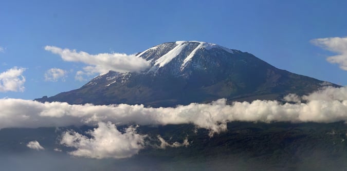
Shira is Kilimanjaro's western volcanic plateau and a named summit area used in route planning and acclimatisation itineraries.
Track this summit
Add it to your wish list or tick it off once you have climbed it to update your peak-bagging dashboard.
What to expect on this mountain
Shira is Kilimanjaro's western volcanic plateau and a named summit area used in route planning and acclimatisation itineraries.
Fast altitude gain and exposed moorland terrain shape the main route risks on the Shira side of Kilimanjaro.
Airports
Photos from Shira
Routes for Shira and nearby objectives
Shira Route
A high western Kilimanjaro route variation that starts on the Shira plateau and suits stronger acclimatised trekkers.