Stage 1
St Dogmaels to Newport
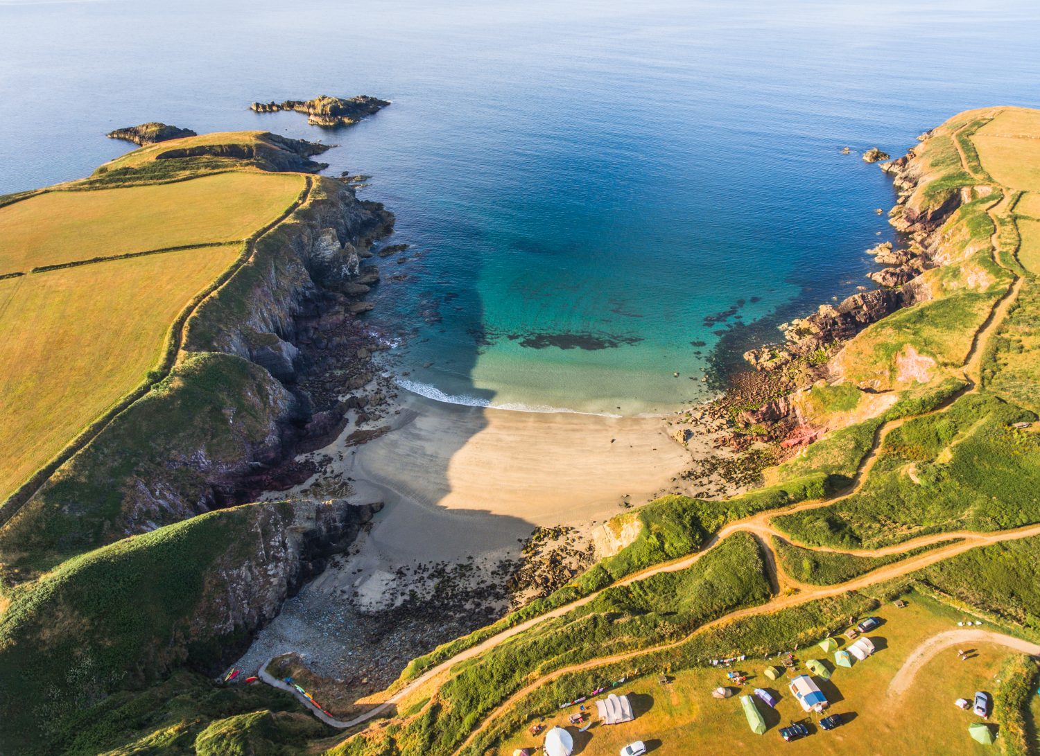
Unknown start to Unknown finish
Most challenging opening section of the trail, with a long committing day and no services between Poppit and Newport Sands.
United Kingdom · Pembrokeshire
Wales’s flagship coastal National Trail from St Dogmaels to Amroth.
Save it for later or mark it as completed to improve your dashboard recommendations.
The Pembrokeshire Coast Path is Wales’s original National Trail, a 186 mile (299 km) long-distance walk running from St Dogmaels in the north to Amroth in the south. It strings together sea cliffs, estuaries, coves, beaches, headlands and small harbour villages, so the character changes constantly even though the route always stays tied to the coast. Some days feel remote and rugged, particularly on the more exposed western and southern sections, while others pass through easier stretches with regular villages, pubs, buses and short-hop access points. The official trail information describes the full path as a formidable challenge, with roughly 35,000 feet of ascent and descent over the whole line, but it is also one of the best British trails for section walking because transport, accommodation and escape points recur all along the route. Walkers usually tackle it north to south, following the way the guidebooks, gates and stiles are numbered, although the trail works in either direction.
Pembrokeshire Coast Path is the classic big coastal walk in west Wales: a long, serious trail with enough variety to feel fresh every day. The line links cliff-top walking, sandy bays, low red rock shelves, volcanic headlands, estuary crossings and long beach approaches, so it offers much more than a single repeated landscape. For stronger walkers the official guidebook’s twelve-day schedule gives a useful benchmark, but the route rewards a slower trip because the coast path repeatedly passes bird cliffs, coves, village harbours and beaches that are worth lingering over. This is a route where logistics matter almost as much as fitness. Coastal buses, rail access at key points and frequent overnight options make it realistic to build shorter sections, yet the tougher days still demand respect, especially around St Dogmaels, the steeper western stretches, and the more rugged ground between Angle and Freshwater West.
What makes the trail valuable for trip planning is that the route is not just scenic, it is highly legible. The official section breakdown gives fifteen established stages, from the demanding St Dogmaels to Newport opener through to the beach-rich finish into Amroth. Along the way you get dramatic cliff scenery near Pwll Deri and Porthgain, wildflower-rich walking around Martin’s Haven, tidal-crossing complications between Dale and Neyland, military-use restrictions near Freshwater West, and some of the busiest, most beach-focused walking near Tenby and the southern end. Spring and autumn are often the best balance of trail conditions, wildlife and accommodation availability, while summer needs earlier booking and winter can turn muddy, windy and harder going. This listing now treats the route as a real long-distance trail rather than a placeholder: there is a mapped line, downloadable GPX, staged breakdown, official source trail facts and gallery imagery from the coast itself.


Unknown start to Unknown finish
Most challenging opening section of the trail, with a long committing day and no services between Poppit and Newport Sands.
Unknown start to Unknown finish
Lower cliffs than the opener, but still a full coastal stage with steady up-and-down walking.
Unknown start to Unknown finish
Shorter stage on volcanic coastal cliffs, useful as a recovery day or as part of a longer itinerary.
Unknown start to Unknown finish
Dramatic sheer-cliff stage with a strong sense of exposure and open coastal walking.
Unknown start to Unknown finish
Exhilarating and often rugged section around the St Davids peninsula.
Unknown start to Unknown finish
Longer day close to accommodation and facilities, which makes it easier to plan flexible overnight stops.
Unknown start to Unknown finish
Contains a series of very steep hills northwest of Newgale and feels harder than the raw distance suggests.
Unknown start to Unknown finish
Lower red cliffs, strong wildflower interest and a good stage for coastal wildlife watching.
Unknown start to Unknown finish
Well-served stage with many access points and strong bus support for shorter day planning.
Unknown start to Unknown finish
Long estuary-side stage with two tidal crossings that may require road detours depending on conditions.
Unknown start to Unknown finish
Lengthy southern estuary section with maritime, environmental and agricultural interest.
Unknown start to Unknown finish
Rugged, remote and challenging coast section with fewer easy break points.
Unknown start to Unknown finish
Flatter walking than much of the trail, but check local military-use restrictions before committing to the section.
Unknown start to Unknown finish
Undulating south-coast stage with beaches, villages and regular refreshment options.
Unknown start to Unknown finish
Beach-rich closing stage and one of the busiest sections of the whole route.