Japan Mountain Highlights
The strongest live overview of Japan as a mountain destination.
- Difficulty
- Moderate
- Duration
- 8 days
- Region
- Fuji Area
Commercial hiking terrain around Mount Fuji and the major summit access routes.
The strongest live overview of Japan as a mountain destination.
Japan's most commercially balanced mountain week.
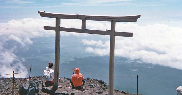
The classic Mount Fuji ascent from the south.
The classic crowd-route Mount Fuji ascent.
Use these route-linked adventures to plan the trails and traverses that sit inside this region.
A multi-peak route concept linking Fuji, Tate, and Haku into one Japanese mountain challenge.
The best-known commercial summit line on Mount Fuji from the northern side of the mountain.
The standard shorter southern summit route on Mount Fuji.
Supporting planning details for where trips start, finish, or stay overnight in this region.
Main southern logistics base for Mount Fuji summit itineraries.
Eastern Mount Fuji base with easy access to alternative summit routes.