Kilimanjaro Lemosho Climb
The premium Kilimanjaro trekking line.
- Difficulty
- Challenging
- Duration
- 7 days
- Region
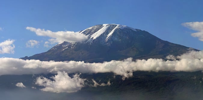
- Kilimanjaro
Commercial trekking terrain around Kilimanjaro and the route network above Moshi.


The premium Kilimanjaro trekking line.
The flagship scenic Kilimanjaro route.
Kilimanjaro's best-known hut route.
The most complete standard Kilimanjaro itinerary.
The dry-side Kilimanjaro classic.
A high-start Kilimanjaro plateau itinerary.
Kilimanjaro's sharper southern route option.
The core Tanzanian mountain week.
The complete northern Tanzania mountain challenge.
Use these route-linked adventures to plan the trails and traverses that sit inside this region.
A combined northern Tanzania mountain route linking Kilimanjaro, Meru, and Lengai.
The classic hut-based Kilimanjaro route from Marangu Gate.
A high western Kilimanjaro route variation that starts on the Shira plateau and suits stronger acclimatised trekkers.
The drier northern Kilimanjaro approach from the Kenyan side of the massif.
A steep direct Kilimanjaro route that joins the southern summit line after a harder opening approach.
A longer western Kilimanjaro route designed for acclimatisation and a more complete mountain experience.
The longest standard Kilimanjaro itinerary, circling the mountain for the strongest acclimatisation profile.
The most commercially established scenic route on Kilimanjaro.
Supporting planning details for where trips start, finish, or stay overnight in this region.
Western access point used for Lemosho, Shira, and Northern Circuit Kilimanjaro itineraries.
Classic trailhead for Kilimanjaro's Machame Route.
Historic eastern gate for Kilimanjaro's Marangu Route.
Main logistics base for Kilimanjaro climbs and related trekking programmes.
Common descent gate and logistics node for southern Kilimanjaro itineraries.
Northern approach trailhead used for Rongai Route ascents on Kilimanjaro.
Steep southern trailhead for the direct Umbwe ascent line on Kilimanjaro.